Category:NUTS maps of the European Union
Jump to navigation
Jump to search
English: The Nomenclature of Territorial Units for Statistics, (NUTS, for the French nomenclature d'unités territoriales statistiques), is a geocode standard for referencing the spatial divisions of countries for statistical purposes. The NUTS divisions do not necessarily correspond to administrative divisions within the country.
A NUTS code begins with a two-letter code referencing the country, which is identical to the ISO 3166-1 alpha-2 code (except UK instead of GB for the United Kingdom). The subdivision of the country is then referred to with one number. A second or third subdivision level is referred to with another number each.
Each numbering starts with 1, as 0 is used for the upper level. In case the subdivision has more than 9 entities, capital letters are used to continue the numbering.Media in category "NUTS maps of the European Union"
The following 17 files are in this category, out of 17 total.
-
 EU NUTS 2 population density 2007.svg 850 × 600; 2.09 MB
-
 Density of Population in EU 2014-it.svg 609 × 600; 2.15 MB
-
 Density of Population in EU 2014.svg 609 × 600; 2.15 MB
-
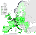
 Population density by NUTS 3 region (2017).svg 950 × 830; 9.06 MB
-
 Disposable income, by NUTS 2 regions, 2006 (1) (PPCS per inhabitant).png 880 × 1,042; 242 KB
-
 EER NUTS-2.svg 609 × 600; 2.16 MB
-
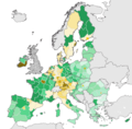 European regions by GDP in percentage of the EU average.png 1,039 × 1,024; 380 KB
-
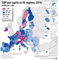 Eurostat GDP Regions 2018.png 509 × 528; 272 KB
-
 Map of GDP per capita in the EU in 2007 (NUTS 3).png 3,546 × 3,524; 2.47 MB
-
 Map of GDP per capita in the EU in 2007 (NUTS 3).svg 762 × 757; 4.29 MB
-
 NUTS 1 regions EU-27.svg 609 × 600; 2.71 MB
-
 NUTS 1 regions.svg 768 × 640; 3.02 MB
-
 NUTS 2 regions EU-27.svg 609 × 600; 2.13 MB
-
 NUTS 2 regions.svg 768 × 640; 2.36 MB
-
 NUTS 3 region (2017).svg 950 × 793; 7.1 MB
-
 NUTS 3 regions EU-27.svg 762 × 757; 3.38 MB
-
 NUTS-2 regions in EU with GDP over €100 billion.jpg 4,245 × 4,337; 2.51 MB


.svg)
_(PPCS_per_inhabitant).png)


.png)
.svg)


.svg)

