Category:NCEP weather maps for May 2002
Jump to navigation
Jump to search
Media in category "NCEP weather maps for May 2002"
The following 10 files are in this category, out of 10 total.
-
 2002-05-20 24-hr Precipitation Map NOAA.png 935 × 677; 46 KB
-
 2002-05-20 500-Millibar Height Contour Map NOAA.png 832 × 665; 79 KB
-
 2002-05-20 Color Max-min Temperature Map NOAA.png 800 × 350; 24 KB
-
 2002-05-20 Max-min Temperature Map NOAA.png 936 × 666; 46 KB
-
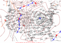
 2002-05-20 Surface Weather Map NOAA.png 1,088 × 783; 46 KB
-
 2002-05-21 24-hr Precipitation Map NOAA.png 935 × 677; 45 KB
-
 2002-05-21 500-Millibar Height Contour Map NOAA.png 832 × 665; 70 KB
-
 2002-05-21 Color Max-min Temperature Map NOAA.png 800 × 350; 25 KB
-
 2002-05-21 Max-min Temperature Map NOAA.png 936 × 666; 45 KB
-
 2002-05-21 Surface Weather Map NOAA.png 1,088 × 783; 47 KB


