Category:NARA images of California
Jump to navigation
Jump to search
States of the United States: Alabama · Alaska · Arizona · Arkansas · California · Colorado · Connecticut · Delaware · Florida · Georgia · Hawaii · Idaho · Illinois · Indiana · Iowa · Kansas · Kentucky · Louisiana · Maine · Maryland · Massachusetts · Michigan · Minnesota · Mississippi · Missouri · Montana · Nebraska · Nevada · New Hampshire · New Jersey · New Mexico · New York · North Carolina · North Dakota · Ohio · Oklahoma · Oregon · Pennsylvania · Rhode Island · South Carolina · South Dakota · Tennessee · Texas · Utah · Vermont · Virginia · Washington · West Virginia · Wisconsin · Wyoming – Washington, D.C.
American Samoa · Guam · Northern Mariana Islands · Puerto Rico · United States Virgin Islands – Midway Atoll
American Samoa · Guam · Northern Mariana Islands · Puerto Rico · United States Virgin Islands – Midway Atoll
English: Images from NARA—the National Archives and Records Administration — of California from the 19th and 20th centuries.
- Includes images from the Environmental Protection Agency's NARA Program to photographically document subjects of Environmental Concern, compiled 1972—1977.
Subcategories
This category has the following 17 subcategories, out of 17 total.
Media in category "NARA images of California"
The following 200 files are in this category, out of 467 total.
(previous page) (next page)-
-

-

-

-

-

-

-

-

-

-

-

-

-

-

-

-

-

-

-

-

-

-

-

-

-

-

-

-

-

-
 "San Joaquin Valley, California - Contract Labor" - NARA - 532157.tif 3,000 × 2,998; 8.58 MB
-

-
 95-PNW-034-DSC00030 - DPLA - 1311ce864e252daa27f71c327b0e604d.JPG 2,048 × 1,536; 1.4 MB
-
 95-PNW-041-Kirk North Aerial Recon-023 - DPLA - 555dcc98930c9b85d2b01f26e5f5c380.jpg 778 × 1,151; 1.19 MB
-
 95-PNW-041-Kirk North Chews Ridge-012 - DPLA - 48d53626b2d48244eed8913c78db3571.jpg 788 × 1,151; 1.18 MB
-
 95-PNW-041-Kirk South Coast-009 - DPLA - 2564580f423d30432a9f44f5e2e638cf.jpg 776 × 1,154; 994 KB
-

-

-
 Active Fires - California - DPLA - b28bc9d0140389ae51cf1fa5bff9c07c.jpg 4,727 × 3,891; 2.38 MB
-
 Active Fires - California - DPLA - cb236a805d93412ecb57f4bdda0d54ce.jpg 4,697 × 3,857; 2.72 MB
-
 Administrative Structures - California - DPLA - e80edf93b870c749d0401bced3671668.jpg 4,918 × 3,865; 2.68 MB
-

-

-

-

-
-

-

-
-

-

-
 Aircraft and Airports - California - DPLA - 1e30e8c1d3c5bd54114c0599a82eda62.jpg 5,125 × 4,001; 1.73 MB
-
 Aircraft and Airports - California - DPLA - 202234030905c9c3c27e2da3b17ba827.jpg 6,133 × 4,993; 4.64 MB
-

-

-
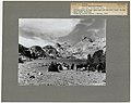
 ALPINE LAKE IN THE SIERRA NEVADA, CALIFORNIA - NARA - 524184.jpg 3,000 × 2,513; 4.48 MB
-

-

-

-

-

-

-

-
-

-

-

-

-

-

-

-

-

-
-

-

-

-

-

-
-

-

-
-
 BLACK ANGUS CATTLE AT RANCH - NARA - 542626.jpg 3,000 × 2,047; 4.82 MB
-
 Burnt Pinus jeffreyi Sierra National Forest.jpg 1,958 × 2,673; 2.42 MB
-
 Calculating by slide rule.png 600 × 407; 181 KB
-
 CALIFORNIA - NARA - 542808.jpg 2,014 × 3,000; 4.98 MB
-
 CALIFORNIA - NARA - 542813.jpg 1,980 × 3,000; 4.13 MB
-
 CALIFORNIA - NARA - 542814.jpg 3,000 × 2,178; 3.82 MB
-
 CALIFORNIA - NARA - 542849.jpg 3,000 × 2,011; 3.07 MB
-
 CALIFORNIA - NARA - 542850.jpg 2,012 × 3,000; 5.48 MB
-
 CALIFORNIA - NARA - 542993.jpg 3,000 × 2,036; 710 KB
-
 CALIFORNIA - NARA - 543232.jpg 2,038 × 3,000; 1.38 MB
-
 CALIFORNIA - NARA - 543261.jpg 1,988 × 3,000; 973 KB
-
 California - Yosemite - NARA - 543504.jpg 3,000 × 2,026; 1.22 MB
-
 CALIFORNIA WESTERN RAILROAD - NARA - 542899.jpg 3,000 × 2,055; 2.47 MB
-
 CALIFORNIA--BIG CREEK - NARA - 542783.jpg 2,046 × 3,000; 2.66 MB
-
 CALIFORNIA--BIG CREEK - NARA - 542784.jpg 2,003 × 3,000; 4.53 MB
-
 CALIFORNIA--NORTHERN COAST - NARA - 542796.jpg 3,000 × 2,024; 3.57 MB
-
 CALIFORNIA--SEQUOIA NATIONAL PARK - NARA - 542725.jpg 2,037 × 3,000; 5.27 MB
-
 CALIFORNIA--SIERRA NATIONAL FOREST - NARA - 542608.jpg 3,000 × 2,023; 2.83 MB
-
 CALIFORNIA--SISKIYOU NATIONAL FOREST - NARA - 542848.jpg 1,832 × 3,000; 2.47 MB
-
 CALIFORNIA-MONTEREY BAY - NARA - 543278.jpg 3,000 × 2,079; 1.04 MB
-
 CALIFORNIA-MONTEREY BAY - NARA - 543282.jpg 3,000 × 2,039; 915 KB
-
 CALIFORNIA-MONTEREY BAY - NARA - 543302.jpg 3,000 × 2,046; 1,009 KB
-
 CALIFORNIA-MONTEREY BAY - NARA - 543306.jpg 3,000 × 2,043; 1.09 MB
-
 CALIFORNIA-MONTEREY BAY - NARA - 543317.jpg 3,000 × 2,025; 928 KB
-
 CALIFORNIA-SILVER RIVER - NARA - 542991.jpg 2,055 × 3,000; 782 KB
-
 CALIFORNIA-SOUTHERN COASTLINE - NARA - 543172.jpg 3,000 × 2,050; 998 KB
-
 Cascading Waters - NARA - 543563.jpg 3,000 × 2,037; 1.34 MB
-
 CENTRAL CALIFORNIA - NARA - 542618.jpg 2,032 × 3,000; 4.28 MB
-
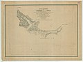
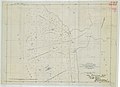 Chart of San Francisco Bar Showing Location of the Steamer Escambia - NARA - 128215928.jpg 6,380 × 4,638; 1.33 MB
-
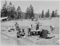
 Civilian Conservation Corps in California, Camp 17, Kitchen - NARA - 197069.tif 2,000 × 1,556; 2.99 MB
-
 Civilian Conservation Corps in California, Camp Mammouth, laundry - NARA - 197070.tif 2,000 × 1,557; 2.99 MB
-
 Civilian Conservation Corps in California, Camp Millwood - NARA - 197072.tif 2,000 × 1,558; 3 MB
-

-

-
 Civilian Conservation Corps in California, Camp Rock Creek, kp - NARA - 197074.tif 2,000 × 1,557; 2.99 MB
-
 Civilian Conservation Corps in California, Camp Rock Creek, wash room - NARA - 197073.tif 2,000 × 1,564; 3.01 MB
-
 Civilian Conservation Corps in California, Camp Vista Grande, Co. 909 - NARA - 197108.tif 2,000 × 1,600; 3.07 MB
-
 Civilian Conservation Corps in California, March Field District - NARA - 197109.tif 2,000 × 1,605; 3.09 MB
-
 Civilian Conservation Corps in California, March Field District - NARA - 197110.tif 2,000 × 1,607; 3.09 MB
-
 Civilian Conservation Corps in California, March Field District - NARA - 197111.tif 2,000 × 1,547; 2.98 MB
-
 Civilian Conservation Corps in California, March Field District - NARA - 197112.tif 2,000 × 1,583; 3.04 MB
-
 Civilian Conservation Corps in California, March Field District - NARA - 197113.tif 2,000 × 1,555; 2.99 MB
-
 Civilian Conservation Corps in California, March Field District - NARA - 197114.tif 2,000 × 1,539; 2.96 MB
-
 Civilian Conservation Corps in California, March Field District, cooks - NARA - 197115.tif 1,589 × 2,000; 3.05 MB
-
 CLOVER LEAVES - NARA - 542971.jpg 3,000 × 1,998; 890 KB
-
 CONGRESS TRAIL SEQUOIA AND KINGS CANYON NATIONAL PARKS - NARA - 542753.jpg 3,000 × 2,043; 3.62 MB
-
 CONGRESS TRAIL. SEQUOIA AND KINGS CANYON NATIONAL PARKS - NARA - 542748.jpg 2,027 × 3,000; 4.26 MB
-
 Construction Erosion Control - California - DPLA - 2aa8b1c7ec44a4e6bea90fef387a1af2.jpg 4,753 × 3,876; 3.21 MB
-

-

-

-
 Deaddogroute101.jpg 1,714 × 2,550; 1.38 MB
-
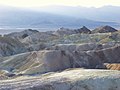
 Death Valley Scenic Byway - Red Cathedral in Death Valley - NARA - 7717977.jpg 1,200 × 900; 1.13 MB
-
 Death Valley Scenic Byway - The Badlands in Death Valley - NARA - 7717901.jpg 1,024 × 768; 127 KB
-
 Dedication of Lady Bird Johnson Grove in Redwood National Park, California - NARA - 194298.tif 3,000 × 2,028; 17.41 MB
-

-
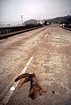
 DOG LIES DEAD ON MAJOR TRUCKING ROAD, ROUTE 101 - NARA - 542954.jpg 2,011 × 3,000; 1.41 MB
-
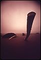 DRIFTWOOD APPEARS TO TAKE ROOT IN SAND - NARA - 543082.jpg 2,030 × 3,000; 902 KB
-
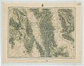 Economic Features of Eastern California, Atlas Sheet 65(D) - NARA - 100306267.jpg 7,470 × 5,901; 7.33 MB
-
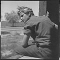
 Eighteen year-old mother from Oklahoma now a California migrant - NARA - 195857.tiff 9,648 × 7,608; 140.06 MB
-
-

-

-
 Farm Security Administration, Migrant worker on California highway - NARA - 196260.tif 1,548 × 2,000; 2.97 MB
-
-
 Fire Control- Detection - California - DPLA - 85d20ddc97a9507748eaf3eee9611e14.jpg 4,755 × 3,775; 1.92 MB
-
 Fire Control- Lookouts - California - DPLA - 9765c411f8092aece78e3960b5597e04.jpg 4,909 × 4,031; 2.49 MB
-
 Fire Effects - All States - DPLA - 7be35884ee7fd6c7823578d36ba1b502.jpg 5,013 × 4,067; 2.84 MB
-
 Fire Prevention - All States - DPLA - a8787ea26e4eb2f73dcfd530fa74610a.jpg 5,072 × 4,138; 2.83 MB
-

-

-

-
 Fire Suppression- Ground Mop Up - All States - DPLA - e3b5609c682414971b9954d650ef3386.jpg 4,971 × 4,112; 2.41 MB
-
 FLOTSAM ON BEACH - NARA - 542976.jpg 2,044 × 3,000; 1.07 MB
-

-

-

-
-
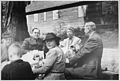
 Franklin D. Roosevelt, Francis Carr, and Anna Redding in California - NARA - 195683.jpg 3,000 × 2,310; 1.13 MB
-
 From U.S. Coast Guard Chart No. 601, San Francisco to San Diego - NARA - 122206747.jpg 6,184 × 6,123; 1.59 MB
-
 Frost - Touched Grass - NARA - 543562.jpg 2,018 × 3,000; 1.07 MB
-
 Frost - Touched Vegetation - NARA - 543560.jpg 3,000 × 2,028; 1.29 MB
-
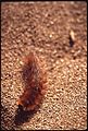 FURRY CATERPILLAR - NARA - 542957.jpg 2,031 × 3,000; 1.38 MB
-
 Headquarters & Park Village - NARA - 84786370.jpg 11,059 × 6,976; 6.12 MB
-

-
 Hiking - Riding - California - DPLA - 175c54707a15b2bd0a6c4ae12bde47d2.jpg 4,773 × 3,768; 2.36 MB
-
 Hiking - Riding - California - DPLA - 17c71a6de3759e5a7da4608946ef306c.jpg 4,725 × 3,846; 2.93 MB
-
 Hiking - Riding - California - DPLA - 41029ad5a331dbd4a752a7bf0386080b.jpg 4,773 × 3,864; 2.93 MB
-
 Hiking - Riding - California - DPLA - 9ba4449f150a9b47c878c543c54bccfd.jpg 4,779 × 3,864; 2.55 MB
-
 Hiking - Riding - California - DPLA - c88f7ebcf6d8adfc7101778902cce27e.jpg 4,737 × 3,786; 2.16 MB
-

-
 Injured Trees - California - DPLA - 5438f3a805172f78a1fb9d4800675e8a.jpg 4,753 × 3,882; 3.06 MB
-
 Injured Trees - California - DPLA - e5462f204825e80880c5858bf68ebf1d.jpg 4,776 × 3,888; 2.34 MB
-
 Instrumentation- Climatic - California - DPLA - 445914857f7f81569a65c778da157367.jpg 4,977 × 4,020; 2.4 MB
-

-
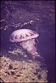 JELLYFISH - NARA - 543277.jpg 2,020 × 3,000; 1,020 KB
-

-

-
 KeySystemMole.jpeg 1,340 × 487; 173 KB
-
 Laboratory Techniques - All States - DPLA - 9e0c5d6d1c44e7f284f6d5cddda2f809.jpg 4,756 × 3,876; 2.44 MB
-
 Lake Scenes - California - DPLA - 03d9ca2fdaac739bef11d805bc16e8c5.jpg 4,733 × 3,767; 2.02 MB
-
 Lake Scenes - California - DPLA - 4e3064249780355e658309d7c9181f54.jpg 4,721 × 3,749; 1.62 MB
-
 Lake Scenes - California - DPLA - 6c9f67674d5a8cd5c83aa23284d3b765.jpg 4,793 × 3,713; 2.07 MB
-
 Lake Scenes - California - DPLA - aae47aaada8666c4323d67e7af69e930.jpg 3,147 × 2,349; 1,003 KB
-
 Land Classification Map of Part of North Central California - NARA - 135841466.jpg 7,468 × 5,966; 4.24 MB
-
 Land Classification Map of Part of Southern California - NARA - 135841472.jpg 7,492 × 5,949; 4.21 MB
-

-

-
 Logging- Felling - California - DPLA - 2f7149e7e5356d08e87ee61c4960c178.jpg 4,794 × 3,780; 2.29 MB
-
 Logging- Hauling - All States - DPLA - a95d44e5af3e7b56f04011219d402a3b.jpg 4,795 × 3,875; 2.96 MB
-
 Logging- Scaling - California - DPLA - 3d271bb8eefa26a0c4e0b59bdb1b2d3f.jpg 4,775 × 3,809; 1.94 MB
-
 Logging- Transportation- Trucks - California - DPLA - dff01915299ebdd7f062a78d407dc15a.jpg 4,770 × 3,822; 2.02 MB
-
 Map and Profile of the Canada de las Uvas - NARA - 100305674.jpg 9,656 × 7,178; 3.65 MB
-
 Map of area near Los Angeles, California - NARA - 100305836.jpg 9,200 × 6,675; 3.18 MB
-
 Map of area of California - NARA - 100305838.jpg 9,216 × 6,105; 2.76 MB
-
 Map of Public Surveys in California - NARA - 139309196.jpg 9,964 × 11,858; 4.88 MB
-
 Map of San Francisco Bay and Country Adjacent East - NARA - 100305697 (page 1).jpg 8,136 × 14,228; 9.07 MB

,%22_California,_1936._(vertical_orientation,_ca._1936_-_NARA_-_519922.jpg)
,%22_California,_1936.,_ca._1936_-_NARA_-_519918.jpg)
,%22_California,_1936.,_ca._1936_-_NARA_-_519939.jpg)
,%22_California,_1936.,_ca._1936_-_NARA_-_519931.jpg)

,%22_California,_1936.,_ca._1936_-_NARA_-_519930.jpg)
,%22_California,_1936.,_ca._1936_-_NARA_-_519938.jpg)
,%22_California,_1936.,_ca._1936_-_NARA_-_519933.jpg)
,_Archie..._-_NARA_-_293488.jpg)
,%22_California,_1936.,_ca._1936_-_NARA_-_519920.jpg)
,%22_California,_1936.,_ca._1936_-_NARA_-_519936.jpg)
,%22_California,_1936.,_ca._1_-_NARA_-_519929.jpg)
,%22_California,_1936.,_ca._1936_-_NARA_-_519916.jpg)
,%22_California,_1936.,_ca._1936_-_NARA_-_519925.jpg)
,%22_California,_1936.,_ca._1936_-_NARA_-_519921.jpg)

,%22_Calif_-_NARA_-_519940.jpg)
,%22_California,_1936.,_ca._1936_-_NARA_-_519924.jpg)
,%22_California,_1936._(vertical_orientation),_ca._1936_-_NARA_-_519923.jpg)
,%22_California,_1936.,_ca._1936_-_NARA_-_519919.jpg)
,%22_California,_1936.,_ca._1936_-_NARA_-_519932.jpg)
,%22_California,_1936._(vertical_orient_-_NARA_-_519934.jpg)
,%22_California,_1936.,_ca._1936_-_NARA_-_519935.jpg)
,%22_California,_1936.,_ca._1936_-_NARA_-_519937.jpg)
,%22_California,_1936.,_ca._1936_-_NARA_-_519928.jpg)
,%22_California,_1936.,_ca._1936_-_NARA_-_519926.jpg)
,%22_California,_1936.,_ca._1936_-_NARA_-_519917.jpg)
,%22_California,_1936.,_ca._1936_-_NARA_-_519927.jpg)
.jpg)


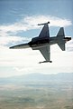
_as_it_sails_along_the_Southern_California_coastline_during_carrier_qualifications_training_-_DPLA_-_4958f676187615f32cde5ead1bf71404.jpeg)
,_Firebirds,_flown_by_Lieutenant_(LT)_Pawlowski,_pilot,_and_LT_Jones,_copilot,_Naval_A_-_DPLA_-_bafb555af438239f394155f25e51b877.jpeg)


_aircraft_over_the_Pacific_Missile_Test_Center_range._The_plane_will_be_used_to_t_-_DPLA_-_8e1ed9e665641ade418ebf963db16f8c.jpeg)


_(Visit_of_Secretary_Dirk_Kempthorne_and_aides_to_San_Francisco_and_vicinity),_California,_(for_touring,_meetings_with_Interior_personnel,_class_-_DPLA_-_36bc160e454d88558c83a0464325796a.jpg)
_(Visit_of_Secretary_Dirk_Kempthorne_and_aides_to_San_Francisco_and_vicinity),_California,_(for_touring,_meetings_with_Interior_personnel,_class_-_DPLA_-_766aa6ced9a715e6ed8d9ca68476d9da.jpg)
_(Visit_of_Secretary_Dirk_Kempthorne_and_aides_to_San_Francisco_and_vicinity),_California,_(for_touring,_meetings_with_Interior_personnel,_class_-_DPLA_-_b1ea1b21f6b403b915895de41ca7f81d.jpg)
_(Visit_of_Secretary_Dirk_Kempthorne_and_aides_to_San_Francisco_and_vicinity),_California,_(for_touring,_meetings_with_Interior_personnel,_class_-_DPLA_-_e7f252826a93b6c071ef399f1c9e4b1d.jpg)
_Aerial_views_of_California_(taken_during_visit_of)_Acting_Secretary_P._Lynn_Scarlett_(48-DPA-N_Scarl_CA_Aer_DSC_0033.JPG_-_DPLA_-_9138697dd9f73c9a71268cbd26285b1f.JPG)
_Acting_Secretary_P._Lynn_Scarlett_(and_associates)_on_visit_to_California,_(with_stop_in--and_flight)_in_and_out_of--Sacramento_(48-DPA-N_Scarl_CA_-_DPLA_-_1af3c4a2e3009cb0e18c50d4305494f6.JPG)


_lower_equipment_to_a_landing_craft_on_15_July_1986.jpg)


_-_NARA_-_100306267.jpg)


_-_NARA_-_31482104.jpg)


_-_NARA_-_31482134.jpg)


.jpg)
.jpg)


,_September_1996_-_Scenic-General_-_Bird_in_rocky_coastline_(CA)_-_DPLA_-_7a1a781354eb907d11a324b43fa9cdb3.JPG)
,_September_1996_-_Scenic-General_-_Tule_elk_on_hillside_(CA)_-_DPLA_-_36c7b4816b2be8234795877fe59e69b7.JPG)


.jpg)
_Acting_Secretary_P._Lynn_Scarlett_(and_aides)_on_visit_to_San_Francisco,_California_(for_touring,_and_participation_along_with_Transportation_Secre_-_DPLA_-_633cd2e1aa233e33b851ff38e2ede3b1.JPG)
_Acting_Secretary_P._Lynn_Scarlett_(and_aides)_on_visit_to_San_Francisco,_California_(for_touring,_and_participation_along_with_Transportation_Secre_-_DPLA_-_68c14bf380b0690b5db2b8efa7b00e2f.JPG)
_Acting_Secretary_P._Lynn_Scarlett_(and_aides)_on_visit_to_San_Francisco,_California_(for_touring,_and_participation_along_with_Transportation_Secre_-_DPLA_-_6cc8a27b2af353645766d6ae90cc03ba.JPG)
_Acting_Secretary_P._Lynn_Scarlett_(and_aides)_on_visit_to_San_Francisco,_California_(for_touring,_and_participation_along_with_Transportation_Secre_-_DPLA_-_c0f1e2e2c4843cb1f35f5e3f36b7e049.JPG)
_Acting_Secretary_P._Lynn_Scarlett_(and_aides)_on_visit_to_San_Francisco,_California_(for_touring,_and_participation_along_with_Transportation_Secre_-_DPLA_-_c7c4545d9c39be9d4a88e0156ef6c4b5.JPG)
_Acting_Secretary_P._Lynn_Scarlett_(and_aides)_on_visit_to_San_Francisco,_California_(for_touring,_and_participation_along_with_Transportation_Secre_-_DPLA_-_e4b69f03cb1bd86e65564cab8ab09581.JPG)
_Acting_Secretary_P._Lynn_Scarlett_(and_aides)_on_visit_to_San_Francisco,_California_(for_touring,_and_participation_along_with_Transportation_Secre_-_DPLA_-_e55453ca32892f82f09650ebae003de9.JPG)