Category:Námestie M. R. Štefánika (Myjava)
Jump to navigation
Jump to search
 | |||||
| Upload media | |||||
| Instance of | |||||
|---|---|---|---|---|---|
| Location | Myjava, Myjava District, Trenčín Region, Slovakia | ||||
 | |||||
Subcategories
This category has the following 3 subcategories, out of 3 total.
H
- Hotel Štefánik, Myjava (2 F)
L
- Lutheran church in Myjava (16 F)
Media in category "Námestie M. R. Štefánika (Myjava)"
The following 9 files are in this category, out of 9 total.
-
 Myjava - hotel Štefánik.jpg 4,032 × 3,024; 3.3 MB
-
 Myjava - hotel Štefánik2.jpg 4,032 × 3,024; 2.74 MB
-
 Myjava - mestský úrad.jpg 4,032 × 3,024; 4.21 MB
-
 Myjava - Námestie M. R. Štefánika.jpg 3,024 × 4,032; 2.98 MB
-
 Myjava - pamätník padlým v boji proti fašiznu.jpg 4,032 × 3,024; 3.55 MB
-
 Myjava stred.jpg 2,000 × 3,008; 1.81 MB
-
 MYJAVA. Pamätník SNP..jpg 1,366 × 1,024; 1.36 MB
-
 MYJAVA. Plastika Zbratanie.jpg 889 × 1,378; 1.03 MB
-
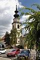
 Námestie M. R. Štefánika.jpg 1,176 × 713; 188 KB


