Category:Mweelrea Mountains
Jump to navigation
Jump to search
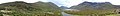
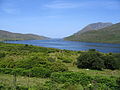
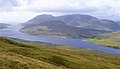
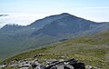
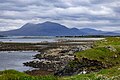
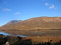
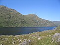
Mweelrea is a mountain, and a mountain range, in Connemara in Ireland
mountain in Mayo, Ireland  | |||||
| Upload media | |||||
| Instance of | |||||
|---|---|---|---|---|---|
| Location | County Mayo, Connacht, Ireland | ||||
| Topographic prominence |
| ||||
| Elevation above sea level |
| ||||
 | |||||
Media in category "Mweelrea Mountains"
The following 51 files are in this category, out of 51 total.
-
 Across Killary Harbour - geograph.org.uk - 4968167.jpg 4,000 × 3,000; 2.37 MB
-
 Admiralty Chart No 2706 Ballynakill and Killary Bays, Published 1860.jpg 16,396 × 11,304; 36.28 MB
-
 Ben Bury from the north ridge of Mweelrea.jpg 832 × 526; 134 KB
-

-

-

-
 Ben Lugmore as seen from the south east ridge of Mweelrea.jpg 893 × 527; 129 KB
-
 Ben Lugmore2.jpg 5,184 × 2,920; 4.58 MB
-
 Bridge at Cushinyen - geograph.org.uk - 238994.jpg 640 × 480; 119 KB
-

-
 Doo Lough and Glencullin Lough - geograph.org.uk - 1404769.jpg 640 × 480; 76 KB
-
 Doolough - MweelRea.JPG 2,048 × 1,536; 745 KB
-
 Doolough Pass, the Gem of Mayo - geograph.org.uk - 447610.jpg 640 × 85; 20 KB
-
 East ridge of Mweelrea as seen from col with Ben Bury.jpg 5,184 × 2,920; 4.2 MB
-
 East summit cairn on Ben Bury, Mweelrea, Ireland.jpg 847 × 544; 120 KB
-
 Ireland (2409315407).jpg 3,888 × 2,592; 3.36 MB
-
 Kyllary Harbour from Derrynacleigh.JPG 2,048 × 1,536; 1.05 MB
-
 Landscape (3614548188).jpg 4,600 × 3,068; 12.44 MB
-
 Looking up the SE ridge of Mweelrea, Ireland.jpg 891 × 506; 141 KB
-
 Lough Bellawaum, Mweelrea, Mayo, Ireland.jpg 764 × 518; 119 KB
-

-
 Mweel Rea Mountains, Northeast Corrie - geograph.org.uk - 102580.jpg 640 × 480; 107 KB
-
 Mweelrea & Ben Lugmore from Bencollaghduff.jpg 898 × 600; 50 KB
-
 Mweelrea & Ben Lugmore from massif of Leenane Hill.jpg 852 × 489; 93 KB
-

-
 Mweelrea and Renvyle 01HDR (3585855558).jpg 2,555 × 1,831; 798 KB
-
 Mweelrea and SE face, from col to Mweelrea SE Spur (Pt 475).jpg 841 × 508; 136 KB
-
 Mweelrea depuis Rosroe - Killary harbour-Mweelrea.JPG 2,048 × 1,536; 874 KB
-
 Mweelrea from below col to Mweelrea Spur (Pt 475).jpg 827 × 481; 123 KB
-
 Mweelrea from Ben Lugmore.jpg 887 × 603; 162 KB
-
 Mweelrea from Renvyle 01HDR (3585080785).jpg 2,492 × 1,498; 528 KB
-
 Mweelrea from Renvyle HDR (3585886034).jpg 2,514 × 1,845; 751 KB
-
 Mweelrea from summit of Ben Bury.jpg 820 × 533; 138 KB
-
 Mweelrea from the East.jpg 984 × 627; 250 KB
-
 Mweelrea from the summit of Ben Lugmore.jpg 895 × 570; 105 KB
-
 Mweelrea Mountain from Renvyle.jpg 4,608 × 3,086; 3.72 MB
-
 Mweelrea SE Spur (Pt 475) from the SE ridge of Mweelrea.jpg 818 × 536; 94 KB
-
 Mweelrea summit and SE face, from the SE ridge.jpg 873 × 569; 166 KB
-

-
 Mweelrea, Killary Harbour, Ireland.jpg 4,250 × 2,813; 4.03 MB
-
 Mweelrea, Killary Harbour.jpg 800 × 600; 113 KB
-
 Mweelrea, the south flank. - geograph.org.uk - 71333.jpg 640 × 428; 83 KB
-
 Mweelrea.jpg 640 × 427; 108 KB
-
 North East Ridge of Ben Bury (Mweelrea) - geograph.org.uk - 1227201.jpg 479 × 640; 103 KB
-
 Northeast Mweelrea - "The Ramp".jpg 2,080 × 1,544; 753 KB
-
 Rosroe Quay- Killary Harbour- Mweelrea.JPG 2,048 × 1,536; 791 KB
-
 Rosroe-Killary harbour-pisciulture.JPG 2,048 × 1,536; 844 KB
-
 The Hidden Way - geograph.org.uk - 102575.jpg 640 × 480; 111 KB
-
 Towards Mweelrea - geograph.org.uk - 969083.jpg 427 × 640; 189 KB
-
 View north west up Killary Harbour - geograph.org.uk - 201457.jpg 640 × 480; 117 KB
-


,_and_Mweelrea_(far,_left)_from_Ben_Creggan_South_Top1.jpg)
,_and_Mweelrea_(far,_left)_from_Ben_Creggan_South_Top2.jpg)
,_and_Mweelrea_(far,_left)_from_Ben_Creggan_South_Top3.jpg)


_and_SE_summit_ridge_of_Mweelrea.jpg)


.jpg)

.jpg)


,_and_Ben_Lugmore_(centre),_from_summit_of_Ben_Gorm.jpg)
.jpg)
.jpg)

.jpg)
.jpg)
.jpg)


_from_the_SE_ridge_of_Mweelrea.jpg)

_and_Ben_Lugmore_(right).jpg)


_-_geograph.org.uk_-_1227201.jpg)


_-_geograph.org.uk_-_1955044.jpg)