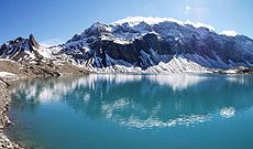
Category:Muttsee
Jump to navigation
Jump to search
| Object location | | View all coordinates using: OpenStreetMap |
|---|
reservoir in the canton of Glarus, Switzerland | |||||
| Upload media | |||||
| Instance of | |||||
|---|---|---|---|---|---|
| Location |
| ||||
| Basin country | |||||
| Dam | |||||
 | |||||
Media in category "Muttsee"
The following 21 files are in this category, out of 21 total.
-
1193 Tödi.jpg 14,000 × 9,600; 131.02 MB
-
Building site Muttsee as seen from Nüschenstock.JPG 4,608 × 3,456; 7.45 MB
-
Building site Muttsee as seen from Ruchi.JPG 4,608 × 3,456; 8.44 MB
-
Building site Muttsee as seen from Rüchi.JPG 4,608 × 3,456; 7.74 MB
-
ETH-BIB-Muttsee v. S. W. aus 2600 m-Inlandflüge-LBS MH01-004765.tif 6,753 × 4,604; 89.11 MB
-
ETH-BIB-Muttsee, Bifertenstock aus 3200 m-Inlandflüge-LBS MH01-006390.tif 6,321 × 4,575; 82.9 MB
-
ETH-BIB-Muttsee, Glärnisch, Ruchen von S. aus 4000 m-Inlandflüge-LBS MH01-002524.tif 6,439 × 4,063; 74.92 MB
-
ETH-BIB-Muttsee, Ruchi, Hintersulzhorn v. W. aus 2600 m-Inlandflüge-LBS MH01-004769.tif 6,652 × 4,554; 86.83 MB
-
ETH-BIB-Muttsee, Ruchi, Selbsanft-Inlandflüge-LBS MH01-000327.tif 6,476 × 4,706; 87.32 MB
-
ETH-BIB-Muttsee, Scheidstöckli, Nüschenstock v. S. O. aus 4000 m-Inlandflüge-LBS MH01-002252.tif 6,551 × 4,462; 83.71 MB
-
ETH-BIB-Ruchi, Muttsee, Scheidstöckli, Tödi-LBS H1-029586.tif 8,206 × 5,848; 137.34 MB
-
Kalktrittli.jpg 4,608 × 3,456; 11.19 MB
-
Muttenbergen Spherical Panorama.jpg 12,246 × 6,123; 54.94 MB
-
Muttsee 20100605 MartinSteiger CCBYSA 001.jpg 2,592 × 1,944; 1.2 MB
-
Muttsee during construction time.jpg 7,968 × 2,394; 5.02 MB
-
Muttsee in July.jpg 4,608 × 3,456; 11.11 MB
-
Muttsee.jpg 1,595 × 936; 448 KB
-
Nüschenstock and Rüchi as seen from Muttsee.JPG 4,608 × 3,456; 7.13 MB
-
Rock structure in Kalktrittli.jpg 4,608 × 3,456; 10.28 MB


