Category:Muscogee maps
Jump to navigation
Jump to search
Media in category "Muscogee maps"
The following 41 files are in this category, out of 41 total.
-

-

-
 1815m4.jpg 1,689 × 1,442; 147 KB
-
 1817 Map of Mississippi and Alabama.jpeg 4,000 × 3,484; 1.26 MB
-
 20150407-RD-LSC-0208 (17038974979).jpg 7,360 × 4,912; 7.13 MB
-
 20150407-RD-LSC-0210 (17225136715).jpg 4,912 × 7,360; 7.03 MB
-

-
 Alabama tribal land map 1830.png 572 × 555; 78 KB
-
 Battle of Horseshoe Bend.jpg 2,988 × 5,312; 4.92 MB
-
 Bulletin (1922) (19802858393).jpg 6,820 × 5,116; 5.18 MB
-
 Bulletin (1922) (20235765530).jpg 6,276 × 8,262; 7.42 MB
-
 Bulletin (1922) (20415182202).jpg 3,776 × 4,688; 3.77 MB
-
 Carte sur la Guerre des Creeks.jpg 800 × 1,219; 551 KB
-
 Cessions Southeastern Tribes- Andrew Jackson.jpg 2,030 × 1,512; 1.91 MB
-
 Collections of the Georgia Historical Society (1916) (14598015370).jpg 4,598 × 3,456; 1.55 MB
-
 Creek Cessions of the Treaty of Indian Springs (1821).jpg 600 × 692; 115 KB
-
 Creek Cessions of the Treaty of Indian Springs (1825).jpg 600 × 692; 114 KB
-
 Creek Country 1812-1814.jpg 806 × 667; 151 KB
-
 Creek land cessions 1733-1832.jpg 356 × 380; 24 KB
-
 Creek war 1813-14.jpg 354 × 478; 46 KB
-
 DeSoto Map Leg 2 HRoe 2008.jpg 600 × 470; 290 KB
-
 Fort Hull map.jpg 1,384 × 735; 153 KB
-
 Fort Okfuskee.jpg 1,395 × 707; 185 KB
-
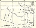
 IndianTerritory.jpg 1,000 × 1,061; 233 KB
-
 Map of British West Florida showing 1763 and 1764 boundaries.jpg 600 × 398; 45 KB
-
 Map of Land Ceded by Treaty of Fort Jackson.png 320 × 336; 25 KB
-

-
 Mappa a'n Hyns Dagrow.png 2,025 × 1,547; 3.19 MB
-
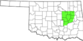
 Muscogee Creek Nation Territory.png 1,723 × 913; 1.03 MB
-
 Muscogee Nation Jurisdiction.png 7,750 × 3,850; 875 KB
-
 MuscogeeOSTA.svg 800 × 395; 2.49 MB
-
 Muskogee USC2000 PHS.svg 959 × 593; 173 KB
-
 Native American Towns in Alabama 1818.jpeg 2,005 × 2,551; 585 KB
-
 Native American Towns in Alabama before 1832.jpeg 3,956 × 3,838; 1.49 MB
-
 Oklahoma Tribal Statistical Area.svg 828 × 400; 1.49 MB
-

-
-
 Trails of Tears de.png 2,025 × 1,547; 3.05 MB
-
 Trails of Tears en.png 2,025 × 1,547; 3.04 MB
-
 University of California publications in history (1911) (14750237496).jpg 2,940 × 2,336; 1,001 KB
-
 YamaseeWarMap01.png 1,008 × 697; 131 KB
.jpg)


.jpg)
.jpg)


_(19802858393).jpg)
_(20235765530).jpg)
_(20415182202).jpg)


_(14598015370).jpg)
.jpg)
.jpg)


_(14766674102).jpg)


_(14750237496).jpg)
