Category:Murton, County Durham
Jump to navigation
Jump to search
English: Murton is a village in County Durham, England. Lying six miles (9.6 km) east of the city of Durham and seven miles (11.25 km) south of Sunderland, it has a population of 7,339.
village in County Durham, England  | |||||
| Upload media | |||||
| Instance of | |||||
|---|---|---|---|---|---|
| Location | County Durham, North East England, England | ||||
| Population |
| ||||
 | |||||
Subcategories
This category has the following 4 subcategories, out of 4 total.
Media in category "Murton, County Durham"
The following 83 files are in this category, out of 83 total.
-
 50p for the meter anybody^ - geograph.org.uk - 716310.jpg 640 × 436; 95 KB
-

-
 A19 near Murton - geograph.org.uk - 3238289.jpg 1,920 × 1,080; 828 KB
-
 A19 near Seaham, County Durham - geograph.org.uk - 3219223.jpg 1,920 × 1,080; 714 KB
-
 A19 southbound - geograph.org.uk - 6674789.jpg 640 × 488; 55 KB
-
 A19 southbound - geograph.org.uk - 6674790.jpg 640 × 480; 50 KB
-
 Artificially created valley wetland - geograph.org.uk - 1345153.jpg 640 × 444; 104 KB
-
 Brannigan visits Dalton Park - panoramio.jpg 3,888 × 2,592; 2.85 MB
-
 Broadoaks, Murton - geograph.org.uk - 3219239.jpg 640 × 480; 53 KB
-
 Church Lane, Murton (B1285) - geograph.org.uk - 3219254.jpg 640 × 480; 92 KB
-
 Church Street (B1285) - geograph.org.uk - 3219260.jpg 640 × 480; 52 KB
-
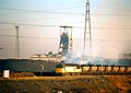 Class 56 departing from Hawthorn Colliery (geograph 1675905).jpg 1,130 × 800; 439 KB
-
 Colliery Walk in Murton - geograph.org.uk - 2975521.jpg 3,648 × 2,736; 2.33 MB
-
 Crossing on Cycle Route 1 at Murton Bridge - geograph.org.uk - 3840387.jpg 3,264 × 2,448; 2.84 MB
-
 Cycle Route 1 heading South from Murton - geograph.org.uk - 3840391.jpg 3,264 × 2,448; 3.03 MB
-
 Cycle Route No.1 at Dalton Park - geograph.org.uk - 3539194.jpg 3,264 × 2,448; 3.84 MB
-
 Dalton Moor - geograph.org.uk - 314331.jpg 640 × 480; 68 KB
-
 Dalton Park outlet village, Murton - geograph.org.uk - 4548072.jpg 640 × 480; 78 KB
-
 Dalton Park Shopping Centre from the Saddle - geograph.org.uk - 3539188.jpg 3,264 × 2,448; 4.21 MB
-
 Disused Railway - geograph.org.uk - 43490.jpg 640 × 427; 76 KB
-
 Falcon Trail footpath - geograph.org.uk - 1345168.jpg 640 × 480; 91 KB
-
 Farm track off the B1285 - geograph.org.uk - 3219232.jpg 640 × 480; 85 KB
-
 Farmland and hedgerow, Murton Moor farm - geograph.org.uk - 3219233.jpg 640 × 566; 153 KB
-
 Farmland and pylon line - geograph.org.uk - 3219225.jpg 640 × 480; 64 KB
-
 Farmland east of Murton - geograph.org.uk - 3219266.jpg 640 × 480; 76 KB
-
 Farmland, Murton Moor Farm - geograph.org.uk - 3219235.jpg 640 × 480; 75 KB
-

-
 Footpath north from Station Road in Murton - geograph.org.uk - 2975541.jpg 3,648 × 2,736; 1.95 MB
-
 Footpath towards South Hetton - geograph.org.uk - 3219227.jpg 640 × 480; 107 KB
-
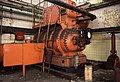
 Gas compressors, Hawthorn Coking Works - geograph.org.uk - 716299.jpg 640 × 427; 111 KB
-
 Green Lane near South Sharpley - geograph.org.uk - 314246.jpg 640 × 480; 108 KB
-
 Hare Trail, Dalton Park - geograph.org.uk - 1345123.jpg 640 × 480; 105 KB
-
 Hawthorn-Ryehope Way - geograph.org.uk - 5074620.jpg 800 × 600; 221 KB
-
 Hawthorn-Ryehope Way - geograph.org.uk - 5074625.jpg 800 × 600; 228 KB
-
 Hawthorn-Ryehope Way - geograph.org.uk - 5074629.jpg 800 × 600; 205 KB
-

-
 High Sharpley - geograph.org.uk - 314249.jpg 640 × 480; 70 KB
-
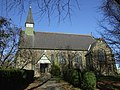 Holy Trinity Church, Murton - geograph.org.uk - 3219253.jpg 640 × 480; 108 KB
-
 Houses on Broadoaks, Murton - geograph.org.uk - 3219236.jpg 1,024 × 648; 118 KB
-
 Houses on Station Road, Murton - geograph.org.uk - 3219243.jpg 640 × 480; 49 KB
-
 Houses on Williams Road, Murton - geograph.org.uk - 3219249.jpg 640 × 480; 74 KB
-
 Information board valley wetland - geograph.org.uk - 1345162.jpg 640 × 480; 107 KB
-

-
 Leaving County Durham on the B1285 - geograph.org.uk - 3171836.jpg 3,648 × 2,736; 2.32 MB
-
 Main Road through Murton - geograph.org.uk - 259836.jpg 640 × 425; 108 KB
-
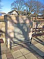 Memorial to William McNally - geograph.org.uk - 314274.jpg 480 × 640; 85 KB
-
 Murton - geograph.org.uk - 5074622.jpg 800 × 600; 201 KB
-
 Murton Colliery (geograph 1980494).jpg 640 × 427; 54 KB
-
 Murton County Primary School.jpg 640 × 480; 79 KB
-
 Murton Library, Barnes Road.jpg 640 × 480; 61 KB
-
 Murton Moor - geograph.org.uk - 5074628.jpg 800 × 600; 186 KB
-
 Murton pit - geograph.org.uk - 629652.jpg 640 × 424; 66 KB
-
 Murton pit.jpg 636 × 363; 41 KB
-
 Murton Station Post Office.jpg 640 × 480; 70 KB
-

-

-
 New apartments, Murton - geograph.org.uk - 3219257.jpg 640 × 480; 88 KB
-
 Northern edge of Murton - geograph.org.uk - 2909012.jpg 3,264 × 2,448; 1.32 MB
-
 Old railway walk near Murton - geograph.org.uk - 2909002.jpg 3,264 × 2,448; 1.55 MB
-
 Old road, Murton - geograph.org.uk - 5074617.jpg 800 × 600; 289 KB
-
 Ood invades Dalton Park - panoramio.jpg 2,592 × 3,888; 3.7 MB
-
 Pithead wheel, Murton.jpg 640 × 480; 68 KB
-
 Post Office, Murton - geograph.org.uk - 3219242.jpg 640 × 480; 76 KB
-
 Reclaimed spoil heap - geograph.org.uk - 1345213.jpg 640 × 480; 101 KB
-
 Roundabout on the A19 - geograph.org.uk - 1345250.jpg 640 × 480; 95 KB
-

-

-
 South Sharpley Farm and windfarm - geograph.org.uk - 314227.jpg 640 × 480; 54 KB
-
 South Sharpley windfarm - geograph.org.uk - 314226.jpg 640 × 480; 55 KB
-
 St Joseph's R C Primary School Murton - geograph.org.uk - 2171035.jpg 2,048 × 1,536; 716 KB
-
 Station Road (B1285), Murton - geograph.org.uk - 3219244.jpg 640 × 480; 67 KB
-
 The A19 heading north - geograph.org.uk - 3219267.jpg 640 × 480; 81 KB
-
 The Colliery Inn in Murton - geograph.org.uk - 2975531.jpg 2,976 × 2,196; 921 KB
-
 The Dalton Park Inn, Murton - geograph.org.uk - 3219255.jpg 1,024 × 714; 119 KB
-
 The Pemberton Arms - geograph.org.uk - 3219100.jpg 1,024 × 625; 98 KB
-

-
 Townhouses, Murton - geograph.org.uk - 3219261.jpg 640 × 480; 78 KB
-
 View of the Pemberton Arms, Cold Heseldon - geograph.org.uk - 3784201.jpg 4,608 × 3,456; 4.35 MB
-
 Village allotments - geograph.org.uk - 1345139.jpg 640 × 291; 75 KB
-
 Voting for Christmas - geograph.org.uk - 297844.jpg 640 × 480; 63 KB
-

-
 Williams Road, Murton - geograph.org.uk - 3219250.jpg 640 × 480; 82 KB
-
 Winds Lane, Murton - geograph.org.uk - 314261.jpg 640 × 480; 77 KB


_-_geograph.org.uk_-_3219254.jpg)
_-_geograph.org.uk_-_3219260.jpg)
.jpg)


.jpg)


,_Murton_-_geograph.org.uk_-_3219244.jpg)


