Category:Murrumburrah, New South Wales
Jump to navigation
Jump to search
town in New South Wales, Australia  | |||||
| Upload media | |||||
| Instance of | |||||
|---|---|---|---|---|---|
| Location |
| ||||
| Population |
| ||||
| Elevation above sea level |
| ||||
 | |||||
English: Murrumburrah is a township in New South Wales, Australia in Harden Shire and forms a twin town with Harden. It is near both the Canberra region of the Australian Capital Territory, and the Riverina Region in the southwest area of NSW. It is on the Burley Griffin Way, the major link from the Riverina to the Hume Highway near Yass, and ultimately Sydney, Canberra and the coast. At the 2006 census, Murrumburrah had a population of 952.
Subcategories
This category has the following 6 subcategories, out of 6 total.
Media in category "Murrumburrah, New South Wales"
The following 17 files are in this category, out of 17 total.
-
 Carl Valerius and Bill the Bastard.jpg 1,851 × 2,468; 1.57 MB
-
 Council Chambers Murrumburrah.JPG 3,872 × 2,592; 2.46 MB
-
 Harden stone 2.jpg 1,600 × 1,200; 731 KB
-
 Harden West Mine, Murrumburrah, N.S.W. (24059532642).jpg 1,358 × 830; 163 KB
-
 J A Kenneth Mackay.jpg 2,531 × 3,796; 3.17 MB
-
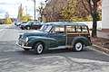
 Murrumburrah Antique Car 001.JPG 6,016 × 4,000; 9.03 MB
-
 Murrumburrah Antique Car 002.JPG 6,016 × 4,000; 8.49 MB
-
 Murrumburrah Antique Car 003.JPG 6,016 × 4,000; 9.81 MB
-
 Murrumburrah Entering from Jugiong Road.JPG 5,832 × 3,736; 6.45 MB
-
 Murrumburrah from Bridge 001.JPG 6,016 × 4,000; 7.63 MB
-
 Murrumburrah Sheep Head Tile.JPG 6,016 × 4,000; 7.31 MB
-
 Murrumburrah Town Entry Sign.JPG 5,672 × 3,744; 7.27 MB
-
 Murrumburrah Train 001.JPG 6,016 × 4,000; 7.42 MB
-
 Murrumburrah Train 002.JPG 6,016 × 4,000; 7.06 MB
-
 Murrumburrah Video Game Bears.JPG 6,016 × 4,000; 7.52 MB
-
 Pizza and Kebabs Murrumburrah.JPG 3,248 × 2,496; 1.74 MB
-
 Trooper Bradford.jpg 3,265 × 4,897; 5.17 MB


.jpg)


