Category:Murgleiter
Jump to navigation
Jump to search
hiking trail in the Black Forest _(cropped).jpg) | |||||
| Upload media | |||||
| Instance of | |||||
|---|---|---|---|---|---|
| Named after | |||||
| Location | Baden-Württemberg, Germany | ||||
| Start point | |||||
| Destination point | |||||
| official website | |||||
| |||||
Deutsch: Murgleiter, ein Wanderweg durchs Murgtal im Nordschwarzwald.
Subcategories
This category has the following 3 subcategories, out of 3 total.
Media in category "Murgleiter"
The following 200 files are in this category, out of 221 total.
(previous page) (next page)-
 Auf dem Merkur.jpg 4,320 × 3,240; 10.21 MB
-
 Ausblick vom Merkur (1).jpg 4,320 × 3,240; 9.68 MB
-
 Ausblick vom Merkur (2).jpg 4,320 × 3,240; 8.09 MB
-
 Ausblick vom Merkur (3).jpg 4,320 × 3,240; 9.81 MB
-
 Ausblick vom Merkur (4).jpg 4,320 × 3,240; 10.26 MB
-
 Ausblick vom Wanderweg Fatima-Kapelle - Reichental (1), Gernsbach.jpg 4,320 × 3,240; 2.97 MB
-
 Ausblick vom Wanderweg Fatima-Kapelle - Reichental (2), Gernsbach.jpg 4,320 × 3,240; 2.97 MB
-
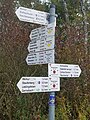
 Baden-Baden-Merkur-76-Wegweiser-2015-gje.jpg 3,456 × 5,184; 3.22 MB
-
 Bergstation der Merkur-Bergbahn.jpg 4,320 × 3,240; 9.74 MB
-
 Blick auf Reichental von der Fatima-Kapelle 1.jpg 4,320 × 3,240; 2.99 MB
-
 Blick auf Reichental von der Fatima-Kapelle 2.jpg 4,320 × 3,240; 2.96 MB
-
 Blick auf Schloss Eberstein und Obertsrot.jpg 4,320 × 3,240; 3.02 MB
-
 Blick vom Schloss Eberstein (Gernsbach).jpg 4,320 × 3,240; 2.97 MB
-
 Blick zum Schloss Eberstein (2).jpg 4,320 × 3,240; 3.4 MB
-
 Fachwerkdorf Reichental, Gernsbach (1).jpg 4,320 × 3,240; 7.62 MB
-
 Fachwerkdorf Reichental, Gernsbach (2).jpg 3,240 × 4,320; 6.59 MB
-
 Fachwerkdorf Reichental, Gernsbach (3).jpg 4,320 × 3,240; 7.53 MB
-
 Fachwerkdorf Reichental, Gernsbach (4).jpg 3,240 × 4,320; 7.5 MB
-
 Fachwerkdorf Reichental, Gernsbach (5).jpg 4,320 × 3,240; 8.11 MB
-
 Fachwerkdorf Reichental, Gernsbach (7).jpg 4,320 × 3,240; 2.99 MB
-
 Fatima-Kapelle Reichental, Gernsbach.jpg 4,320 × 3,240; 8.9 MB
-
 Felsenweg am Rockertfelsen (1), Gernsbach.jpg 4,320 × 3,240; 7.6 MB
-
 Felsenweg am Rockertfelsen (2), Gernsbach.jpg 4,320 × 3,240; 8.36 MB
-
 Felsenweg am Rockertfelsen (3), Gernsbach.jpg 4,320 × 3,240; 9.67 MB
-
 Felsenweg am Rockertfelsen (4), Gernsbach.jpg 4,320 × 3,240; 9.3 MB
-

-
 Gleitschirmflieger-Startplatz am Merkur Baden-Baden (Ausblick ins Murgtal).jpg 4,320 × 3,240; 8.35 MB
-
 Im Fachwerkdorf Reichental 1.jpg 4,320 × 3,240; 3.02 MB
-
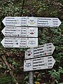
 Infotafel - panoramio (1).jpg 1,600 × 1,125; 1.62 MB
-
 Kleiner Latschigfelsen.jpg 4,000 × 3,000; 1.73 MB
-
 Latschigfelsen.JPG 2,592 × 1,944; 1.75 MB
-
 Merkurturm (1).jpg 3,240 × 4,320; 9.49 MB
-
 Merkurturm (2).jpg 3,240 × 4,320; 9.23 MB
-
 Murgleiter Wegzeichen kl.jpg 225 × 135; 51 KB
-
 Murgleiter-Portal.jpg 5,347 × 3,565; 2.38 MB
-
 Panoramaweg vom Schloss Eberstein Richtung Erzgrube.jpg 4,320 × 3,240; 2.96 MB
-
 Rinkenkopf 2.JPG 3,920 × 2,204; 1.37 MB
-
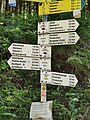
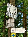
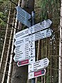
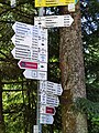
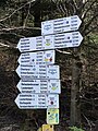
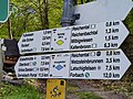
 Schilderstandort Binsenwasen (u.a. Gernsbacher Runde, Murgleiter) (cropped).jpg 1,075 × 503; 104 KB
-
 Schilderstandort Binsenwasen (u.a. Gernsbacher Runde, Murgleiter).jpg 4,320 × 3,240; 2.93 MB
-
 Schloss Eberstein bei Gernsbach 2.jpg 4,320 × 3,240; 2.97 MB
-
 Stadtbahn-Haltestelle Obertsrot mit Blick zum Schloss Eberstein (1).jpg 4,320 × 3,240; 3.19 MB
-
 Stadtbahn-Haltestelle Obertsrot mit Blick zum Schloss Eberstein (2).jpg 4,320 × 3,240; 3 MB
-
 SWV Wegweiser Arboretum.jpg 3,264 × 2,448; 3.46 MB
-
 SWV Wegweiser B15 Schwarzenbachmauer.jpg 4,512 × 6,016; 9.05 MB
-
 SWV Wegweiser BABA012 Verbrannter Felsen (1).jpg 3,024 × 4,032; 4.14 MB
-
 SWV Wegweiser BABA012 Verbrannter Felsen (2).jpg 3,024 × 4,032; 2.84 MB
-
 SWV Wegweiser BABA013 Ebersteinburg Parkplatz Wolfsschlucht (1).jpg 3,024 × 4,032; 3.81 MB
-
 SWV Wegweiser BABA013 Ebersteinburg Parkplatz Wolfsschlucht (2).jpg 3,024 × 4,032; 4.22 MB
-
 SWV Wegweiser BABA013 Ebersteinburg Parkplatz Wolfsschlucht.jpg 3,024 × 4,032; 7.79 MB
-
 SWV Wegweiser BABA015 Teufelskanzel (1).jpg 3,024 × 4,032; 4.71 MB
-
 SWV Wegweiser BABA015 Teufelskanzel (2).jpg 3,024 × 4,032; 5.28 MB
-
 SWV Wegweiser BABA016 Vettersbruch (1).jpg 3,024 × 4,032; 2.1 MB
-
 SWV Wegweiser BABA016 Vettersbruch (2).jpg 3,024 × 4,032; 3.53 MB
-
 SWV Wegweiser BABA104 Unter dem Merkur.jpg 3,024 × 4,032; 3.98 MB
-
 SWV Wegweiser BABA181 Ebersteinburg Gasthaus Wolfsschlucht.jpg 3,024 × 4,032; 3.58 MB
-
 SWV Wegweiser F02 Erbersbronn Hugenloch.jpg 2,448 × 3,264; 4.23 MB
-
 SWV Wegweiser FDSBA076 Rinkenturmwegle.jpg 4,032 × 3,024; 7.33 MB
-
 SWV Wegweiser FDSBA080 Rinkenkopfwegle.jpg 3,024 × 4,032; 7.49 MB
-
 SWV Wegweiser FDSBA081 Sommerseitenweg.jpg 3,024 × 4,032; 5.18 MB
-
 SWV Wegweiser FDSBM056 Halde.jpg 3,024 × 4,032; 8.15 MB
-
 SWV Wegweiser FDSBM057 Ruhbach.jpg 2,448 × 3,264; 4.93 MB
-
 SWV Wegweiser FDSBM060 Damwildgehege.jpg 2,448 × 3,264; 4.47 MB
-
 SWV Wegweiser FDSBM067 Eulengrund.jpg 2,448 × 3,264; 2.99 MB
-
 SWV Wegweiser FDSBM068 Gärtenbühlwegle.jpg 3,024 × 4,032; 6.5 MB
-
 SWV Wegweiser FDSBM069 Gärtenbühl.jpg 3,024 × 4,032; 7.21 MB
-
 SWV Wegweiser FDSBM070 Fuchsloch.jpg 3,024 × 4,032; 8.41 MB
-
 SWV Wegweiser FDSBM071 Satteleiwegle.jpg 3,024 × 4,032; 7.32 MB
-
 SWV Wegweiser FDSBM478 Wasserstube.jpg 3,024 × 4,032; 6.52 MB
-
 SWV Wegweiser FDSBO017 Buhlbach.jpg 3,024 × 4,032; 7.34 MB
-
 SWV Wegweiser FDSBO022 Forellenhof.jpg 4,032 × 3,024; 7.29 MB
-
 SWV Wegweiser FDSBO023 Hänger.jpg 3,024 × 4,032; 5.8 MB
-
 SWV Wegweiser FDSBO024 Röhrsbächle.jpg 2,448 × 3,264; 5.39 MB
-
 SWV Wegweiser FDSBO029 Murgursprung.jpg 3,264 × 2,448; 5.89 MB
-
 SWV Wegweiser FDSBO036 Parkplatz Kraftenbuckel.jpg 3,024 × 4,032; 6.13 MB
-
 SWV Wegweiser FDSBO037 Bogenweg.jpg 2,448 × 3,264; 4.65 MB
-
 SWV Wegweiser FDSBO040 Rotmurg-Wiesen.jpg 2,448 × 3,264; 5.77 MB
-
 SWV Wegweiser FDSBO043 Rechtmurgwegle.jpg 2,448 × 3,264; 4.53 MB
-
 SWV Wegweiser FDSBO058 Tannenfels.jpg 3,024 × 4,032; 6.65 MB
-
 SWV Wegweiser FDSBO061 Köpfleshütte.jpg 3,024 × 4,032; 8.68 MB
-
 SWV Wegweiser FDSBO062 Aiterbach.jpg 3,024 × 4,032; 6.89 MB
-
 SWV Wegweiser FDSBO066 Rotmurgwegle.jpg 3,024 × 4,032; 7.05 MB
-
 SWV Wegweiser FDSBO097 Rotmurg-Schanze.jpg 3,024 × 4,032; 7.73 MB
-
 SWV Wegweiser FDSBO098 Peterles Buckel.jpg 3,024 × 4,032; 6.42 MB
-
 SWV Wegweiser FDSBO099 Aiterbächle.jpg 3,024 × 4,032; 6.9 MB
-
 SWV Wegweiser FDSBO484 Fischerstüble.jpg 3,024 × 4,032; 7.75 MB
-
 SWV Wegweiser FDSBO500 Wiedenbrunnen.jpg 2,448 × 3,264; 6 MB
-
 SWV Wegweiser FDSBS339 Mäder-Unterstand.jpg 2,448 × 3,264; 5.06 MB
-
 SWV Wegweiser FDSBS340 Haselbach.jpg 3,024 × 4,032; 4.62 MB
-
 SWV Wegweiser FDSBS341 Schwarzenberg Alte Burg.jpg 3,024 × 4,032; 6.55 MB
-
 SWV Wegweiser FDSBS342 Schwarzenberg Silberbergwegle.jpg 4,032 × 3,024; 6.3 MB
-
 SWV Wegweiser FDSBS343 Roter Rain.jpg 3,024 × 4,032; 6.74 MB
-
 SWV Wegweiser FDSBS345 Staig.jpg 3,024 × 4,032; 6.47 MB
-
 SWV Wegweiser FDSBS346 Panoramastüble (1).jpg 3,024 × 4,032; 4.91 MB
-
 SWV Wegweiser FDSBS346 Thierhalde.jpg 3,024 × 4,032; 7.21 MB
-
 SWV Wegweiser FDSBS356 Schönmünzach Waldstraße.jpg 3,024 × 4,032; 6.59 MB
-
 SWV Wegweiser FDSBS357 Schönmünzach Bahnhof.jpg 4,032 × 3,024; 6.57 MB
-
 SWV Wegweiser FDSBS358 Schönmünzach Schönmünzstraße.jpg 3,024 × 4,032; 7.9 MB
-
 SWV Wegweiser FDSBS359 Schönmünzach Schifferstraße.jpg 3,024 × 4,032; 6 MB
-
 SWV Wegweiser FDSBS363 Schönmünzach Draigrund.jpg 3,024 × 4,032; 7.32 MB
-
 SWV Wegweiser FDSBS375 Schlossbergwegle.jpg 3,024 × 4,032; 6.26 MB
-
 SWV Wegweiser FDSBS376 Eckköpfle.jpg 3,024 × 4,032; 6.98 MB
-
 SWV Wegweiser FDSBS377 Silberberg.jpg 2,448 × 3,264; 4.81 MB
-
 SWV Wegweiser FDSBS389 Huzenbacher See (1).jpg 3,024 × 4,032; 8.16 MB
-
 SWV Wegweiser FDSBS389 Huzenbacher See (2).jpg 3,024 × 4,032; 9.52 MB
-
 SWV Wegweiser FDSBS465 Schwarzenbachquelle.jpg 3,024 × 4,032; 7.37 MB
-
 SWV Wegweiser FDSBS466 Eichäcker.jpg 2,448 × 3,264; 4.63 MB
-
 SWV Wegweiser FDSBS472 Mäder.jpg 3,024 × 4,032; 5.95 MB
-
 SWV Wegweiser FDSBS494 School.jpg 3,024 × 4,032; 7.22 MB
-
 SWV Wegweiser FDSBT034 Häslen.jpg 3,024 × 4,032; 6.17 MB
-
 SWV Wegweiser FDSBT074 Sattelei.jpg 3,024 × 4,032; 6.37 MB
-
 SWV Wegweiser FDSBT077 Rinkenkopf.jpg 3,024 × 4,032; 6.52 MB
-
 SWV Wegweiser FDSBT081 Am Waldacker.jpg 3,024 × 4,032; 6.85 MB
-
 SWV Wegweiser FDSBT202 Heideweg.jpg 4,512 × 6,016; 13.34 MB
-
 SWV Wegweiser FDSBT221 Am Krummen Loch.jpg 2,448 × 3,264; 4.72 MB
-
 SWV Wegweiser FDSBT222 Wiesenwegle.jpg 2,448 × 3,264; 5.54 MB
-
 SWV Wegweiser FDSBT240 David Finkbeiner-Hütte.jpg 3,024 × 4,032; 6.28 MB
-
 SWV Wegweiser FDSBT241 An der Furt.jpg 3,024 × 4,032; 8.38 MB
-
 SWV Wegweiser FDSBT245 Pflanzgarten.jpg 3,024 × 4,032; 10.65 MB
-
 SWV Wegweiser FDSBT249 Überzwercher Berg (1).jpg 3,024 × 4,032; 8.08 MB
-
 SWV Wegweiser FDSBT263 Am Brunnenweg.jpg 3,024 × 4,032; 7.8 MB
-
 SWV Wegweiser FDSBT390 Dachsbau.jpg 3,024 × 4,032; 8.42 MB
-
 SWV Wegweiser FDSBT391 Kleemisse.jpg 3,024 × 4,032; 8.18 MB
-
 SWV Wegweiser FDSBT392 Kleemisse.jpg 3,024 × 4,032; 9.61 MB
-
 SWV Wegweiser FDSBT393 Hinterer Plon.jpg 3,024 × 4,032; 6.54 MB
-
 SWV Wegweiser FDSBT464 Wiesenhütte.jpg 3,024 × 4,032; 7.68 MB
-
 SWV Wegweiser FDSBT470 Seeblick.jpg 2,448 × 3,264; 5.53 MB
-
 SWV Wegweiser FDSBT475 Rinkenwall.jpg 3,024 × 4,032; 7.96 MB
-
 SWV Wegweiser FDSBT476 Rinkenturm.jpg 3,264 × 2,448; 3.9 MB
-
 SWV Wegweiser FDSBT487 Flößerhütte.jpg 3,024 × 4,032; 7.74 MB
-
 SWV Wegweiser FDSBT488 Pflanzgarten.jpg 3,024 × 4,032; 7.64 MB
-
 SWV Wegweiser L06 Latschighang.jpg 2,448 × 3,264; 3.72 MB
-
 SWV Wegweiser L17 Hutweg (2).jpg 4,032 × 3,024; 7.32 MB
-
 SWV Wegweiser MLF1 Riedberg.jpg 4,032 × 3,024; 5.81 MB
-
 SWV Wegweiser MLF11 Grundablass.jpg 4,032 × 3,024; 5.27 MB
-
 SWV Wegweiser MLF13 Raumünzach Kraftwerk.jpg 2,448 × 3,264; 3.99 MB
-
 SWV Wegweiser MLF14 Hornbach.jpg 3,024 × 4,032; 6.33 MB
-
 SWV Wegweiser MLF1A Forkelgrund.jpg 4,032 × 3,024; 7 MB
-
 SWV Wegweiser MLF3 Forkel.jpg 4,032 × 3,024; 6.97 MB
-
 SWV Wegweiser OGOP051 Steinmäuerle.jpg 3,024 × 4,032; 7.97 MB
-
 SWV Wegweiser OGOP052 Steinmäuerle Infotafel.jpg 3,024 × 4,032; 7.74 MB
-
 SWV Wegweiser RAGA004.jpg 3,024 × 4,032; 4.78 MB
-
 SWV Wegweiser RAGA106.jpg 3,024 × 4,032; 3.49 MB
-
 SWV Wegweiser RAGA107.jpg 3,024 × 4,032; 2.98 MB
-
 SWV Wegweiser RAGA109.jpg 3,024 × 4,032; 3.39 MB
-
 SWV Wegweiser RAGA110 (1).jpg 3,024 × 4,032; 4.66 MB
-
 SWV Wegweiser RAGA110 (2).jpg 3,024 × 4,032; 3.72 MB
-
 SWV Wegweiser RAGA110a.jpg 3,024 × 4,032; 6.52 MB
-
 SWV Wegweiser RAGA117 (1).jpg 3,024 × 4,032; 5.06 MB
-
 SWV Wegweiser RAGA117 (2).jpg 3,024 × 4,032; 3.69 MB
-
 SWV Wegweiser RAGA126.jpg 2,234 × 2,978; 4.25 MB
-
 SWV Wegweiser RAGA127.jpg 3,024 × 4,032; 4.82 MB
-
 SWV Wegweiser RAGA128.jpg 3,024 × 4,032; 3.54 MB
-
 SWV Wegweiser RAGA129.jpg 3,024 × 4,032; 4.09 MB
-
 SWV Wegweiser RAGA130 (1).jpg 3,024 × 4,032; 3.8 MB
-
 SWV Wegweiser RAGA130 (2).jpg 3,024 × 4,032; 3.62 MB
-
 SWV Wegweiser RAGA131.jpg 3,024 × 4,032; 3.28 MB
-
 SWV Wegweiser RAGA132.jpg 3,024 × 4,032; 3.25 MB
-
 SWV Wegweiser RAGA133.jpg 3,024 × 4,032; 3.67 MB
-
 SWV Wegweiser RAGA134.jpg 3,024 × 4,032; 2.87 MB
-
 SWV Wegweiser RAGA135.jpg 3,024 × 4,032; 4.76 MB
-
 SWV Wegweiser RAGA136 (1).jpg 3,024 × 4,032; 3.89 MB
-
 SWV Wegweiser RAGA136 (2).jpg 3,024 × 4,032; 3.72 MB
-
 SWV Wegweiser RAGA141.jpg 3,024 × 4,032; 3.77 MB
-
 SWV Wegweiser RAGA142.jpg 3,024 × 4,032; 3.7 MB
-
 SWV Wegweiser RAGE214 Obertsrot (2).jpg 4,032 × 3,024; 5.9 MB
-
 SWV Wegweiser RAGE214a Obertsrot.jpg 4,032 × 3,024; 6.84 MB
-
 SWV Wegweiser RAGE217 Rehackerbrunnen.jpg 3,024 × 4,032; 5.73 MB
-
 SWV Wegweiser RAGE218 Birketsplatz.jpg 3,024 × 4,032; 6.33 MB
-
 SWV Wegweiser RAGE220 Eichrodtsruh.jpg 2,448 × 3,264; 4.84 MB
-
 SWV Wegweiser RAGE221 Dachsstein.jpg 3,264 × 2,448; 5.4 MB
-
 SWV Wegweiser RAGE222 Rockert.jpg 2,448 × 3,264; 4.57 MB
-
 SWV Wegweiser RAGE223 Elsbethhütte.jpg 3,024 × 4,032; 6.55 MB
-
 SWV Wegweiser RAGE223b Elsbethhütte.jpg 4,032 × 3,024; 6.15 MB
-
 SWV Wegweiser RAGE228.jpg 3,024 × 4,032; 2.7 MB
-
 SWV Wegweiser RAGE237 Fußwiesen.jpg 2,448 × 3,264; 5.46 MB
-
 SWV Wegweiser RAGE239 Großer Rank.jpg 3,024 × 4,032; 6.3 MB
-
 SWV Wegweiser RAGE240 Schloss Eberstein.jpg 3,024 × 4,032; 5.15 MB
-
 SWV Wegweiser RAGE240a Schloss Eberstein (1).jpg 3,024 × 4,032; 6.69 MB
-
 SWV Wegweiser RAGE240b Schloss Eberstein.jpg 3,024 × 4,032; 5.07 MB
-
 SWV Wegweiser RAGE263 Wegkreuz Eben.jpg 2,448 × 3,264; 4.22 MB
-
 SWV Wegweiser RAGE273 Auerhahn.jpg 3,024 × 4,032; 5.48 MB
-
 SWV Wegweiser RAGE273a Auerhahn.jpg 4,032 × 3,024; 6.95 MB
-
 SWV Wegweiser RAGE274 Johannesplatz.jpg 3,024 × 4,032; 6.51 MB
-
 SWV Wegweiser RAGE280 Büchet (1).jpg 4,032 × 3,024; 6.11 MB
-
 SWV Wegweiser RAGE287 Schlosswiesen.jpg 4,032 × 3,024; 8.3 MB
-
 SWV Wegweiser RAGE291 Blumenplatz.jpg 4,512 × 6,016; 8.97 MB
-
 SWV Wegweiser RAGE294 Obertsroter Straße (1).jpg 3,024 × 4,032; 6.54 MB
-
 SWV Wegweiser RAGE296 Wingolfbrunnen.jpg 3,024 × 4,032; 7.57 MB
-
 SWV Wegweiser RAGE301 Fatimakapelle.jpg 4,032 × 3,024; 7.56 MB
-
 SWV Wegweiser RAGE301a Fatimakapelle (1).jpg 4,032 × 3,024; 6.52 MB
-
 SWV Wegweiser RAGE309.jpg 3,024 × 4,032; 4 MB
-
 SWV Wegweiser RAGE321 Luisenruhe (1).jpg 3,024 × 4,032; 7.22 MB
-
 SWV Wegweiser RAGE321 Luisenruhe (2).jpg 4,032 × 3,024; 6.6 MB
-
 SWV Wegweiser RAGE322 Gernweg (1).jpg 4,032 × 3,024; 6.17 MB
-
 SWV Wegweiser RAGE327 Eberpfad.jpg 3,024 × 4,032; 6.31 MB
-
 SWV Wegweiser RAGE328.jpg 3,024 × 4,032; 3.72 MB
-
 SWV Wegweiser RAGE329.jpg 3,024 × 4,032; 3.46 MB
-
 SWV Wegweiser RAGE335.jpg 3,024 × 4,032; 4.11 MB
-
 SWV Wegweiser RAGE336 (1).jpg 3,024 × 4,032; 4.41 MB
-
 SWV Wegweiser RAGE337.jpg 3,024 × 4,032; 2.38 MB

.jpg)
.jpg)
.jpg)
.jpg)
,_Gernsbach.jpg)
,_Gernsbach.jpg)


.jpg)
.jpg)
.jpg)
.jpg)
.jpg)
.jpg)
.jpg)
.jpg)

,_Gernsbach.jpg)
,_Gernsbach.jpg)
,_Gernsbach.jpg)
,_Gernsbach.jpg)
.jpg)
.jpg)

.jpg)


.jpg)
.jpg)


.jpg)

.jpg)
.jpg)


.jpg)
.jpg)
.jpg)
.jpg)

.jpg)
.jpg)
.jpg)
.jpg)


.jpg)


.jpg)
.jpg)


.jpg)


.jpg)


.jpg)
.jpg)

.jpg)
.jpg)


.jpg)
.jpg)


.jpg)
.jpg)


.jpg)


.jpg)


.jpg)


.jpg)


.jpg)

.jpg)
.jpg)
.jpg)


.jpg)
