Category:Munslow
Jump to navigation
Jump to search
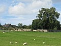
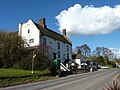
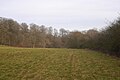
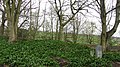
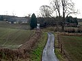
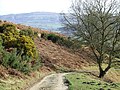
English: Munslow is a small village and civil parish in Shropshire, England. It is situated on the B4368 road.
Polski: Munslow – wieś i civil parish w Anglii, w hrabstwie Shropshire. W 2011 roku civil parish liczyła 386 mieszkańców.

village and civil parish in Shropshire, United Kingdom  | |||||
| Upload media | |||||
| Instance of | |||||
|---|---|---|---|---|---|
| Location | Shropshire, West Midlands, England | ||||
 | |||||
Subcategories
This category has the following 7 subcategories, out of 7 total.
A
B
H
- Hungerford, Shropshire (18 F)
M
- Millichope Park (14 F)
- Munslow War Memorial (2 F)
U
- Upper Millichope (2 F)
Media in category "Munslow"
The following 118 files are in this category, out of 118 total.
-

-
 An unusual warning sign of a bridleway crossing - geograph.org.uk - 5999874.jpg 1,600 × 1,065; 554 KB
-
 Approaching a bend in the B4368 - geograph.org.uk - 6105634.jpg 800 × 600; 143 KB
-
 Approaching the B4368 at Beambridge - geograph.org.uk - 2435662.jpg 800 × 600; 311 KB
-
 April afternoon overlooking Corvedale - geograph.org.uk - 3420803.jpg 640 × 480; 247 KB
-
 Aston Hall walled garden - geograph.org.uk - 3680143.jpg 2,513 × 1,883; 1.71 MB
-
 B4368 towards Shipton - geograph.org.uk - 6107271.jpg 800 × 600; 121 KB
-
 B4368, Beambridge - geograph.org.uk - 6105641.jpg 800 × 600; 172 KB
-
 B4368, Munslow (geograph 2126945).jpg 640 × 480; 127 KB
-
 B4368, Munslow - geograph.org.uk - 6105579.jpg 800 × 600; 148 KB
-
 B4638 towards Munslow - geograph.org.uk - 6105567.jpg 800 × 600; 115 KB
-
 Barn, Hungerford Mill - geograph.org.uk - 6105667.jpg 800 × 529; 94 KB
-
 Boundary Stone - geograph.org.uk - 5313096.jpg 471 × 640; 121 KB
-
 Bridleway down through Speller Coppice - geograph.org.uk - 2672603.jpg 816 × 612; 298 KB
-
 Close up, Elizabeth II, Munslow - geograph.org.uk - 6105682.jpg 2,094 × 3,931; 2.09 MB
-
 Corvedale and the Brown Clee - geograph.org.uk - 2185378.jpg 2,016 × 1,512; 903 KB
-
 Cottages, Munslow - geograph.org.uk - 6105582.jpg 800 × 469; 88 KB
-
 Crop field and hedgerow off the B4368 - geograph.org.uk - 6105546.jpg 800 × 600; 166 KB
-
 Crop field off the B4368, Aston Munslow - geograph.org.uk - 6105566.jpg 800 × 600; 107 KB
-
 Crop under polythene - geograph.org.uk - 3160134.jpg 640 × 360; 241 KB
-
 Crown Hotel - geograph.org.uk - 4904377.jpg 2,048 × 1,536; 1.53 MB
-

-
 Elizabeth II postbox, Munslow - geograph.org.uk - 6105680.jpg 2,525 × 2,268; 1.92 MB
-
 Emerging from the hill - geograph.org.uk - 5542865.jpg 1,024 × 684; 515 KB
-
 Enjoying a run in High Wood - geograph.org.uk - 2672571.jpg 661 × 881; 366 KB
-
 Entering Munslow - geograph.org.uk - 6105574.jpg 800 × 536; 112 KB
-
 Entrance to Badgers Brook - geograph.org.uk - 1073379.jpg 640 × 480; 127 KB
-
 Farm buildings, Holloway Farm - geograph.org.uk - 5798050.jpg 1,024 × 680; 274 KB
-
 Farm road, Hope Dale - geograph.org.uk - 3163321.jpg 640 × 360; 242 KB
-
 Farm road, Munslow - geograph.org.uk - 5542920.jpg 1,024 × 684; 453 KB
-
 Farm road, Munslow - geograph.org.uk - 5543001.jpg 1,024 × 684; 527 KB
-
 Farm track and Nissen hut, Aston Munslow - geograph.org.uk - 5999862.jpg 1,600 × 1,200; 714 KB
-
 Farmland near Rushbury - geograph.org.uk - 2160139.jpg 640 × 405; 164 KB
-
 Field edge, Munslow - geograph.org.uk - 5543007.jpg 1,024 × 684; 435 KB
-
 Grazing, Corvedale - geograph.org.uk - 6105632.jpg 640 × 480; 83 KB
-
 Grazing, Corvedale - geograph.org.uk - 6105672.jpg 800 × 600; 122 KB
-
 Grazing, Corvedale - geograph.org.uk - 6107265.jpg 800 × 509; 116 KB
-
 Green lane, Munslow - geograph.org.uk - 5542887.jpg 1,024 × 684; 543 KB
-
 Green lane, Munslow - geograph.org.uk - 5542896.jpg 1,024 × 684; 485 KB
-
 Heading for the main road - geograph.org.uk - 832864.jpg 640 × 480; 79 KB
-
 Houses on the B4368, Beambridge - geograph.org.uk - 6105637.jpg 800 × 600; 118 KB
-

-
 Limestone dip slope - geograph.org.uk - 5542880.jpg 1,024 × 684; 277 KB
-
 Lone tree, Corve Dale - geograph.org.uk - 5542983.jpg 1,024 × 684; 397 KB
-
 Looking across the fields to Aston Hall - geograph.org.uk - 3680138.jpg 2,470 × 1,850; 1.44 MB
-
 Middlehope Hill - geograph.org.uk - 3304224.jpg 1,600 × 1,200; 1.53 MB
-
 Middlehope Hill trig point - geograph.org.uk - 2672623.jpg 816 × 612; 297 KB
-
 Middlehope Hill trig, close up - geograph.org.uk - 2672626.jpg 612 × 816; 332 KB
-
 Millichope Lodge - geograph.org.uk - 6105636.jpg 800 × 477; 117 KB
-
 Minor road towards Rushbury - geograph.org.uk - 6105652.jpg 640 × 480; 84 KB
-
 Muddy track - geograph.org.uk - 5542981.jpg 1,024 × 684; 413 KB
-
 Munslow - geograph.org.uk - 200747.jpg 640 × 480; 110 KB
-
 Munslow - geograph.org.uk - 5541829.jpg 1,024 × 684; 391 KB
-
 Munslow House, Munslow - geograph.org.uk - 6054918.jpg 554 × 640; 223 KB
-
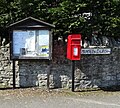
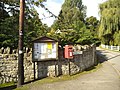 Munslow Notices - geograph.org.uk - 3691720.jpg 800 × 600; 153 KB
-
 Munslow village street - geograph.org.uk - 4904389.jpg 2,048 × 1,536; 1.55 MB
-
 North West side of Big Wood, near Millichope - geograph.org.uk - 4580415.jpg 1,024 × 768; 170 KB
-
 Oilseed rape, Munslow - geograph.org.uk - 5542929.jpg 1,024 × 684; 317 KB
-
 Old field boundary on Wenlock Edge - geograph.org.uk - 6476397.jpg 640 × 480; 103 KB
-
 Old Quarry, Whitbach - geograph.org.uk - 3414862.jpg 4,320 × 3,240; 3.38 MB
-

-
 Old Toll House by the B4368, Beambridge - geograph.org.uk - 6114556.jpg 640 × 426; 130 KB
-
 Ordnance Survey Cut Mark - geograph.org.uk - 5315298.jpg 640 × 340; 91 KB
-
 Ordnance Survey Rivet - geograph.org.uk - 5313093.jpg 409 × 640; 87 KB
-
 Path between Munslow and Aston Munslow - geograph.org.uk - 3020237.jpg 1,600 × 1,200; 777 KB
-
 Pond at bottom of Baldwyns Gate - geograph.org.uk - 4580424.jpg 1,024 × 768; 151 KB
-
 Road to Munslow Church - geograph.org.uk - 6105685.jpg 5,184 × 3,888; 5.95 MB
-
 Road to New House Farm - geograph.org.uk - 4904352.jpg 2,048 × 1,536; 1.56 MB
-
 Road, Millichope - geograph.org.uk - 3163312.jpg 640 × 360; 236 KB
-
 Rotunda near Munslow - geograph.org.uk - 2167687.jpg 640 × 452; 284 KB
-
 Ruined barn, Munslow - geograph.org.uk - 5542913.jpg 1,024 × 684; 308 KB
-
 Sheep grazing, Wenlock Edge - geograph.org.uk - 3414845.jpg 4,315 × 2,160; 1.47 MB
-
 Snow clearing away, Corvedale - geograph.org.uk - 3420781.jpg 640 × 360; 214 KB
-
 Snow drifts, Little London - geograph.org.uk - 3420799.jpg 640 × 480; 300 KB
-
 Spring crop - geograph.org.uk - 3160142.jpg 640 × 360; 199 KB
-
 Stone barn, Malt House Farm - geograph.org.uk - 6105670.jpg 800 × 600; 106 KB
-
 Sunken lane above Munslow - geograph.org.uk - 5542870.jpg 1,024 × 684; 452 KB
-
 Sunken lane, Munslow - geograph.org.uk - 5542860.jpg 428 × 640; 125 KB
-
 Telephone box, Munslow - geograph.org.uk - 5543014.jpg 1,024 × 684; 350 KB
-
 The barns of the former Whitbach Farm - geograph.org.uk - 2669919.jpg 1,142 × 857; 613 KB
-
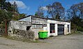 The Crown Garage, Munslow - geograph.org.uk - 6105577.jpg 800 × 476; 124 KB
-
 The Jack Mytton Way - geograph.org.uk - 2669984.jpg 881 × 661; 352 KB
-

-
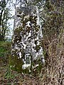
 The Munslow Deans Yews - geograph.org.uk - 4771680.jpg 1,440 × 960; 1,005 KB
-
 Topley Hill - geograph.org.uk - 2669942.jpg 1,240 × 930; 700 KB
-
 Topley Plantation - geograph.org.uk - 6064454.jpg 1,024 × 683; 268 KB
-

-
 Track and outbuildings - geograph.org.uk - 832872.jpg 640 × 480; 116 KB
-

-
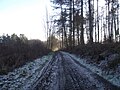 Track through Playground Plantation near Munslow - geograph.org.uk - 4580436.jpg 1,024 × 768; 270 KB
-
 Tree lined lane - geograph.org.uk - 5125879.jpg 4,608 × 3,456; 1.67 MB
-
 Up the field, along the bridleway - geograph.org.uk - 2672596.jpg 914 × 685; 319 KB
-

-
 Violas, Wildegoose Garden - geograph.org.uk - 6172004.jpg 678 × 1,024; 951 KB
-
 Waymarkers on Wenlock Edge - geograph.org.uk - 6476416.jpg 640 × 480; 98 KB
-
 Whitbach farmhouse - geograph.org.uk - 2669926.jpg 1,306 × 979; 837 KB
-
 Wildegoose Garden - geograph.org.uk - 6171993.jpg 1,024 × 678; 974 KB
-
 Wildegoose Garden - geograph.org.uk - 6171995.jpg 1,024 × 678; 787 KB
-
 Wildegoose Garden - geograph.org.uk - 6171997.jpg 1,024 × 678; 997 KB
-
 Wildegoose Garden - geograph.org.uk - 6172001.jpg 1,024 × 678; 1.04 MB
-
 Wildegoose Garden - geograph.org.uk - 6172002.jpg 1,024 × 678; 949 KB
-
 Winter cereal, Munslow - geograph.org.uk - 5543005.jpg 1,024 × 684; 319 KB
-
 Winter cereals above Munslow - geograph.org.uk - 3163298.jpg 640 × 360; 220 KB
-
 Wood, Beambridge - geograph.org.uk - 3160153.jpg 640 × 360; 281 KB
-
 Woodland bridleway at Munslow Common - geograph.org.uk - 2476757.jpg 640 × 480; 130 KB
-
 Access road to Little London - geograph.org.uk - 1073151.jpg 640 × 480; 107 KB
-
 Bridleway meets lane - geograph.org.uk - 200914.jpg 640 × 480; 131 KB
-
 Farmland north of Munslow, Shropshire - geograph.org.uk - 669036.jpg 640 × 454; 153 KB
-
 Footpath from Munslow, Shropshire - geograph.org.uk - 675017.jpg 640 × 456; 140 KB
-
 Hillside near Munslow, Shropshire - geograph.org.uk - 675523.jpg 640 × 480; 131 KB
-

-

-

-

-
 Old Quarry near Munslow, Shropshire - geograph.org.uk - 676185.jpg 640 × 416; 132 KB
-
 Public Track to Munslow, Shropshire - geograph.org.uk - 676113.jpg 640 × 480; 135 KB
-
 Track to Munslow Common, Shropshire - geograph.org.uk - 676116.jpg 640 × 480; 154 KB
-
 Track to Munslow Common, Shropshire - geograph.org.uk - 676166.jpg 640 × 480; 143 KB


.jpg)


_near_Munslow,_Shropshire_-_geograph.org.uk_-_676659.jpg)


