Category:Munlochy
Jump to navigation
Jump to search
human settlement in Highland, Scotland, UK  | |||||
| Upload media | |||||
| Instance of | |||||
|---|---|---|---|---|---|
| Location |
| ||||
 | |||||
English: Munlochy (; Scottish Gaelic: Bun Lòchaidh/Poll Lòchaidh) is a small village, in northern Scotland, lying at the head of Munlochy Bay (Ob Poll Lòchaidh). There are few early records of a settlement, but it seems likely that Munlochy expanded in the 1760s due to quarry workers extracting stone nearby to build Fort George on the far side of the Moray Firth.
Subcategories
This category has the following 3 subcategories, out of 3 total.
Media in category "Munlochy"
The following 66 files are in this category, out of 66 total.
-
 A9161 in Munlochy - geograph.org.uk - 4750234.jpg 2,298 × 1,623; 1.32 MB
-
 Above Munlochy Bay - geograph.org.uk - 5716677.jpg 640 × 480; 42 KB
-
 Allangrange Arms - geograph.org.uk - 3603000.jpg 2,560 × 1,920; 2.77 MB
-
 Autumn colour near Munlochy - geograph.org.uk - 1039688.jpg 640 × 457; 205 KB
-
 B9161 passing through Munlochy - geograph.org.uk - 4750231.jpg 2,223 × 1,473; 999 KB
-
 Balnaguie chambered neolithic cairn - geograph.org.uk - 1419815.jpg 640 × 480; 211 KB
-
 Beech Avenue near Munlochy - geograph.org.uk - 1039685.jpg 640 × 504; 186 KB
-
 Beech Hedge and Trees - geograph.org.uk - 362613.jpg 640 × 482; 73 KB
-
 Drain outflow near the head of Munlochy Bay - geograph.org.uk - 3864321.jpg 1,400 × 1,050; 692 KB
-
 Drumderfit Farm Road - geograph.org.uk - 361291.jpg 640 × 482; 96 KB
-
 Drumore Farm - geograph.org.uk - 361301.jpg 640 × 482; 54 KB
-
 Drumsmittal Lane - geograph.org.uk - 203516.jpg 600 × 443; 155 KB
-
 Drumsmittal Lane - geograph.org.uk - 207863.jpg 640 × 480; 163 KB
-
 Drumsmittal Wood - geograph.org.uk - 345336.jpg 640 × 480; 406 KB
-
 Drynie Woodlands - geograph.org.uk - 345332.jpg 640 × 427; 248 KB
-
 Farmhouse and steading at Crasky - geograph.org.uk - 284844.jpg 640 × 425; 126 KB
-
 Fields beside Bayhead Wood - geograph.org.uk - 361298.jpg 640 × 482; 61 KB
-
 Forestry Houses - Munlochy - geograph.org.uk - 6313384.jpg 800 × 571; 154 KB
-
 Garage and filling station - geograph.org.uk - 2177366.jpg 640 × 480; 59 KB
-
 Head of Munlochy Bay - geograph.org.uk - 4753780.jpg 640 × 360; 46 KB
-
 Junction on Drumsmittal lane. - geograph.org.uk - 204313.jpg 640 × 452; 349 KB
-
 Main road through Munlochy - geograph.org.uk - 2177100.jpg 1,024 × 737; 194 KB
-
 Mains of Drynie - geograph.org.uk - 345339.jpg 640 × 480; 279 KB
-
 Millbank Road - Munlochy - geograph.org.uk - 6313476.jpg 1,024 × 640; 138 KB
-
 Millbank Road - Munlochy - geograph.org.uk - 6313515.jpg 1,024 × 640; 130 KB
-
 Millbank Road, Munlochy - geograph.org.uk - 1515192.jpg 640 × 426; 89 KB
-
 Millbank Road, Munlochy - geograph.org.uk - 4764286.jpg 800 × 600; 209 KB
-
 Munlochy Bay - geograph.org.uk - 1247888.jpg 640 × 426; 76 KB
-
 Munlochy Bay - geograph.org.uk - 2177391.jpg 640 × 480; 79 KB
-
 Munlochy Hall - geograph.org.uk - 6313491.jpg 1,024 × 768; 157 KB
-
 Munlochy Hall - geograph.org.uk - 6313505.jpg 1,024 × 640; 151 KB
-
 Munlochy Mill - geograph.org.uk - 6313360.jpg 640 × 480; 94 KB
-
 Munlochy Mill - geograph.org.uk - 6313496.jpg 640 × 480; 97 KB
-
 Munlochy on the Black Isle - geograph.org.uk - 3636698.jpg 640 × 480; 69 KB
-
 Munlochy Post Office - geograph.org.uk - 4764284.jpg 800 × 600; 249 KB
-
 Munlochy Primary School - geograph.org.uk - 4037789.jpg 1,164 × 788; 954 KB
-
 Munlochy railway station (site), Highland - geograph.org.uk - 4413710.jpg 1,600 × 1,200; 588 KB
-
 Northern shore of Munlochy Bay - geograph.org.uk - 4199225.jpg 1,400 × 1,059; 349 KB
-

-
 Old Mill, Munlochy - geograph.org.uk - 4362183.jpg 800 × 600; 98 KB
-
 Ordnance Survey One-Inch Sheet 27 Strathpeffer & Invergordon, Published 1947.jpg 9,085 × 6,974; 9.25 MB
-
 Ordnance Survey One-Inch Sheet 28 Inverness, Published 1958.jpg 8,236 × 9,883; 9.83 MB
-
 Ordnance Survey Sheet NH 65 (28 65) Munlochy, Published 1950.jpg 7,624 × 8,794; 13.29 MB
-
 Post Office and High Street, Munlochy.jpg 640 × 391; 80 KB
-
 Post Office, Munlochy - geograph.org.uk - 4037770.jpg 1,280 × 857; 1.25 MB
-
 Road building at Cotterton - geograph.org.uk - 315453.jpg 640 × 480; 122 KB
-

-
 Road junction near Crasky - geograph.org.uk - 284848.jpg 640 × 425; 122 KB
-
 Road to Bayhead Farm - geograph.org.uk - 361294.jpg 640 × 482; 87 KB
-
 Roskill - geograph.org.uk - 207862.jpg 640 × 480; 105 KB
-
 Royal Bank of Scotland, Munlochy - geograph.org.uk - 4037777.jpg 1,024 × 690; 203 KB
-
 Sandy soils - geograph.org.uk - 207861.jpg 640 × 480; 90 KB
-
 Scrapyard in Littleburn - geograph.org.uk - 219570.jpg 640 × 480; 66 KB
-
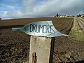 Sign for Drumore Farm - geograph.org.uk - 361302.jpg 640 × 482; 65 KB
-
 The flats at the head of Munlochy Bay - geograph.org.uk - 3864348.jpg 1,400 × 1,050; 603 KB
-
 The head of Munlochy Bay - geograph.org.uk - 6413179.jpg 1,600 × 901; 570 KB
-
 The road by Knockbain - geograph.org.uk - 408971.jpg 640 × 404; 66 KB
-
 Tullich Steading - geograph.org.uk - 362606.jpg 640 × 482; 53 KB
-
 Village Hall, Munlochy - geograph.org.uk - 4031982.jpg 1,280 × 857; 1.02 MB
-
 Waiting to be fed - geograph.org.uk - 340059.jpg 427 × 640; 127 KB
-
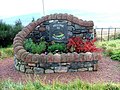
 War memorial close to Munlochy. - geograph.org.uk - 203514.jpg 600 × 466; 123 KB
-
 Weather Station at Munlochy - geograph.org.uk - 6313366.jpg 1,024 × 846; 207 KB
-
 Welcome to Munlochy - geograph.org.uk - 2177350.jpg 640 × 480; 121 KB
-
 A832 passing the edge of Munlochy - geograph.org.uk - 1145125.jpg 640 × 480; 117 KB
-
 Minor road to Culbokie - geograph.org.uk - 663139.jpg 640 × 426; 77 KB
-
 Trig point near Munlochy - geograph.org.uk - 663130.jpg 640 × 426; 88 KB


,_Highland_-_geograph.org.uk_-_4413710.jpg)


_Munlochy,_Published_1950.jpg)


