Category:Muni Metro maps
Jump to navigation
Jump to search
Media in category "Muni Metro maps"
The following 29 files are in this category, out of 29 total.
-
Muni Metro map (2021-08).jpg 1,140 × 1,022; 157 KB
-
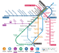
February 2022 Muni Metro map.png 1,140 × 1,140; 794 KB
-
Muni Metro map (2022-02-19).gif 1,140 × 1,140; 173 KB
-
Central Subway shuttle service map, November 2022.png 959 × 1,036; 842 KB
-
September 2024 Muni Metro map.png 3,279 × 3,065; 1 MB
-
All About Muni Metro (1980).jpg 5,232 × 2,592; 2.07 MB
-
Balboa Park station complex map, 2018.svg 2,100 × 3,200; 123 KB
-
BART geographic map, 1967.jpg 3,198 × 2,553; 1.04 MB
-
Central Subway - Phases 2-4.svg 3,000 × 1,950; 5.37 MB
-
Forest Hill Station (31215976597).jpg 7,848 × 5,235; 20.48 MB
-
Forest Hill Station (32283883598).jpg 7,764 × 5,179; 19.53 MB
-
Forest Hill Station (44338480320).jpg 5,159 × 7,661; 12.28 MB
-
Forest Hill Station (46103640852).jpg 7,748 × 5,168; 24.8 MB
-
Fourth-stockton-modified-LPA-alignment-1.gif 902 × 930; 127 KB
-
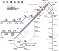
Muni Metro (2020-08).svg 1,600 × 1,400; 56 KB
-
Muni Metro (vector).svg 1,600 × 1,380; 62 KB
-
Muni Metro map (2023-01-07).png 1,920 × 1,741; 1.25 MB
-
Muni Metro unofficial map.pdf 1,547 × 1,143; 133 KB
-
Muni Metro with CS.svg 1,600 × 1,380; 64 KB
-
Muni Metro.png 1,787 × 1,156; 157 KB
-
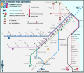
San francisco rail system wv.svg 1,341 × 1,074; 158 KB
-
San francisco rail system.png 1,559 × 1,356; 452 KB
-
San francisco rail system.svg 1,559 × 1,356; 208 KB
-
San Francisco streetcar and cable car network.svg 600 × 600; 50 KB
-
San Francisco subway map (Muni).png 1,352 × 853; 75 KB
-
Sanfrancisco railsystem printmap.png 3,460 × 3,008; 1.27 MB
-
SFMuniMetro.png 4,418 × 2,208; 430 KB
-
Sfo2.png 529 × 604; 52 KB
-
West Portal Station (44338405530).jpg 7,803 × 5,205; 15.53 MB


