Category:Mundham
Jump to navigation
Jump to search
village in the United Kingdom | |||||
| Upload media | |||||
| Instance of | |||||
|---|---|---|---|---|---|
| Location | South Norfolk, Norfolk, East of England, England | ||||
| Population |
| ||||
| Area |
| ||||
 | |||||
Subcategories
This category has the following 3 subcategories, out of 3 total.
Media in category "Mundham"
The following 200 files are in this category, out of 374 total.
(previous page) (next page)-

-

-

-
 448th Bombardment Group Memorial - geograph.org.uk - 4012831.jpg 499 × 640; 133 KB
-
 A Chinook helicopter over Mundham - geograph.org.uk - 2265716.jpg 640 × 480; 104 KB
-
 A field boundary hedge - geograph.org.uk - 6073878.jpg 800 × 600; 152 KB
-
 A healthy ash tree - geograph.org.uk - 4014705.jpg 640 × 480; 368 KB
-

-
 Access road to Springhill - geograph.org.uk - 4491850.jpg 640 × 480; 520 KB
-
 Air Ambulance at Seething - geograph.org.uk - 4648844.jpg 640 × 608; 339 KB
-

-
 Barn at the Laurels - geograph.org.uk - 1057579.jpg 640 × 480; 40 KB
-
 Barn conversion at Rat's Hole - geograph.org.uk - 6073847.jpg 800 × 585; 108 KB
-
 Barn conversion in Birch Way, Mundham - geograph.org.uk - 3374152.jpg 640 × 480; 192 KB
-
 Barns at The Laurels - geograph.org.uk - 6073836.jpg 800 × 573; 103 KB
-
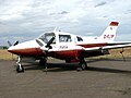
 Beechcraft 18 3TM - geograph.org.uk - 4648849.jpg 640 × 466; 205 KB
-
 Beechcraft 18 3TM - geograph.org.uk - 4648851.jpg 640 × 480; 279 KB
-
 Beechcraft 18 3TM - geograph.org.uk - 4648852.jpg 640 × 480; 278 KB
-
 Beechcraft 18 3TM - geograph.org.uk - 4648853.jpg 640 × 480; 267 KB
-
 Birch trees in Tub Plantation - geograph.org.uk - 4491888.jpg 640 × 480; 587 KB
-
 Birch Way becomes a track - geograph.org.uk - 3374131.jpg 640 × 480; 251 KB
-
 Birch Way past Hill Farm, Mundham - geograph.org.uk - 3374140.jpg 640 × 480; 202 KB
-
 Birch Way past Rat's Hole - geograph.org.uk - 6073844.jpg 800 × 592; 115 KB
-
 Birch Way past the Old Granary, Mundham - geograph.org.uk - 3374187.jpg 640 × 480; 114 KB
-
-
 Blocked entrance to Mundham House - geograph.org.uk - 6073972.jpg 800 × 570; 171 KB
-

-
 Boeing B-17 Flying Fortress "Sally B" - geograph.org.uk - 4649107.jpg 640 × 634; 317 KB
-

-

-

-

-

-
 Boggy ground in Tub Plantation - geograph.org.uk - 4491874.jpg 640 × 480; 569 KB
-
 Brambles at the foot of Buck's Hill - geograph.org.uk - 4883903.jpg 640 × 360; 351 KB
-
 Buck's Hill - geograph.org.uk - 1931953.jpg 3,072 × 2,304; 2.61 MB
-
 Buck's Hill - geograph.org.uk - 4883893.jpg 640 × 360; 267 KB
-
 Bungay Road past Thwaite Cottage - geograph.org.uk - 6073871.jpg 800 × 567; 129 KB
-
 Byroad, but I wouldn't want to take it - geograph.org.uk - 2265719.jpg 640 × 480; 155 KB
-
 Bücker Bü 131 "Jungmann" - geograph.org.uk - 4648864.jpg 640 × 480; 310 KB
-
 Bücker Bü 131 "Jungmann" - geograph.org.uk - 4648865.jpg 640 × 627; 193 KB
-
 Bücker Bü 131 "Jungmann" - geograph.org.uk - 4648867.jpg 640 × 480; 310 KB
-
 C-47 Dakota - geograph.org.uk - 4648860.jpg 640 × 625; 333 KB
-
 C-47 Dakota - geograph.org.uk - 4648861.jpg 640 × 611; 358 KB
-
 C-47 Dakota - geograph.org.uk - 4648862.jpg 640 × 604; 322 KB
-
 C-47 Dakota - geograph.org.uk - 4648863.jpg 640 × 630; 401 KB
-
 Cars and aircraft parked side by side - geograph.org.uk - 4648889.jpg 640 × 480; 282 KB
-
 Catch a Ball stall - geograph.org.uk - 4648877.jpg 640 × 515; 405 KB
-
 Cereal crop field at Buck's Hill - geograph.org.uk - 4883878.jpg 640 × 360; 277 KB
-
 Cereal crop field by Mundham - geograph.org.uk - 4883932.jpg 640 × 360; 297 KB
-
 Charity Air Day at Seeting Airfield - geograph.org.uk - 4648843.jpg 640 × 480; 293 KB
-
 Classic cars at Seething Airfield - geograph.org.uk - 4648882.jpg 640 × 480; 351 KB
-
 Cowslips, Seething Airfield - geograph.org.uk - 5772537.jpg 1,024 × 683; 325 KB
-
 Crop fields at Loddon Ingloss - geograph.org.uk - 4883940.jpg 640 × 360; 265 KB
-
 Crop fields by Loddon Ingloss - geograph.org.uk - 4883860.jpg 640 × 360; 288 KB
-
 Crop fields south of Mundham - geograph.org.uk - 4883870.jpg 640 × 360; 237 KB
-
 Crossroads at The Laurels, Mundham - geograph.org.uk - 2265744.jpg 640 × 480; 135 KB
-

-
 Curtiss P-40M Kittyhawk fighter aircraft - geograph.org.uk - 4648890.jpg 640 × 637; 424 KB
-
 Curtiss P-40M Kittyhawk fighter aircraft - geograph.org.uk - 4648891.jpg 640 × 429; 250 KB
-
 Curtiss P-40M Kittyhawk fighter aircraft - geograph.org.uk - 4648893.jpg 640 × 540; 272 KB
-
 Curtiss P-40M Kittyhawk fighter aircraft - geograph.org.uk - 4648894.jpg 640 × 510; 335 KB
-
 Daffodils by The Laurels, Mundham - geograph.org.uk - 3374207.jpg 480 × 640; 254 KB
-
-
 Diverging tracks - geograph.org.uk - 4883949.jpg 640 × 360; 253 KB
-
 Drainage ditch at Loddon Ingloss - geograph.org.uk - 4883947.jpg 640 × 360; 257 KB
-
 Drainage ditch beside Birch Way, Mundham - geograph.org.uk - 3374206.jpg 640 × 480; 167 KB
-
 Drainage ditch beside path to Mundham - geograph.org.uk - 3374272.jpg 640 × 480; 272 KB
-

-

-
 Early start at Seething Airfield - geograph.org.uk - 5521168.jpg 640 × 427; 59 KB
-
 Electricity sub-station - geograph.org.uk - 4802493.jpg 640 × 538; 442 KB
-
 Electricity sub-station - geograph.org.uk - 4802495.jpg 640 × 480; 368 KB
-
 Electricity sub-station - geograph.org.uk - 4802497.jpg 640 × 480; 370 KB
-

-

-
 Entrance to Mundham House - geograph.org.uk - 6073974.jpg 800 × 562; 142 KB
-
 Entrance to Seething Airfield - geograph.org.uk - 4125026.jpg 2,857 × 1,960; 767 KB
-

-
 Fairground ride at Seething Airfield - geograph.org.uk - 4648876.jpg 640 × 506; 381 KB
-
 Fairground ride at Seething Airfield - geograph.org.uk - 4648879.jpg 640 × 530; 403 KB
-
 Farm buildings at Mundham - geograph.org.uk - 1057604.jpg 640 × 480; 46 KB
-

-
 Farm track to Birch Way in Mundham - geograph.org.uk - 4883887.jpg 640 × 360; 270 KB
-
 Farm track to Ingloss Lane - geograph.org.uk - 4883953.jpg 640 × 360; 241 KB
-
 Farm tracks in fields by Mundham - geograph.org.uk - 4883963.jpg 640 × 360; 339 KB
-
 Farmland and the general landscape - geograph.org.uk - 1068367.jpg 640 × 480; 41 KB
-
 Farmland opposite St Peter, Mundham - geograph.org.uk - 5067130.jpg 640 × 480; 61 KB
-
 Field boundary east of Seething - geograph.org.uk - 3374298.jpg 640 × 480; 242 KB
-
 Field by White Witches - geograph.org.uk - 6073818.jpg 800 × 572; 142 KB
-
 Field north of The Laurels, Mundham - geograph.org.uk - 3374235.jpg 640 × 480; 225 KB
-
 Field south of Abbey Farm, Mundham - geograph.org.uk - 3374244.jpg 640 × 480; 234 KB
-
 Field south of Sandy Lane - geograph.org.uk - 6073860.jpg 800 × 580; 158 KB
-
 Field west of Birch Way, Mundham - geograph.org.uk - 3374227.jpg 640 × 480; 205 KB
-
 Fields and two Parish Churches - geograph.org.uk - 1058715.jpg 640 × 480; 50 KB
-
 Fields beside the path to Mundham Road - geograph.org.uk - 4883888.jpg 640 × 360; 279 KB
-
 Fields between Seething and Mundham - geograph.org.uk - 3374256.jpg 640 × 480; 201 KB
-
 Fields by Loddon Ingloss - geograph.org.uk - 4883865.jpg 640 × 360; 247 KB
-
 Fields by Loddon Ingloss - geograph.org.uk - 4883867.jpg 640 × 360; 244 KB
-
 Fields by Mundham - geograph.org.uk - 4883955.jpg 640 × 360; 270 KB
-
 Fields by Oaksbeck Plantation - geograph.org.uk - 4014687.jpg 640 × 437; 125 KB
-
 Fields east of Mundham Lane - geograph.org.uk - 6073984.jpg 800 × 572; 155 KB
-
 Fields east of Mundham Lane - geograph.org.uk - 6073989.jpg 800 × 531; 136 KB
-
 Fields east of Seething - geograph.org.uk - 3374250.jpg 640 × 480; 221 KB
-
 Fields east of Seething airfield - geograph.org.uk - 4014679.jpg 640 × 480; 149 KB
-
 Fields south of Mundham - geograph.org.uk - 4883885.jpg 640 × 360; 269 KB
-
 Fields south of Thwaite Spring - geograph.org.uk - 6073880.jpg 800 × 564; 156 KB
-
 Fields west of Ingloss Lane - geograph.org.uk - 4883871.jpg 640 × 360; 264 KB
-
 Firefighters on stand-by - geograph.org.uk - 4648874.jpg 640 × 623; 401 KB
-
 Firefighters on standby - geograph.org.uk - 4648872.jpg 640 × 480; 274 KB
-

-

-
 Footpath behind St Ethelbert's church, Mundham - geograph.org.uk - 6065176.jpg 4,032 × 2,268; 6.47 MB
-
 Footpath from Mundham to Seething - geograph.org.uk - 3374265.jpg 640 × 480; 253 KB
-

-
 Footpath junction, Seething - geograph.org.uk - 3374284.jpg 640 × 439; 191 KB
-

-
 Footpath off Mundham Lane - geograph.org.uk - 6073986.jpg 800 × 576; 179 KB
-
 Footpath past Mundham church - geograph.org.uk - 6065173.jpg 4,032 × 2,268; 4.29 MB
-
 Footpath to Abbey Farm, Seething - geograph.org.uk - 3374254.jpg 640 × 480; 293 KB
-
 Footpath to Ingloss Lane - geograph.org.uk - 4883875.jpg 640 × 360; 252 KB
-
 Footpath to Ingloss Lane - geograph.org.uk - 4883930.jpg 640 × 360; 341 KB
-
 Footpath to Manor Farm - geograph.org.uk - 4883943.jpg 640 × 360; 279 KB
-
 Footpath to Mundham Road - geograph.org.uk - 4883864.jpg 640 × 360; 240 KB
-
 Footpath to Mundham Road - geograph.org.uk - 4883873.jpg 640 × 360; 231 KB
-
 Footpath to Seething - geograph.org.uk - 3374234.jpg 640 × 480; 228 KB
-
 Forge House as seen from Birch Way - geograph.org.uk - 6073977.jpg 800 × 545; 150 KB
-

-
 G-FLYP FlyPast - geograph.org.uk - 5189187.jpg 640 × 480; 263 KB
-
 Gate on the path to Lower Barn, Seething - geograph.org.uk - 3374286.jpg 480 × 640; 174 KB
-
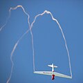
 Glider aerobatics - geograph.org.uk - 4648899.jpg 640 × 616; 384 KB
-
 Glider FX - geograph.org.uk - 4648897.jpg 640 × 640; 454 KB
-
 Glider performing a loop - geograph.org.uk - 4648898.jpg 640 × 625; 398 KB
-

-
 Greenhouse on the edge of Tub Plantation - geograph.org.uk - 4491890.jpg 640 × 480; 597 KB
-
 Hangars at Seething Airfield - geograph.org.uk - 5521154.jpg 640 × 427; 57 KB
-
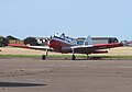 Havilland Canada Chipmunk T10 - geograph.org.uk - 4649079.jpg 640 × 448; 248 KB
-

-
 Hedgerow beside Grange Road - geograph.org.uk - 6073962.jpg 800 × 567; 119 KB
-
 Hedgerow in cattle pasture - geograph.org.uk - 1455316.jpg 640 × 480; 111 KB
-
 Henry Osborn plaque, Mundham church.jpg 1,440 × 717; 323 KB
-
 Herschel Dome, and Genesis Dome at Seething Obseratory - geograph.org.uk - 4125105.jpg 2,931 × 2,201; 694 KB
-
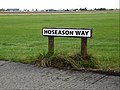 Hoseason Way sign - geograph.org.uk - 4125034.jpg 2,948 × 2,214; 1.3 MB
-
 House name signs in Mundham - geograph.org.uk - 6073834.jpg 800 × 558; 118 KB
-
 Ice cream van at Seething Airfield - geograph.org.uk - 4649096.jpg 640 × 514; 326 KB
-
 Improvised footbridge in Tub Plantation - geograph.org.uk - 4491877.jpg 480 × 640; 567 KB
-
 Interesting garden feature - geograph.org.uk - 1061048.jpg 480 × 640; 117 KB
-

-
 Ivy-clad oak trees beside Bungay Road - geograph.org.uk - 6073879.jpg 800 × 600; 167 KB
-
 Light aircraft at Seething airfield - geograph.org.uk - 5189186.jpg 640 × 480; 258 KB
-
 Lights and Planets - geograph.org.uk - 1690480.jpg 800 × 531; 29 KB
-
 Loddon road - geograph.org.uk - 1057592.jpg 640 × 480; 126 KB
-
 London Road passing St Ethelbert's church, Mundham - geograph.org.uk - 6065177.jpg 4,032 × 2,268; 3.79 MB
-
 London Road, Mundham - geograph.org.uk - 6065174.jpg 4,032 × 2,268; 4.23 MB
-
 Looking back onto my steps - geograph.org.uk - 1569579.jpg 640 × 480; 153 KB
-

-
 Looking towards Mundham - geograph.org.uk - 1068346.jpg 640 × 480; 37 KB
-
 Lower Barn and farm buildings - geograph.org.uk - 1068384.jpg 640 × 480; 48 KB
-
 Lt Col George Todd.jpg 450 × 655; 44 KB
-
 Map of Mundham.png 451 × 408; 68 KB
-

-

-
 Meadow by Tub Plantation - geograph.org.uk - 4491834.jpg 640 × 480; 336 KB
-
 Meadow by Tub Plantation - geograph.org.uk - 4491854.jpg 640 × 480; 388 KB
-
 Meandering drainage ditch - geograph.org.uk - 4883898.jpg 640 × 360; 303 KB
-
 Memorial to the 448th BG near the airfield museum - geograph.org.uk - 6181739.jpg 3,456 × 2,592; 3.87 MB
-
 Memorial to the 448th BG near the airfield museum - geograph.org.uk - 6181741.jpg 3,456 × 2,592; 3.98 MB
-
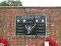
 Memorial to the 448th Bombardment Group at Seething Airfield - geograph.org.uk - 6181731.jpg 3,456 × 2,592; 3.78 MB
-
 MG car engine - geograph.org.uk - 4648880.jpg 640 × 623; 531 KB
-

-

-

-

-

-
 Mill Farmhouse - geograph.org.uk - 1581216.jpg 640 × 491; 139 KB
-
 Mr Snowman - geograph.org.uk - 1650993.jpg 2,272 × 1,704; 836 KB
-
 Mundham Church.jpg 2,560 × 1,920; 2.09 MB
-
 Mundham Common - geograph.org.uk - 1569527.jpg 640 × 480; 97 KB
-
 Mundham Common post box - geograph.org.uk - 1569538.jpg 640 × 480; 92 KB
-
 Mundham Font.jpg 1,200 × 1,599; 100 KB
-
 Mundham Grange from across the field - geograph.org.uk - 2265709.jpg 640 × 480; 137 KB
-

-
 Mundham House - geograph.org.uk - 1057590.jpg 640 × 480; 102 KB
-
 Mundham House - geograph.org.uk - 6073970.jpg 800 × 558; 143 KB
-
 Mundham Lane past Mill Farmhouse - geograph.org.uk - 6074031.jpg 800 × 568; 149 KB
-
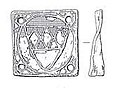 Mundham medieval mount.jpg 171 × 125; 15 KB
-
 Mundham Norman Door 1.jpg 1,200 × 1,599; 268 KB
-
 Mundham Norman Door 2.jpg 1,200 × 1,599; 215 KB
-
 Mundham Norman Door 3.jpg 1,200 × 1,599; 348 KB
-
 Mundham old school - geograph.org.uk - 1068391.jpg 640 × 480; 56 KB
-
 Mundham Organ.jpg 1,200 × 1,599; 190 KB
-
 Mundham Pew End 1 Pointy.jpg 1,200 × 1,599; 144 KB
-
 Mundham Pew End 2 Curved.jpg 1,200 × 1,599; 115 KB
-
 Mundham Pew End 3 Round.jpg 1,200 × 1,599; 188 KB
-
 Mundham Plaque 1792 Osmund Clarke Bird.jpg 1,200 × 1,599; 142 KB
-
 Mundham Plaque 1792 Osmund Clarke.jpg 1,599 × 1,200; 136 KB
-
 Mundham Plaque 1918 War Marble.jpg 1,200 × 1,599; 118 KB
-
 Mundham Plaque 1930 CHH.jpg 1,599 × 1,200; 203 KB
-
 Mundham Plaque 1939 GET.jpg 1,599 × 1,200; 167 KB
-
 Mundham Plaque Floor 1617 William Harborne.jpg 1,200 × 1,599; 189 KB
_-_geograph.org.uk_-_4648868.jpg)
_-_geograph.org.uk_-_4648869.jpg)
_-_geograph.org.uk_-_4648870.jpg)


_-_geograph.org.uk_-_4648892.jpg)


