Category:Muir of Ord
Jump to navigation
Jump to search
village in Highland, Scotland, UK  | |||||
| Upload media | |||||
| Instance of | |||||
|---|---|---|---|---|---|
| Location |
| ||||
| Population |
| ||||
| official website | |||||
 | |||||
English: Muir of Ord is a village in Highland, Scotland. It is situated near the western boundary of the Black Isle, about 20 km west of the city of Inverness, and 10 km south of Dingwall.
Nederlands: Muir of Ord ( Schots-Gaelisch: Am Blàr Dubh) is een dorp in de Schotse Hooglanden gelegen op het schiereiland Black Isle, ongeveer 20 kilometer ten westen van Inverness en ongeveer 10 kilometer ten zuiden van Dingwall met een populatie van ongeveer 1800.
Norsk bokmål: Muir of Ord ( Skotsk gælisk: Am Blàr Dubh) er en landsby (village) i regionen Highland i Skottland. Landsbyen ligger på vestsida av halvøya Black Isle på den skotske nordøstkysten, innerst i Moray Firth. Den ligger ikke langt fra bunnen av fjordarmen Beauly Firth, mellom landsbyene Beauly og Conon Bridge. Den er omlag ti kilometer sør for byen Dingwall og 20 km vest for Inverness.
Subcategories
This category has the following 3 subcategories, out of 3 total.
Media in category "Muir of Ord"
The following 55 files are in this category, out of 55 total.
-
 Bowling green, Muir of Ord - geograph.org.uk - 4033687.jpg 1,280 × 857; 936 KB
-
 Car park, Muir of Ord - geograph.org.uk - 4033729.jpg 1,280 × 857; 1,023 KB
-
 Castle Hill, Muir of Ord - geograph.org.uk - 4033673.jpg 1,280 × 857; 981 KB
-
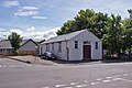
 East Parish Church - geograph.org.uk - 2449244.jpg 3,648 × 2,736; 1.13 MB
-
 Former Drill Hall - geograph.org.uk - 4031968.jpg 1,280 × 857; 998 KB
-
 Gates to Muir of Ord Football Club - geograph.org.uk - 4033713.jpg 1,280 × 857; 1.05 MB
-
 Logan Smithy circa 1910 - geograph.org.uk - 2449255.jpg 1,777 × 1,113; 428 KB
-
 Muir of Ord Free Church of Scotland - geograph.org.uk - 3212705.jpg 4,608 × 3,456; 3.04 MB
-
 Muir of Ord Golf Club - geograph.org.uk - 4035394.jpg 1,280 × 857; 880 KB
-
 Muir of Ord Industrial Estate - geograph.org.uk - 589753.jpg 640 × 480; 84 KB
-
 Muir of Ord Library 2022.jpg 8,000 × 6,000; 12.98 MB
-
 Muir of Ord Library.jpg 8,000 × 6,000; 13.7 MB
-
 Muir of Ord post office - geograph.org.uk - 5613831.jpg 1,024 × 683; 344 KB
-
 Muir of Ord war memorial (geograph 3151878).jpg 2,800 × 2,218; 1.75 MB
-
 Muir of Ord.jpg 640 × 416; 46 KB
-
 Network Rail test train, approaching Muir of Ord (geograph 4073832).jpg 2,346 × 2,800; 2.28 MB
-
 Old Tarradale School - geograph.org.uk - 4035162.jpg 1,280 × 857; 1.14 MB
-
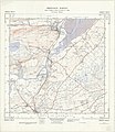
 Ordnance Survey One-Inch Sheet 27 Strathpeffer & Invergordon, Published 1947.jpg 9,085 × 6,974; 9.25 MB
-
 Ordnance Survey One-Inch Sheet 27 Strathpeffer, Published 1957.jpg 8,262 × 9,891; 11.61 MB
-
 Ordnance Survey Sheet NH 55 Dingwall, Published 1962.jpg 7,648 × 8,805; 13.41 MB
-
 Parish Church East, Muir of Ord (geograph 4034643).jpg 1,280 × 857; 826 KB
-
 Play park, Muir of Ord - geograph.org.uk - 4033698.jpg 1,280 × 857; 1.06 MB
-
 Post Office, Muir of Ord (geograph 4033658).jpg 1,280 × 790; 1.03 MB
-
 Roadworks on the A862 in Muir of Ord - geograph.org.uk - 4441299.jpg 1,024 × 666; 229 KB
-
 Royal Bank of Scotland, Muir of Ord - geograph.org.uk - 4033746.jpg 1,024 × 686; 202 KB
-
 Seaforth Road, Muir of Ord - geograph.org.uk - 4034646.jpg 1,280 × 857; 1.06 MB
-
 Shop units in Seaforth Road - geograph.org.uk - 4033762.jpg 1,279 × 823; 866 KB
-
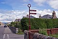 Signpost off Tarradale Terrace - geograph.org.uk - 4033678.jpg 1,024 × 686; 222 KB
-
 Tarradale Gardens - geograph.org.uk - 4033719.jpg 1,276 × 762; 1.04 MB
-
 Tarradale Hotel (geograph 5781497).jpg 5,184 × 3,456; 2.5 MB
-
 Tarradale Hotel, Muir of Ord - geograph.org.uk - 1751778.jpg 1,024 × 768; 163 KB
-
 Tarradale Primary School - geograph.org.uk - 4035124.jpg 1,280 × 857; 1.04 MB
-
 Tarradale Primary School - geograph.org.uk - 4035142.jpg 1,280 × 857; 1.02 MB
-
 Tarradale Terrace - geograph.org.uk - 4033653.jpg 1,280 × 801; 946 KB
-
 Tarradale Terrace - geograph.org.uk - 4033741.jpg 1,276 × 777; 1.17 MB
-
 Tarradale Terrace - geograph.org.uk - 5613834.jpg 1,024 × 683; 242 KB
-
 The Free Church of Scotland, Urray (geograph 5060522).jpg 4,379 × 3,284; 6.23 MB
-
 The Logan Smithy - geograph.org.uk - 2449252.jpg 522 × 370; 51 KB
-
 The Muir Hub (geograph 5845754).jpg 1,400 × 1,000; 397 KB
-
 The Railway nr Muir of Ord (geograph 3292227).jpg 640 × 452; 86 KB
-
 Unit on Muir of Ord Industrial Estate - geograph.org.uk - 589747.jpg 640 × 480; 86 KB
-
 Urray House, Muir of Ord - geograph.org.uk - 3882878.jpg 1,024 × 768; 284 KB
-
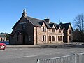
 Village Hall, Muir of Ord - geograph.org.uk - 3820409.jpg 1,024 × 768; 167 KB
-
 Village Hall, Muir of Ord - geograph.org.uk - 4034638.jpg 1,280 × 857; 1.06 MB
-
 Weak bridge over the railway, Muir of Ord - geograph.org.uk - 1751676.jpg 1,024 × 768; 184 KB
-
 Ark Road - geograph.org.uk - 142394.jpg 640 × 480; 125 KB
-
 Field - geograph.org.uk - 174559.jpg 640 × 480; 77 KB
-
 Loch-na-Mhoid - geograph.org.uk - 156470.jpg 640 × 480; 74 KB
-
 Loch-na-Mhoid - geograph.org.uk - 156474.jpg 640 × 480; 71 KB
-
 Muir of Ord Maltings - geograph.org.uk - 142239.jpg 640 × 453; 75 KB
-
 Road sign at junction - geograph.org.uk - 501581.jpg 640 × 482; 122 KB
-
 Tarradale Park - geograph.org.uk - 171270.jpg 640 × 480; 77 KB
-
 The Ark road - geograph.org.uk - 174560.jpg 640 × 480; 92 KB
-
 View of the Beauly Firth - geograph.org.uk - 175013.jpg 640 × 480; 73 KB
-
 Winnie`s - geograph.org.uk - 156467.jpg 640 × 480; 133 KB


.jpg)
.jpg)


.jpg)

.jpg)


.jpg)


.jpg)

.jpg)
.jpg)


