Category:Mudford
Jump to navigation
Jump to search
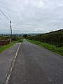
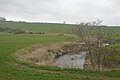
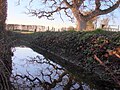
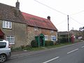
English: Mudford is a village and parish in Somerset, England, situated from Yeovil in the South Somerset district on the River Yeo. The village has a population of 649. The parish includes the hamlets of Mudford Sock, West Mudford and Up Mudford.
village in the United Kingdom  | |||||
| Upload media | |||||
| Instance of | |||||
|---|---|---|---|---|---|
| Location | South Somerset, Somerset, South West England, England | ||||
| Population |
| ||||
| Said to be the same as | Mudford (Wikimedia duplicated page, civil parish) | ||||
 | |||||
Media in category "Mudford"
The following 72 files are in this category, out of 72 total.
-
 A359 Down into Mudford - geograph.org.uk - 1446077.jpg 640 × 480; 67 KB
-
 A359 to Yeovil - geograph.org.uk - 5847431.jpg 1,024 × 785; 148 KB
-
 Ashington Lane - geograph.org.uk - 5799741.jpg 1,024 × 787; 255 KB
-
 Ashington Wood - geograph.org.uk - 643355.jpg 640 × 480; 75 KB
-
 Broadview Farm - geograph.org.uk - 5847977.jpg 1,024 × 754; 250 KB
-
 Line of headstones on graves in Mudford cemetery, Somerset.jpg 640 × 471; 122 KB
-
 Church of The Blessed Virgin Mary - Mudford - geograph.org.uk - 5847004.jpg 1,024 × 768; 182 KB
-
 Colourful houses on Sock Lane - geograph.org.uk - 5847969.jpg 1,024 × 764; 172 KB
-
 Converted farm Buildings, Higher Farm - geograph.org.uk - 6618234.jpg 1,024 × 768; 207 KB
-

-

-
 Direction Sign - Signpost on the A359 in Mudford parish - geograph.org.uk - 6098103.jpg 1,105 × 1,672; 156 KB
-
 Driveway, Glen Croft - geograph.org.uk - 5799739.jpg 1,024 × 852; 265 KB
-
 Dwellings on Sock Hill - geograph.org.uk - 5847973.jpg 1,024 × 801; 151 KB
-
 Farm Gates - geograph.org.uk - 3504107.jpg 640 × 480; 77 KB
-
 Field of wheat near Hinton - geograph.org.uk - 5847414.jpg 1,024 × 780; 206 KB
-
 Field on Thorney Lane - geograph.org.uk - 5287124.jpg 640 × 480; 55 KB
-
 Hay Storage at Up Mudford - geograph.org.uk - 1446069.jpg 640 × 480; 171 KB
-
 Higher Farm - geograph.org.uk - 6618235.jpg 1,024 × 750; 190 KB
-
 Hillside View, Mudford - geograph.org.uk - 1446080.jpg 640 × 480; 229 KB
-
 Hinton Farm - geograph.org.uk - 5273519.jpg 640 × 480; 68 KB
-
 Hinton Farmhouse with produce for sale. - geograph.org.uk - 1453135.jpg 640 × 480; 192 KB
-
 Hnton Farm - geograph.org.uk - 5847035.jpg 1,024 × 799; 171 KB
-
 Houses in Hinton - geograph.org.uk - 5847050.jpg 1,024 × 768; 202 KB
-

-
 Junction for Mudford Sock - geograph.org.uk - 541094.jpg 640 × 480; 144 KB
-
 Junction on Stone Lane - geograph.org.uk - 5799779.jpg 1,024 × 768; 243 KB
-
 Milking time at Sock Farm - geograph.org.uk - 5799774.jpg 1,024 × 801; 221 KB
-
 Misty day at Up Mudford - geograph.org.uk - 1690594.jpg 640 × 480; 69 KB
-
 Mudford Cemetery - geograph.org.uk - 1692068.jpg 640 × 480; 108 KB
-
 Mudford Memorial Hall - geograph.org.uk - 710797.jpg 640 × 480; 193 KB
-
 Mudford Post Office - geograph.org.uk - 710777.jpg 640 × 480; 218 KB
-
 Mudford Sock - geograph.org.uk - 1466690.jpg 640 × 480; 202 KB
-
 Mudford, millstone at Red Barn, Hinton - geograph.org.uk - 3047991.jpg 640 × 427; 258 KB
-
 Mudford, Red Barn, Hinton - geograph.org.uk - 3047986.jpg 640 × 415; 194 KB
-
 New terraced housing - Mudford - geograph.org.uk - 1295076.jpg 640 × 457; 80 KB
-
 Oil seed Rape off Mudford Rd, Yeovil - geograph.org.uk - 989519.jpg 640 × 482; 123 KB
-
 Old Boundary Marker off Mudford Road (geograph 6687264).jpg 1,180 × 1,744; 435 KB
-

-
 Old Sock Cottage, Mudford Sock - geograph.org.uk - 2400179.jpg 4,000 × 3,000; 1.86 MB
-
 Pasonage Farm - geograph.org.uk - 5847013.jpg 1,024 × 834; 221 KB
-
 Pasture at Up-Mudford - geograph.org.uk - 6618236.jpg 1,024 × 768; 209 KB
-
 Primrose Lane towards Up Mudford. - geograph.org.uk - 1446059.jpg 640 × 480; 205 KB
-
 Primrose Lane, Yeovil - geograph.org.uk - 1446048.jpg 480 × 640; 183 KB
-
 River Yeo - geograph.org.uk - 4571887.jpg 640 × 426; 48 KB
-
 Sock Dairy Farm, Mudford Sock - geograph.org.uk - 2400184.jpg 4,000 × 3,000; 2.01 MB
-
 Sock Farm, Mudford Sock - geograph.org.uk - 2400175.jpg 4,000 × 3,000; 1.69 MB
-
 Stone Farm - geograph.org.uk - 1466682.jpg 640 × 480; 75 KB
-
 The Ditch by the Oak - geograph.org.uk - 5288557.jpg 640 × 480; 113 KB
-
 The Half Moon Inn in Mudford - geograph.org.uk - 4569902.jpg 1,500 × 981; 145 KB
-
 The Half Moon Inn in Mudford - geograph.org.uk - 4569903.jpg 981 × 1,500; 128 KB
-
 Tin roofed house for sale - geograph.org.uk - 710809.jpg 640 × 480; 208 KB
-
 Track to Thorney Lane Farm - geograph.org.uk - 5287127.jpg 427 × 640; 105 KB
-
 Track to Woodside Farm - geograph.org.uk - 5799769.jpg 1,024 × 815; 257 KB
-
 Turning for Mudford Sock - geograph.org.uk - 3264985.jpg 640 × 480; 65 KB
-
 Turning for Mudford Sock - geograph.org.uk - 5799782.jpg 1,024 × 768; 165 KB
-
 West Mudford - geograph.org.uk - 5847028.jpg 1,024 × 813; 159 KB
-
 Yeovil, Mudford Road as seen from Hundred Stone - geograph.org.uk - 2244036.jpg 1,600 × 1,071; 1.99 MB
-
 Yeovil, Place of The Hundred Stone - geograph.org.uk - 2244031.jpg 1,600 × 1,066; 2.15 MB
-
 A good scratch - geograph.org.uk - 543060.jpg 480 × 640; 99 KB
-
 Cattle and Clouds - geograph.org.uk - 1412975.jpg 640 × 480; 150 KB
-
 Droveway Lane - geograph.org.uk - 542996.jpg 640 × 480; 127 KB
-
 Field on Sock Hill - geograph.org.uk - 541098.jpg 640 × 480; 108 KB
-
 Fields beside Sock Lane - geograph.org.uk - 543039.jpg 640 × 475; 110 KB
-
 Fields by Marsh Farm - geograph.org.uk - 541089.jpg 640 × 480; 113 KB
-
 Footpath to Hinton - geograph.org.uk - 710803.jpg 640 × 480; 284 KB
-
 Hinton Farmhouse - Hinton - geograph.org.uk - 409076.jpg 594 × 442; 151 KB
-
 Sock Farm - Mudford Sock - geograph.org.uk - 442160.jpg 640 × 480; 188 KB
-
 Stacks by Sock Lane - geograph.org.uk - 543021.jpg 640 × 468; 134 KB
-
 The Old Farmhouse - West Mudford - geograph.org.uk - 442165.jpg 480 × 640; 187 KB
-
 Thorny Lane - geograph.org.uk - 541298.jpg 480 × 640; 137 KB
-
 Up Mudford - geograph.org.uk - 442156.jpg 640 × 480; 171 KB


.jpg)


