Category:Mudflats in Ireland
Jump to navigation
Jump to search
Media in category "Mudflats in Ireland"
The following 18 files are in this category, out of 18 total.
-
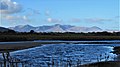
 Beenoskee-4519, Dingle Peninsula, Co. Kerry, Ireland.jpg 1,920 × 1,080; 531 KB
-
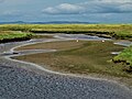
 Bridge-1118, Dingle Peninsula, Co. Kerry, Ireland.jpg 1,920 × 1,080; 613 KB
-
 Bridge-4658, Dingle Peninsula, Co. Kerry, Ireland.jpg 1,920 × 1,080; 532 KB
-
 Caher River-4509, Dingle Peninsula, Co. Kerry, Ireland.jpg 1,920 × 1,080; 412 KB
-
 Clouds of birds Malahide Estuary - geograph.org.uk - 333648.jpg 640 × 480; 43 KB
-
 Curlew-6844, Dingle Peninsula, Co. Kerry, Ireland.jpg 1,920 × 1,080; 543 KB
-
 Curlew-6853, Dingle Peninsula, Co. Kerry, Ireland.jpg 1,920 × 1,080; 605 KB
-
 Estuary or Donegal Bay depends on the tide.png 1,632 × 1,224; 3.08 MB
-
 High Tide-5856, Tralee Bay, Co. Kerry, Ireland.jpg 1,920 × 1,080; 379 KB
-
 Hopefully everything is "Ship Shape and Bristol Fashion" (29611164001).jpg 2,000 × 879; 1,011 KB
-
 Little Egret-8861, Dingle Peninsula, Co. Kerry, Ireland.jpg 1,920 × 1,080; 426 KB
-
 Little Egret-8866, Dingle Peninsula, Co. Kerry, Ireland.jpg 1,920 × 1,080; 481 KB
-
 Marsh-3801, Dingle Peninsula, Co. Kerry, Ireland.jpg 1,920 × 1,080; 291 KB
-
 Mud flats at the head of Dundrum Inner Bay - geograph.org.uk - 2190696.jpg 1,024 × 768; 230 KB
-
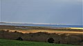
 The Owenmore Estuary at Cloghane - geograph.org.uk - 1427886.jpg 640 × 427; 71 KB
-
 Tidal Estuary-3614, Tralee Bay, Co. Kerry, Ireland.jpg 5,184 × 3,888; 3.02 MB
-
 Tidal Estuary-3616, Tralee Bay, Co. Kerry, Ireland.jpg 5,184 × 3,888; 3.43 MB
-
 Tidal River-6893, Dingle Peninsula, Co. Kerry, Ireland.jpg 1,920 × 1,080; 741 KB


.jpg)


