Category:Muddy trails
Jump to navigation
Jump to search
Media in category "Muddy trails"
The following 60 files are in this category, out of 60 total.
-
 120227-M-KU932-001 (6795347716).jpg 3,300 × 2,400; 6.54 MB
-
 A Muddy Footpath - geograph.org.uk - 97780.jpg 480 × 640; 133 KB
-
 A muddy high Weald Landscape Trail - geograph.org.uk - 1437443.jpg 640 × 480; 141 KB
-

-
 A muddy trail - geograph.org.uk - 745094.jpg 640 × 474; 121 KB
-
 A wood near Creich - geograph.org.uk - 98511.jpg 640 × 480; 132 KB
-

-
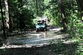 ATV on a muddy trail (5494218531).jpg 4,288 × 2,848; 10.01 MB
-
 Bank Lane - geograph.org.uk - 89977.jpg 640 × 480; 92 KB
-
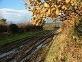
 Blackdown Hills , Muddy Trail - geograph.org.uk - 1243837.jpg 640 × 480; 143 KB
-
 Bridge Closed To Walkers - geograph.org.uk - 265393.jpg 640 × 480; 147 KB
-
 Bridleway near Brocolitia - geograph.org.uk - 1119929.jpg 640 × 480; 134 KB
-
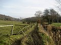
 Bridleway to the river - geograph.org.uk - 668411.jpg 640 × 480; 65 KB
-
 Dales Way - geograph.org.uk - 151328.jpg 640 × 480; 87 KB
-
 Deeper than my wellies^ - geograph.org.uk - 1083875.jpg 640 × 413; 66 KB
-

-
 Flooding at Sherburne WMA (5911977441).jpg 3,264 × 2,448; 3.43 MB
-
 Footpath 10-155-2 on a muddy tractor track, Shelf - geograph.org.uk - 6634466.jpg 2,000 × 1,500; 1.93 MB
-

-
 Footpath, Alderholt, Dorset - geograph.org.uk - 1040593.jpg 1,064 × 1,600; 811 KB
-
 Hag Lane at the summit, Halifax - geograph.org.uk - 5340617.jpg 2,000 × 1,500; 805 KB
-
 Halifax FP749 at Turner Lane - geograph.org.uk - 5340959.jpg 2,000 × 1,500; 1.12 MB
-
 Halifax FP749 on a cart track - geograph.org.uk - 5340577.jpg 2,000 × 1,500; 1.39 MB
-
 Impassable path at Manor Farm - geograph.org.uk - 6540316.jpg 1,024 × 768; 268 KB
-
 Lascar Muddy trail and dense vegetation - Montane rainforests biome (4460866346).jpg 3,216 × 2,136; 1.82 MB
-
 Leeds Country Way below Fulneck - geograph.org.uk - 1141538.jpg 640 × 480; 95 KB
-
 Leeds Country Way heading to Carlton - geograph.org.uk - 4298156.jpg 1,024 × 768; 143 KB
-
 Lepton Lane, Kirkburton - geograph.org.uk - 785955.jpg 640 × 480; 110 KB
-
 Logging - geograph.org.uk - 507267.jpg 640 × 480; 143 KB
-
 Merrills Marauders Chinese troops on the Ledo Road NARA111-SC-193542.tif 6,117 × 5,032; 73.2 MB
-
 Merritown, Stour Valley Way - geograph.org.uk - 1154093.jpg 480 × 640; 113 KB
-
 Merritown, Stour Valley Way - geograph.org.uk - 1154111.jpg 480 × 640; 114 KB
-
 Messy part of the Calderdale Way near Stone Chair - geograph.org.uk - 2848988.jpg 3,072 × 2,304; 1.46 MB
-
 Midwinter muddy tracks - geograph.org.uk - 44089.jpg 640 × 427; 74 KB
-
 Muddy access through woods, off Ashday Lane - geograph.org.uk - 4205277.jpg 4,608 × 3,456; 3.48 MB
-

-
 Muddy tracks leading down to a field in Brastad 1.jpg 4,925 × 3,283; 17.32 MB
-
 Muddy tracks leading down to a field in Brastad 2.jpg 3,283 × 4,925; 17.69 MB
-
 Muddy tracks leading down to a field in Brastad 3.jpg 3,283 × 4,925; 18.4 MB
-
 Muddy tracks leading down to a field in Brastad 4.jpg 3,283 × 4,925; 16.4 MB
-
 Muddy Trail (8500874020).jpg 3,456 × 4,608; 2.99 MB
-
 Path along the River Calder - geograph.org.uk - 3856506.jpg 1,200 × 798; 607 KB
-
 Path heading to Cutsdean - geograph.org.uk - 6406648.jpg 800 × 450; 125 KB
-
 Rambling club in winter - geograph.org.uk - 1083008.jpg 640 × 480; 124 KB
-
 Rutted 4 by 4 track below Carter Fell - geograph.org.uk - 848223.jpg 479 × 640; 107 KB
-

-
 Sowerby Bridge FP84, Goose Pond Lane - geograph.org.uk - 5632395.jpg 2,000 × 1,500; 1.54 MB
-
 Stile and pool on Sowerby Bridge FP 7 - geograph.org.uk - 4236248.jpg 2,000 × 1,500; 1.03 MB
-
 Stock Hill Forest muddy footpath - geograph.org.uk - 569921.jpg 640 × 479; 137 KB
-
 The Kirklees Way at Pildacre Mill Beck - geograph.org.uk - 5246665.jpg 1,600 × 1,200; 733 KB
-
 The Strands - geograph.org.uk - 132414.jpg 640 × 480; 135 KB
-
 Tracks cross - geograph.org.uk - 1083762.jpg 640 × 426; 82 KB
-
 View from the Precincts of Royd Hall - geograph.org.uk - 5653661.jpg 5,152 × 3,864; 4.53 MB
-
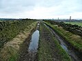
 Waterlogged track, Dale of Corrigall - geograph.org.uk - 1226325.jpg 640 × 425; 128 KB
-
 Wey South path - geograph.org.uk - 804418.jpg 425 × 637; 108 KB
-

-
 A muddy track - geograph.org.uk - 1164857.jpg 640 × 476; 113 KB
-
 A Muddy Track Junction - geograph.org.uk - 354440.jpg 640 × 480; 255 KB
-
 Muddy Track - geograph.org.uk - 344881.jpg 640 × 480; 169 KB
-
 Muddy track - geograph.org.uk - 356218.jpg 640 × 480; 93 KB
.jpg)


.jpg)


.jpg)


.jpg)


.jpg)


