Category:Muchelney
Jump to navigation
Jump to search
English: Muchelney is a village and civil parish in Somerset, England, on the River Parrett, miles south west of Somerton in the South Somerset district. The village has a population of about 210.
village and civil parish in Somerset, UK  | |||||
| Upload media | |||||
| Instance of | |||||
|---|---|---|---|---|---|
| Location | South Somerset, Somerset, South West England, England | ||||
| Population |
| ||||
| Area |
| ||||
| Said to be the same as | Muchelney (Wikimedia duplicated page, civil parish) | ||||
 | |||||
Subcategories
This category has the following 3 subcategories, out of 3 total.
M
P
- Priest's House, Muchelney (4 F)
Media in category "Muchelney"
The following 200 files are in this category, out of 249 total.
(previous page) (next page)-
 2016 Mercedes SLC200.jpg 4,896 × 3,672; 8.1 MB
-
 Abbey ruins, Muchelney - geograph.org.uk - 5546551.jpg 1,024 × 768; 223 KB
-
 Abbot's House, Muchelney - geograph.org.uk - 5604799.jpg 2,504 × 1,805; 2.26 MB
-
 Barn - Muchelney - geograph.org.uk - 1261482.jpg 640 × 480; 53 KB
-
 Barn near the Priest's House - geograph.org.uk - 5694729.jpg 1,024 × 768; 174 KB
-
 Barns in Muchelney - geograph.org.uk - 1575501.jpg 640 × 480; 67 KB
-
 Barry Moor - geograph.org.uk - 5276263.jpg 1,024 × 768; 134 KB
-
 Benchmark on Muchelney Ham Bridge - geograph.org.uk - 4520583.jpg 640 × 480; 122 KB
-
 Byway, Muchelney - geograph.org.uk - 4917784.jpg 1,920 × 1,226; 823 KB
-
 Cast Iron Gravestone, Church of St Peter ^ St Paul - geograph.org.uk - 6054772.jpg 1,060 × 1,600; 502 KB
-

-
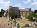
 Church at Muchelney - geograph.org.uk - 4457458.jpg 800 × 600; 111 KB
-
 Church of St Peter and St Paul - geograph.org.uk - 5851253.jpg 640 × 480; 296 KB
-
 Church of St Peter and St Paul, Muchelney - geograph.org.uk - 4817967.jpg 1,024 × 768; 220 KB
-
 Church of St Peter and St Paul, Muchelney - geograph.org.uk - 6055048.jpg 1,600 × 1,004; 352 KB
-
 CNP 3209 (7008419259).jpg 1,024 × 680; 287 KB
-
 Cottages in Muchelney Ham - geograph.org.uk - 1575502.jpg 640 × 480; 137 KB
-
 Court House, Muchelney - geograph.org.uk - 4817950.jpg 1,024 × 768; 179 KB
-
 Cross, Muchelney - geograph.org.uk - 5026713.jpg 3,072 × 2,048; 1.04 MB
-
 Dairy House Farm - geograph.org.uk - 4958318.jpg 1,024 × 768; 277 KB
-
 Dog Rose - geograph.org.uk - 452045.jpg 640 × 480; 75 KB
-
 Ducks (6862305544).jpg 1,024 × 647; 220 KB
-
 Eastmoor Drove - geograph.org.uk - 4910006.jpg 1,920 × 2,880; 1.2 MB
-
 Eastmoor Drove - geograph.org.uk - 4958302.jpg 1,024 × 768; 203 KB
-
 Eastmoor Lane - geograph.org.uk - 1575497.jpg 640 × 480; 123 KB
-
 Eastmoor Lane - geograph.org.uk - 5694744.jpg 1,024 × 768; 237 KB
-
 Entrance, Thorney Lakes and Caravan Park - geograph.org.uk - 4817085.jpg 1,024 × 804; 266 KB
-

-

-
 Fields east of Muchelney - geograph.org.uk - 4917807.jpg 1,920 × 1,280; 766 KB
-
 Finished for the day - geograph.org.uk - 5694741.jpg 1,024 × 768; 176 KB
-
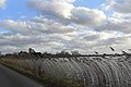
 Flooded fields around Muchelney - geograph.org.uk - 3896291.jpg 800 × 524; 100 KB
-
 Flooded fields near Muchelney - geograph.org.uk - 1053326.jpg 640 × 480; 67 KB
-
 Flooded fields near Muchelney - geograph.org.uk - 2257466.jpg 1,024 × 768; 78 KB
-
 Flooded Fields near Muchelney - geograph.org.uk - 3896297.jpg 800 × 486; 57 KB
-
 Flooded moor near Muchelney - geograph.org.uk - 479857.jpg 640 × 427; 68 KB
-

-
 Footpath by the remains of the Abbey, Muchelney - geograph.org.uk - 5694757.jpg 1,024 × 768; 221 KB
-
 Former monks' reredorter, Muchelney - geograph.org.uk - 5604749.jpg 3,008 × 2,000; 2.54 MB
-
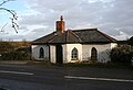
 Former toll-house, Muchelney - geograph.org.uk - 4818091.jpg 1,024 × 768; 158 KB
-
 Fuel Wood For Pottery Kilns - geograph.org.uk - 3365251.jpg 640 × 480; 150 KB
-
 Gallery and pottery, Muchelney - geograph.org.uk - 4817926.jpg 1,024 × 785; 173 KB
-
 Ginkgo tree at Church of St Peter ^ St Paul, Muchelney - geograph.org.uk - 6054777.jpg 1,060 × 1,600; 624 KB
-
 Grassy track east of Muchelney - geograph.org.uk - 6622068.jpg 1,024 × 683; 282 KB
-
 Green, Muchelney - geograph.org.uk - 4921872.jpg 1,920 × 1,176; 721 KB
-
 Greystones, Muchelney - geograph.org.uk - 4817955.jpg 1,024 × 796; 217 KB
-
 Horsey Lane - geograph.org.uk - 4817987.jpg 1,024 × 817; 247 KB
-
 Horsey Lane - geograph.org.uk - 4917365.jpg 1,920 × 1,280; 955 KB
-
 Horsey Lane - geograph.org.uk - 4917388.jpg 1,920 × 1,123; 619 KB
-
 Horsey Lane - geograph.org.uk - 4917516.jpg 1,920 × 1,280; 862 KB
-
 Horsey Lane - geograph.org.uk - 5276278.jpg 1,024 × 831; 165 KB
-
 Horsey Lane - geograph.org.uk - 5546557.jpg 1,024 × 768; 181 KB
-
 Horsey Lane - geograph.org.uk - 5546907.jpg 1,024 × 768; 175 KB
-
 House at Daws Farm - geograph.org.uk - 4958314.jpg 1,024 × 768; 277 KB
-
 House at Thorney East - geograph.org.uk - 4817944.jpg 1,024 × 807; 277 KB
-
 Houses in Lower Muchelney - geograph.org.uk - 4917817.jpg 1,920 × 1,280; 748 KB
-
 Ice on the Levels at Muchelney - geograph.org.uk - 2241945.jpg 640 × 480; 72 KB
-
 Indian Runner Duck (6862299430).jpg 1,024 × 685; 198 KB
-
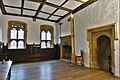
 Interior of Great Hall - geograph.org.uk - 5851239.jpg 640 × 480; 228 KB
-
 John Leach Pottery - geograph.org.uk - 3365255.jpg 640 × 480; 82 KB
-
 Lane and farm buildings at Muchelney - geograph.org.uk - 5851531.jpg 640 × 480; 341 KB
-
 Lane Through Thorney - geograph.org.uk - 5285022.jpg 640 × 428; 66 KB
-
 Lapwings over Thorneymoor - geograph.org.uk - 2780880.jpg 3,888 × 2,592; 1.06 MB
-
 Leafy seat - geograph.org.uk - 5118129.jpg 1,704 × 2,304; 2.09 MB
-
 Looking east towards Muchelney - geograph.org.uk - 4946002.jpg 3,264 × 2,395; 1.75 MB
-
 Looking north from Westover Bridge - geograph.org.uk - 4946007.jpg 3,264 × 2,448; 1.62 MB
-
 Looking towards Muchelney - geograph.org.uk - 3896303.jpg 800 × 533; 86 KB
-
 Looking towards Muchelney from the River Parrett - geograph.org.uk - 2125781.jpg 1,024 × 768; 146 KB
-

-
 Manor House, Lower Muchelney - geograph.org.uk - 4917974.jpg 1,920 × 1,280; 911 KB
-
 Monument on the green at Muchelney - geograph.org.uk - 6622076.jpg 1,024 × 683; 190 KB
-
 Muchelney - geograph.org.uk - 2780842.jpg 3,888 × 2,592; 1.75 MB
-
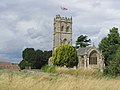 Muchelney - St Peter ^ St Paul's Church - geograph.org.uk - 4283457.jpg 1,024 × 768; 180 KB
-

-
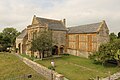 Muchelney Abbey - geograph.org.uk - 5125280.jpg 1,024 × 683; 232 KB
-
 Muchelney Abbey - geograph.org.uk - 5125286.jpg 1,024 × 683; 227 KB
-
 Muchelney Abbey - geograph.org.uk - 5125305.jpg 1,024 × 683; 352 KB
-
 Muchelney Abbey - geograph.org.uk - 5356954.jpg 4,350 × 3,582; 5.98 MB
-
 Muchelney Abbey - geograph.org.uk - 5356962.jpg 4,896 × 3,672; 5.51 MB
-
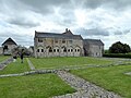 Muchelney Abbey - geograph.org.uk - 5356974.jpg 4,896 × 3,672; 6.56 MB
-
 Muchelney Abbey - geograph.org.uk - 5851247.jpg 640 × 480; 303 KB
-
 Muchelney Abbey - geograph.org.uk - 6622061.jpg 1,024 × 683; 185 KB
-
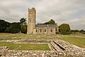 Muchelney Abbey and Parish Church - geograph.org.uk - 5125266.jpg 1,024 × 683; 239 KB
-
 Muchelney Abbey and the Church of St. Peter and St. Paul - geograph.org.uk - 5923883.jpg 7,552 × 5,036; 7.7 MB
-
 Muchelney Abbey Museum, 'The Vicar's Beer' - geograph.org.uk - 6018510.jpg 6,513 × 4,343; 6.2 MB
-

-
 Muchelney Abbey Museum, c13th tile with hunting scene - geograph.org.uk - 6018509.jpg 5,915 × 3,944; 6.19 MB
-
 Muchelney Abbey Museum, Two c13th tiles with hunting scenes - geograph.org.uk - 6018511.jpg 4,129 × 6,195; 7.45 MB
-
 Muchelney Abbey near Langport - geograph.org.uk - 4283451.jpg 1,024 × 768; 170 KB
-
 Muchelney Abbey Remains - geograph.org.uk - 4172634.jpg 1,767 × 1,178; 678 KB
-
 Muchelney Abbey remains - geograph.org.uk - 6622063.jpg 1,024 × 683; 192 KB
-
 Muchelney Abbey ^ Anglican Parish Church - geograph.org.uk - 4946964.jpg 3,264 × 2,448; 1.88 MB
-
 Muchelney Abbey, c15th Abbot's Great Chamber - geograph.org.uk - 6018475.jpg 7,705 × 5,136; 7.01 MB
-
 Muchelney Abbey, c15th Abbot's Great Chamber, fireplace - geograph.org.uk - 6018478.jpg 4,497 × 6,747; 5.12 MB
-

-

-

-
 Muchelney Abbey, c15th vaulting fragment 1 - geograph.org.uk - 6018498.jpg 7,328 × 4,886; 7.15 MB
-
 Muchelney Abbey, c15th vaulting fragment 2 - geograph.org.uk - 6018500.jpg 6,355 × 4,237; 5.46 MB
-
 Muchelney Abbey, c15th vaulting fragment 3 - geograph.org.uk - 6018501.jpg 6,217 × 4,144; 6.57 MB
-
 Muchelney Abbey, c15th vaulting fragment 4 - geograph.org.uk - 6018502.jpg 6,114 × 4,075; 5.68 MB
-
 Muchelney Abbey, from the east - geograph.org.uk - 4072541.jpg 1,024 × 768; 138 KB
-
-

-

-

-
 Muchelney Abbey, Somerset - geograph.org.uk - 6054716.jpg 1,600 × 1,060; 450 KB
-

-
 Muchelney buildings (1) (geograph 7507429).jpg 3,153 × 4,204; 2.56 MB
-
 Muchelney Church from the river bank - geograph.org.uk - 450680.jpg 427 × 640; 36 KB
-
 Muchelney Cross. - panoramio.jpg 2,331 × 3,137; 1.6 MB
-
 Muchelney from Langport church - geograph.org.uk - 3581104.jpg 640 × 427; 72 KB
-
 Muchelney from the disused railway - geograph.org.uk - 2780853.jpg 640 × 427; 58 KB
-
 Muchelney from the River Parrett - geograph.org.uk - 2780898.jpg 3,888 × 2,592; 3.67 MB
-
 Muchelney Graveyard - geograph.org.uk - 5284807.jpg 640 × 428; 70 KB
-
 Muchelney Ham Bridge - geograph.org.uk - 4520580.jpg 640 × 480; 95 KB
-
 Muchelney houses (11) (geograph 7507489).jpg 4,320 × 3,240; 4.43 MB
-
 Muchelney houses (12) (geograph 7509298).jpg 4,241 × 3,181; 3.65 MB
-
 Muchelney houses (3) (geograph 7507432).jpg 4,320 × 3,240; 5.1 MB
-
 Muchelney houses (6) (geograph 7507454).jpg 4,290 × 3,218; 3.4 MB
-
 Muchelney houses (7) (geograph 7507461).jpg 3,891 × 2,918; 6.89 MB
-
 Muchelney houses (8) (geograph 7507474).jpg 4,167 × 3,125; 3.54 MB
-
 Muchelney in the distance - geograph.org.uk - 2257453.jpg 1,024 × 701; 141 KB
-
 Muchelney Level - geograph.org.uk - 4909949.jpg 1,920 × 1,108; 654 KB
-
 Muchelney Level - geograph.org.uk - 5276272.jpg 1,024 × 733; 174 KB
-
 Muchelney Levels, High Water - geograph.org.uk - 2236674.jpg 1,600 × 1,058; 1.29 MB
-
 Muchelney Manor - geograph.org.uk - 4958308.jpg 1,024 × 768; 212 KB
-
 Muchelney to Langport Road - geograph.org.uk - 1137418.jpg 640 × 428; 69 KB
-
 Muchelney village - geograph.org.uk - 1575496.jpg 640 × 480; 89 KB
-
 Muchelney village cross - geograph.org.uk - 1575492.jpg 640 × 480; 112 KB
-
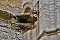 Muchelney, St. Peter and St. Paul's church, Hunky Punk 3 - geograph.org.uk - 6031242.jpg 6,844 × 4,563; 5.92 MB
-
 Muchelney, St. Peter and St. Paul's church, Memorial plaque - geograph.org.uk - 6031235.jpg 6,301 × 4,200; 7.12 MB
-
 Muchelney, St. Peter and St. Paul's church, The altar - geograph.org.uk - 6031239.jpg 7,331 × 4,887; 7.18 MB
-
 Muchelney, St. Peter and St. Paul's church, Tower detail - geograph.org.uk - 6031245.jpg 6,051 × 4,034; 6.73 MB
-

-

-

-

-
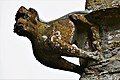 Muchelney, St. Peter and St. Pauls church, Hunky Punk 1 - geograph.org.uk - 6030545.jpg 5,152 × 3,434; 3.13 MB
-
 Muchelney, St. Peter and St. Pauls church, Hunky Punk 2 - geograph.org.uk - 6030549.jpg 5,840 × 3,894; 4.5 MB
-

-
-

-

-

-

-

-
-

-

-

-
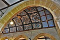
 Muchelney, St. Peter and St. Pauls church, The nave - geograph.org.uk - 6030210.jpg 7,165 × 4,777; 6.72 MB
-
 Muchelney, St. Peter and St. Pauls church, The organ - geograph.org.uk - 6030215.jpg 4,888 × 7,331; 6.96 MB
-

-
 Muchelney, The Church of St. Peter and St. Paul - geograph.org.uk - 5923888.jpg 6,977 × 4,652; 5.76 MB
-
 Muchelney, The Church of St. Peter and St. Paul - geograph.org.uk - 6018459.jpg 7,016 × 4,677; 6.26 MB
-
 Muchelney, The Church of St. Peter and St. Paul - geograph.org.uk - 6018467.jpg 7,421 × 4,947; 7.48 MB
-
 Muchelney, The Church of St. Peter and St. Paul - geograph.org.uk - 6018469.jpg 7,057 × 4,704; 6.93 MB
-
 Muchelney, The Priest's House - geograph.org.uk - 6030542.jpg 5,874 × 3,916; 7.35 MB
-
 North Ham Farm - geograph.org.uk - 4909999.jpg 1,920 × 1,298; 770 KB
-
-
-
 Postbox, Muchelney - geograph.org.uk - 4917542.jpg 1,920 × 1,280; 907 KB
-
 Pottery, Thorney (geograph 4918080).jpg 1,920 × 984; 595 KB
-
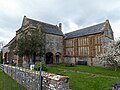
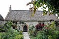
 Priest's House, Muchelney - geograph.org.uk - 5356995.jpg 4,896 × 3,672; 4.9 MB
-
 Priest's House, Muchelney - geograph.org.uk - 5357000.jpg 4,896 × 3,672; 5.67 MB
-
 Priest's house, Muchelney - geograph.org.uk - 5606418.jpg 3,008 × 2,000; 2.75 MB
-

-
 Reredorter at Muchelney Abbey, Somerset - geograph.org.uk - 6054726.jpg 1,600 × 1,060; 566 KB
-
 Restricted byway, Thorney (geograph 4918010).jpg 2,792 × 1,613; 1.11 MB
-
 Restricted byway, Thorney - geograph.org.uk - 4918041.jpg 1,920 × 1,280; 770 KB
-
 Restricted byway, Thorney - geograph.org.uk - 4918052.jpg 1,920 × 1,280; 1,008 KB
-
 River Parrett - geograph.org.uk - 4915717.jpg 1,920 × 1,280; 797 KB
-
 River Parrett at Westover bridge - geograph.org.uk - 443480.jpg 640 × 480; 100 KB
-
 River Parrett, from Westover Bridge - geograph.org.uk - 4818104.jpg 1,024 × 768; 146 KB
-
 River Yeo - geograph.org.uk - 228265.jpg 640 × 480; 61 KB
-
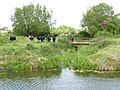 River Yeo and cattle near Huish Episcopi - geograph.org.uk - 4520622.jpg 640 × 480; 102 KB
-
 Road junction at Muchelney - geograph.org.uk - 4457463.jpg 600 × 800; 113 KB
-
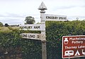
 Road Sign at Law Lane, Muchelney - geograph.org.uk - 5356990.jpg 4,896 × 3,672; 6.21 MB
-
 Roadside cross at Muchelney - geograph.org.uk - 5851268.jpg 480 × 640; 260 KB
-
 Ruined Rail Bridge on River Parrett - geograph.org.uk - 2015048.jpg 1,024 × 768; 195 KB
-
 Sign on the Toll House in Muchelney - geograph.org.uk - 3896310.jpg 800 × 637; 78 KB
-

-
 Sluice on Broad Drove - geograph.org.uk - 5366826.jpg 1,024 × 768; 207 KB
-
 Small copse on Whit Moor - geograph.org.uk - 5367063.jpg 1,024 × 768; 182 KB
-
 Some of the ruins at Muchelney Abbey - geograph.org.uk - 4457461.jpg 800 × 600; 155 KB
-
 South Ham Farm - geograph.org.uk - 4958325.jpg 1,024 × 801; 269 KB
-
 South Somerset cycle path - geograph.org.uk - 12217.jpg 640 × 480; 205 KB
-
 SS Peter & Paul, Muchelney.jpg 3,456 × 4,608; 9.09 MB
-
 St Peter and St Paul's Church, Muchelney - geograph.org.uk - 5604770.jpg 1,957 × 1,958; 1.73 MB
-
 St Peter ^ St Paul Church, Muchelney - geograph.org.uk - 5356944.jpg 4,896 × 3,672; 6.5 MB
-
 St Peter ^ St Paul Church, Muchelney - geograph.org.uk - 5356968.jpg 4,896 × 3,672; 5.74 MB
-
 Stream south of Langport - geograph.org.uk - 1575484.jpg 640 × 480; 151 KB
-
 Street corner, Muchelney - geograph.org.uk - 4817957.jpg 1,024 × 805; 187 KB
-
 Sunset over the flooded fields Muchelney - geograph.org.uk - 2257520.jpg 1,024 × 768; 83 KB
-
 Swans on the flooded fields near Muchelney. - geograph.org.uk - 2257505.jpg 909 × 1,024; 100 KB
-
 Terraced cottages, Muchelney - geograph.org.uk - 4958291.jpg 1,024 × 768; 217 KB
-
 Thatched Cottage, Muchelney Ham - geograph.org.uk - 4958329.jpg 1,024 × 768; 247 KB
-
 Thatched cottages, Thorney (geograph 4917988).jpg 1,920 × 1,220; 695 KB
-
 Thatching in progress, Muchelney - geograph.org.uk - 5276286.jpg 1,024 × 757; 177 KB


.jpg)


.jpg)


.jpg)


_-_geograph.org.uk_-_6018504.jpg)
_(geograph_7507429).jpg)


_(geograph_7507489).jpg)
_(geograph_7509298).jpg)
_(geograph_7507432).jpg)
_(geograph_7507454).jpg)
_(geograph_7507461).jpg)
_(geograph_7507474).jpg)


_-_geograph.org.uk_-_6030224.jpg)


_-_geograph.org.uk_-_6031219.jpg)


.jpg)


.jpg)


.jpg)
