Category:Mowden, County Durham
Jump to navigation
Jump to search
English: Mowden is an area of Darlington, in the Darlington district, in the county of Durham, England.
suburb of Darlington, County Durham, United Kingdom  | |||||
| Upload media | |||||
| Instance of | |||||
|---|---|---|---|---|---|
| Location | Darlington, County Durham, North East England, England | ||||
 | |||||
Media in category "Mowden, County Durham"
The following 35 files are in this category, out of 35 total.
-

-
 Branksome Social Club Darlington - geograph.org.uk - 2207943.jpg 640 × 480; 72 KB
-
 Bus stop on Newton Lane - geograph.org.uk - 4805047.jpg 640 × 480; 87 KB
-
 Bushel Hill Court Darlington - geograph.org.uk - 1452389.jpg 640 × 480; 77 KB
-
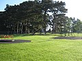 Bushel Hill Park, Mowden, Darlington - geograph.org.uk - 1325379.jpg 640 × 480; 114 KB
-
 Chester Grove Darlington - geograph.org.uk - 1478747.jpg 640 × 462; 69 KB
-
 Convenience Store in Whitby Way Darlington - geograph.org.uk - 2477519.jpg 3,648 × 2,736; 2.43 MB
-
 Conyers Avenue Darlington - geograph.org.uk - 1452393.jpg 640 × 480; 73 KB
-
 Conyers Close in Darlington - geograph.org.uk - 3229759.jpg 3,512 × 2,546; 2.39 MB
-
 Conyers Grove in Darlington - geograph.org.uk - 3229761.jpg 3,648 × 2,736; 4.3 MB
-
 Edgecombe Grove Darlington - geograph.org.uk - 1841985.jpg 2,035 × 1,370; 571 KB
-
 Farmers bridge over Cocker Beck Darlington - geograph.org.uk - 2349653.jpg 3,648 × 2,736; 3.48 MB
-
 Footbridge over Cocker Beck Darlington - geograph.org.uk - 2186881.jpg 2,048 × 1,536; 1,018 KB
-
 Footpath alongside Baydale Beck - geograph.org.uk - 2126246.jpg 640 × 427; 135 KB
-
 Grassed areas on south side of B6279 - geograph.org.uk - 4770085.jpg 1,500 × 1,125; 2.09 MB
-
 Hallview Grove Darlington - geograph.org.uk - 1841990.jpg 2,048 × 1,448; 594 KB
-
 Houses on Staindrop Road - geograph.org.uk - 3227710.jpg 640 × 447; 61 KB
-
 Junior football pitch in Bushell Hill Park, Darlington - geograph.org.uk - 2798795.jpg 3,648 × 2,736; 3.33 MB
-
 Lazenby Grove Darlington - geograph.org.uk - 1598045.jpg 640 × 475; 75 KB
-
 Lunedale Road Darlington - geograph.org.uk - 1451384.jpg 640 × 480; 76 KB
-
 Mowden Bridge crossing Baydale Beck - geograph.org.uk - 4941226.jpg 4,000 × 3,000; 2.33 MB
-
 Mowden Bridge Darlington - geograph.org.uk - 2199698.jpg 2,048 × 1,536; 872 KB
-
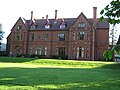 Mowden Hall Darlington - geograph.org.uk - 1327599.jpg 640 × 480; 81 KB
-

-
 Rosedale Crescent Darlington - geograph.org.uk - 2477522.jpg 3,648 × 2,736; 2.11 MB
-
 Sign for the Deacon, Darlington - geograph.org.uk - 4786446.jpg 516 × 640; 47 KB
-
 Southern end of Edgecombe Drive in Darlington - geograph.org.uk - 3229764.jpg 3,576 × 2,638; 3.02 MB
-
 Staindrop Road (B6279) - geograph.org.uk - 3227713.jpg 640 × 480; 67 KB
-
 Staindrop Road Darlington - geograph.org.uk - 1451380.jpg 640 × 480; 64 KB
-
 The Deacon public house in Darlington - geograph.org.uk - 2477530.jpg 3,648 × 2,736; 2.39 MB
-
 The Deacon public house, Darlington - geograph.org.uk - 4805050.jpg 640 × 480; 58 KB
-
 The green at Lazenby Crescent Darlington in July 2006 - geograph.org.uk - 2233384.jpg 1,712 × 1,166; 840 KB
-
 The Mowden. - geograph.org.uk - 150423.jpg 640 × 479; 92 KB
-
 The Pantry in Newton Lane Darlington - geograph.org.uk - 2594605.jpg 2,561 × 1,892; 891 KB
-
 Western end of Bates Avenue in Darlington - geograph.org.uk - 2477527.jpg 3,648 × 2,736; 2.48 MB


_-_geograph.org.uk_-_3227713.jpg)


