Category:Mowbray Point Ruin
Jump to navigation
Jump to search
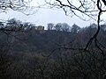
The Mowbray Point Ruin, also known as The Ruin, Hackfall, and as the Hackfall banqueting hall, is a folly which sits on a high point of Hack Fall Wood, North Yorkshire, England. It can often be seen in the background of some images in this category.
An 18th century folly at Hackfall, Grewelthorpe, Yorkshire, England.  | |||||
| Upload media | |||||
| Instance of | |||||
|---|---|---|---|---|---|
| Location | Hackfall, Harrogate, North Yorkshire, Yorkshire and the Humber, England | ||||
| Heritage designation |
| ||||
 | |||||
Media in category "Mowbray Point Ruin"
The following 26 files are in this category, out of 26 total.
-
 'The Ruin', Hackfall - geograph.org.uk - 638612.jpg 480 × 640; 92 KB
-
 Hack Fall Wood 12 July 2019 (2).jpg 4,032 × 3,024; 3.57 MB
-
 Hack Fall Wood Flickr B 01.jpg 1,333 × 2,000; 271 KB
-
 Hack Fall Wood Flickr D 05.jpg 2,000 × 3,005; 7.62 MB
-
 Hack Fall Wood Flickr D 12.jpg 1,280 × 960; 410 KB
-
 Hack Fall Wood Flickr D 13.jpg 960 × 1,280; 420 KB
-
 Hack Fall Wood geograph-2415355-by-C-P-Smith.jpg 1,200 × 1,600; 469 KB
-
 Hack Fall Wood geograph-2933746-by-Gordon-Hatton.jpg 2,448 × 3,264; 2.3 MB
-
 Hack Fall Wood geograph-4921006-by-Stephen-Richards.jpg 640 × 455; 268 KB
-
 Hack Fall Wood geograph-4921026-by-Stephen-Richards.jpg 521 × 640; 257 KB
-

-

-
 Mowbray Point Ruin - geograph.org.uk - 1525494.jpg 640 × 480; 107 KB
-
 The Banqueting House, Hackfall, Grewelthorpe. East Side 01.jpg 1,520 × 2,688; 1.88 MB
-
 The Banqueting House, Hackfall, Grewelthorpe. West Side.jpg 2,688 × 1,520; 2.49 MB
-
 The Ruin at Mowbray Point - geograph.org.uk - 1222080.jpg 640 × 480; 87 KB
-
 The Ruin Hackfall 01.jpg 6,588 × 6,852; 6.88 MB
-
 The Ruin Hackfall 02.jpg 2,829 × 4,549; 2.13 MB
-
 The Ruin Hackfall 03.jpg 4,000 × 3,000; 4.87 MB
-
 The Ruin Hackfall 04.jpg 4,000 × 3,000; 4.71 MB
-
 The Ruin Hackfall 05.jpg 4,000 × 3,000; 5.02 MB
-
 The Ruin Hackfall 06.jpg 4,000 × 3,000; 4.8 MB
-
 The Ruin Hackfall 07.jpg 9,454 × 8,149; 10.85 MB
-
 The Ruin Hackfall 08.jpg 4,000 × 3,000; 4.89 MB
-
 The Ruin Hackfall 09.jpg 4,000 × 3,000; 4.64 MB
-
 The Ure Valley from Mowbray Point - geograph.org.uk - 114131.jpg 640 × 480; 158 KB

.jpg)


