Category:Mountnessing
Jump to navigation
Jump to search
village in Essex, England, UK  | |||||
| Upload media | |||||
| Instance of | |||||
|---|---|---|---|---|---|
| Location | Brentwood, Essex, East of England, England | ||||
 | |||||
English: Mountnessing is a village in south Essex. It is situated to the north-east of Brentwood, south-west of Ingatestone.
Main Wikipedia article: Mountnessing.

Subcategories
This category has the following 7 subcategories, out of 7 total.
Media in category "Mountnessing"
The following 200 files are in this category, out of 263 total.
(previous page) (next page)-
 40 MPH signs, Thoby Lane - geograph.org.uk - 5333504.jpg 640 × 480; 76 KB
-
 66427 Mountnessing 161019.jpg 4,393 × 2,529; 2.82 MB
-
 66428 Mountnessing 161019.jpg 4,769 × 3,089; 2.56 MB
-
 A tyresome sight - geograph.org.uk - 2867253.jpg 640 × 480; 108 KB
-

-
 A12 Brentwood Bypass - geograph.org.uk - 3025800.jpg 3,072 × 2,304; 1.4 MB
-
 A12 Ingatestone Bypass Bridge and Lower Road, Hutton - geograph.org.uk - 1842090.jpg 3,072 × 2,304; 1.38 MB
-
 A12 Jam - geograph.org.uk - 37896.jpg 640 × 482; 67 KB
-
 A12 near Mountnessing - geograph.org.uk - 3251583.jpg 640 × 491; 56 KB
-
 A12 towards Heybridge - geograph.org.uk - 2272431.jpg 1,024 × 768; 120 KB
-
 A12 Trunk Road, Brentwood, Essex - geograph.org.uk - 37909.jpg 640 × 480; 72 KB
-
 A12, bridge near Mountnessing - geograph.org.uk - 3251577.jpg 640 × 430; 51 KB
-
 A12, eastbound - geograph.org.uk - 3251574.jpg 640 × 430; 54 KB
-
 A12, Ingatestone bypass - geograph.org.uk - 3872974.jpg 640 × 430; 35 KB
-
 A12, northbound - geograph.org.uk - 3872973.jpg 640 × 430; 44 KB
-
 Access Denied - geograph.org.uk - 4547308.jpg 4,000 × 3,000; 2.56 MB
-
 All Rape ^ No Footpath - geograph.org.uk - 4465163.jpg 640 × 424; 103 KB
-
 Arable Field Boundary, near Bacons Farm, Mountnessing - geograph.org.uk - 6143161.jpg 3,648 × 2,736; 3.43 MB
-
 Arable Land near Arnold's Farm, Mountnessing - geograph.org.uk - 6129330.jpg 3,648 × 2,255; 2.15 MB
-
 Arable Land near Westlands Farm, Mountnessing - geograph.org.uk - 6143157.jpg 3,648 × 2,255; 1.8 MB
-
 Arnold's Farm, Mountnessing, Essex - geograph.org.uk - 59107.jpg 640 × 480; 102 KB
-
 B1002, Mountnessing - geograph.org.uk - 2602463.jpg 640 × 428; 96 KB
-
 B1002, Mountnessing - geograph.org.uk - 2602476.jpg 640 × 428; 94 KB
-
 Barns at Mountnessing Hall - geograph.org.uk - 4465193.jpg 640 × 424; 81 KB
-
 Barrier, Hall Lane - geograph.org.uk - 5332196.jpg 640 × 480; 105 KB
-

-
 Bench by the bridleway - geograph.org.uk - 3440714.jpg 640 × 480; 133 KB
-
 Blockage near Hall Lane - geograph.org.uk - 5330924.jpg 640 × 480; 151 KB
-
 Bridge over A12 - geograph.org.uk - 3486989.jpg 1,024 × 616; 131 KB
-
 Bridge over the A12 - geograph.org.uk - 2675887.jpg 640 × 430; 52 KB
-
 Bridge, Hall Lane - geograph.org.uk - 5330928.jpg 640 × 480; 133 KB
-
 Bridge, Hall Lane - geograph.org.uk - 5332135.jpg 640 × 480; 146 KB
-
 Bridleway Near Padham's Green - geograph.org.uk - 4465257.jpg 640 × 424; 79 KB
-
 Bridleway to Padham's Green - geograph.org.uk - 2867168.jpg 640 × 480; 164 KB
-
 Bridleway to Padham's Green - geograph.org.uk - 4465221.jpg 640 × 424; 82 KB
-
 Buckwyns Chase, near Billericay - geograph.org.uk - 4514371.jpg 640 × 480; 91 KB
-
 Building, Mountnessing village green - geograph.org.uk - 5333500.jpg 640 × 480; 70 KB
-
 Buttsbury - geograph.org.uk - 2866992.jpg 640 × 428; 81 KB
-
 Buttsbury Church - geograph.org.uk - 2442238.jpg 640 × 426; 80 KB
-
 Buttsbury Ford - geograph.org.uk - 2481267.jpg 640 × 428; 78 KB
-
 Buttsbury Ford - geograph.org.uk - 4514382.jpg 640 × 480; 95 KB
-
 Buttsbury Wash ahead - geograph.org.uk - 2867049.jpg 640 × 428; 162 KB
-
 Buttsbury Wash, Mountnessing - geograph.org.uk - 3247490.jpg 3,318 × 2,212; 1.77 MB
-
 Buttsbury, near Ingatestone - geograph.org.uk - 4514391.jpg 640 × 480; 96 KB
-
 Buttsbury, near Ingatestone - geograph.org.uk - 4514404.jpg 640 × 480; 65 KB
-
 Church Road, Mountnessing - geograph.org.uk - 5333047.jpg 640 × 480; 57 KB
-
 Church Road, Padham's Green - geograph.org.uk - 5333395.jpg 640 × 480; 65 KB
-
 Church Road, Padham's Green - geograph.org.uk - 5333402.jpg 640 × 480; 57 KB
-

-
 Country lanes junction near Billericay - geograph.org.uk - 4514331.jpg 640 × 480; 112 KB
-
 Country lanes near Billericay - geograph.org.uk - 4514378.jpg 640 × 480; 78 KB
-
 Country lanes near Mountnessing, Essex - geograph.org.uk - 4514296.jpg 640 × 480; 124 KB
-
 Dead tree, Padham's Green - geograph.org.uk - 5333367.jpg 480 × 640; 61 KB
-
 Dead vines, Padham's Green - geograph.org.uk - 5333375.jpg 640 × 480; 160 KB
-
 Ditch, Padham's Green - geograph.org.uk - 5333381.jpg 640 × 480; 147 KB
-
 Ditch, Padham's Green - geograph.org.uk - 5333387.jpg 640 × 480; 162 KB
-
 Electricity poles, Mountnessing - geograph.org.uk - 5332120.jpg 480 × 640; 78 KB
-
 End of The Roman Road - geograph.org.uk - 3082823.jpg 640 × 429; 67 KB
-
 Farm adjacent to Mountnessing Hall - geograph.org.uk - 1365435.jpg 640 × 427; 52 KB
-
 Farmyard, Mountnessing Hall - geograph.org.uk - 2442168.jpg 640 × 426; 59 KB
-
 Fence, Hall Lane - geograph.org.uk - 5332985.jpg 640 × 480; 146 KB
-
 Fence, Hall Lane - geograph.org.uk - 5332992.jpg 640 × 480; 160 KB
-
 Field and tree line off Thoby Lane - geograph.org.uk - 2606373.jpg 2,256 × 1,496; 881 KB
-
 Field Margin ^ White House - geograph.org.uk - 4465143.jpg 640 × 424; 73 KB
-
 Field near Padham's Green - geograph.org.uk - 5333328.jpg 640 × 480; 60 KB
-
 Field near Padham's Green - geograph.org.uk - 5333340.jpg 640 × 480; 91 KB
-
 Field off Thoby Lane, near Mountnessing - geograph.org.uk - 2606366.jpg 2,256 × 1,496; 711 KB
-
 Field, Hall Lane - geograph.org.uk - 5332206.jpg 640 × 480; 79 KB
-
 Fields Near Woodlands Farm - geograph.org.uk - 4466194.jpg 640 × 424; 50 KB
-
 Focus Fording - geograph.org.uk - 2481251.jpg 640 × 428; 94 KB
-
 Footbridge Near Woowards - geograph.org.uk - 3087972.jpg 429 × 640; 104 KB
-
 Footbridge Over The Wid - geograph.org.uk - 3088029.jpg 640 × 429; 119 KB
-
 Footbridge Over the Wid - geograph.org.uk - 3672954.jpg 424 × 640; 94 KB
-
 Footbridge south of Kettles Place - geograph.org.uk - 2441388.jpg 640 × 426; 105 KB
-
 Footbridge to Mountnessing Hall - geograph.org.uk - 4465179.jpg 424 × 640; 118 KB
-
 Footpath approaching Padham's Green - geograph.org.uk - 2442196.jpg 640 × 426; 64 KB
-
 Footpath from Mountnessing Churchyard - geograph.org.uk - 5397990.jpg 4,000 × 3,000; 5.06 MB
-
 Footpath near Mountnessing church - geograph.org.uk - 2442190.jpg 640 × 426; 86 KB
-
 Footpath near Mountnessing. - geograph.org.uk - 2441400.jpg 640 × 426; 97 KB
-
 Footpath near Tilehurst - geograph.org.uk - 5398960.jpg 4,000 × 3,000; 5 MB
-
 Footpath north from Mountnessing Churchyard - geograph.org.uk - 5395478.jpg 4,000 × 3,000; 4.55 MB
-
 Footpath north from Mountnessing Churchyard - geograph.org.uk - 5395483.jpg 4,000 × 3,000; 4.82 MB
-
 Footpath on Arable Field Boundary, Mountnessing - geograph.org.uk - 6143154.jpg 3,648 × 2,736; 3.29 MB
-
 Footpath on Field Boundary nr Arnold's Farm, Mountnessing - geograph.org.uk - 6125580.jpg 3,648 × 2,736; 3.73 MB
-
 Footpath through Arable Land to St Anne's Road, Mountnessing - geograph.org.uk - 6129343.jpg 3,648 × 2,255; 2.47 MB
-
 Footpath to Buttsbury Church - geograph.org.uk - 5398969.jpg 4,000 × 3,000; 4.76 MB
-
 Footpath to Coronation Field - geograph.org.uk - 3082872.jpg 429 × 640; 89 KB
-
 Footpath to Kettles Place - geograph.org.uk - 5391318.jpg 4,000 × 3,000; 4.94 MB
-
 Footpath to Kettles Place - geograph.org.uk - 5391319.jpg 4,000 × 3,000; 4.55 MB
-
 Footpath to Kitchen Wood - geograph.org.uk - 5398954.jpg 4,000 × 3,000; 4.75 MB
-
 Footpath to Laundry Lane - geograph.org.uk - 3087951.jpg 640 × 435; 81 KB
-
 Footpath to Mountnessing Churchyard - geograph.org.uk - 5397987.jpg 4,000 × 3,000; 4.95 MB
-
 Footpath to Mountnessing Hall - geograph.org.uk - 2441415.jpg 425 × 640; 90 KB
-
 Footpath to Mountnessing Hall - geograph.org.uk - 3672957.jpg 640 × 424; 52 KB
-
 Footpath to Padhams Green Road - geograph.org.uk - 5397998.jpg 4,000 × 3,000; 5.08 MB
-

-
 Ford at Buttsbury - geograph.org.uk - 5185236.jpg 3,000 × 2,000; 6.47 MB
-
 Ford at Fitzwalters - geograph.org.uk - 5185200.jpg 3,000 × 2,000; 7.78 MB
-
 Ford at Mountnessing - geograph.org.uk - 5185209.jpg 3,000 × 2,000; 6.26 MB
-
 Ford near Buttsbury - geograph.org.uk - 4518223.jpg 3,072 × 1,728; 2.45 MB
-
 Ford Near Fitzwalters Farm - geograph.org.uk - 3087995.jpg 640 × 429; 128 KB
-
 Ford on bridleway to Mountnessing Hall - geograph.org.uk - 3441396.jpg 640 × 480; 107 KB
-
 Ford on Buttsbury Wash - geograph.org.uk - 3414502.jpg 3,872 × 2,592; 2.35 MB
-
 Ford on track from Mountnessing church to Bushwood Farm - geograph.org.uk - 4518435.jpg 3,072 × 1,728; 1.91 MB
-
 Gate and barrier, Hall Lane - geograph.org.uk - 5332171.jpg 640 × 480; 111 KB
-
 Green, Mountnessing - geograph.org.uk - 5333491.jpg 640 × 480; 73 KB
-
 Green, Mountnessing - geograph.org.uk - 5333493.jpg 640 × 480; 65 KB
-
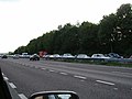
 Gridlock on the A12, Mountnessing - geograph.org.uk - 2947048.jpg 1,600 × 1,200; 409 KB
-
 Hall Lane, Ingatestone and Fryerning - geograph.org.uk - 5330963.jpg 640 × 480; 140 KB
-
 Hall Lane, Mountnessing - geograph.org.uk - 5332146.jpg 640 × 480; 122 KB
-
 Hall Lane, Mountnessing - geograph.org.uk - 5332186.jpg 640 × 480; 81 KB
-
 Harvest Time , Mountnessing , Essex , August 2013 - panoramio.jpg 3,982 × 1,735; 1.75 MB
-
 Ingatestone Hall, The Grass Walk - geograph.org.uk - 4578021.jpg 3,678 × 2,455; 6.85 MB
-
 Ivy from Hall Lane - geograph.org.uk - 5332111.jpg 640 × 480; 138 KB
-
 Joining the A12 from junction 12 - geograph.org.uk - 3486975.jpg 1,024 × 648; 159 KB
-

-
 Just crossed - geograph.org.uk - 4518559.jpg 3,072 × 1,728; 1.5 MB
-
 Just Past a Man Trap^ - geograph.org.uk - 3087986.jpg 429 × 640; 85 KB
-
 Lake Near Chelmwood Farm - geograph.org.uk - 3087961.jpg 640 × 429; 92 KB
-
 Lake Near Mountnessing - geograph.org.uk - 3087965.jpg 640 × 429; 83 KB
-
 Laundry Lane - geograph.org.uk - 3082888.jpg 429 × 640; 85 KB
-
 Laurel at stream - geograph.org.uk - 5330957.jpg 640 × 480; 143 KB
-
 Lay-by where the A12 by-passes Mountnessing - geograph.org.uk - 4048662.jpg 1,536 × 1,152; 801 KB
-
 Log, Mountnessing - geograph.org.uk - 5332153.jpg 640 × 480; 95 KB
-
 Looking to a Water Tower over Tilled Land, Mountnessing - geograph.org.uk - 6129332.jpg 3,648 × 2,255; 2.38 MB
-
 Lower Road and the B1002 Roman Road Roundabout - geograph.org.uk - 1842164.jpg 3,072 × 2,304; 1.27 MB
-
 Lower Road and the River Wid Bridge - geograph.org.uk - 1842162.jpg 3,072 × 2,304; 1.41 MB
-
 Metal barrier, Hall Lane - geograph.org.uk - 5333004.jpg 640 × 480; 145 KB
-
 Metal Footbridge near Trueloves Lane - geograph.org.uk - 6430997.jpg 1,024 × 835; 357 KB
-
 Mill ^ Coronation Field - geograph.org.uk - 3082891.jpg 429 × 640; 57 KB
-
 Mountnessing Hall - geograph.org.uk - 1365406.jpg 640 × 427; 77 KB
-
 Mountnessing Hall - geograph.org.uk - 2442179.jpg 640 × 426; 97 KB
-
 Mountnessing Hall - geograph.org.uk - 4518421.jpg 2,592 × 1,936; 1.06 MB
-
 Mountnessing Hall - geograph.org.uk - 5397984.jpg 4,000 × 3,000; 4.66 MB
-
 Mountnessing Post Mill - geograph.org.uk - 6431014.jpg 1,024 × 768; 157 KB
-
 Mountnessing Post Mill Information Board - geograph.org.uk - 6431017.jpg 1,600 × 1,184; 366 KB
-
 Mountnessing Windmill - geograph.org.uk - 4293970.jpg 4,195 × 2,785; 7.01 MB
-
 Mountnessing Windmill - geograph.org.uk - 5237815.jpg 1,728 × 3,072; 894 KB
-
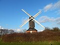 Mountnessing Windmill - geograph.org.uk - 5333487.jpg 640 × 480; 63 KB
-
 Mountnessing Windmill - geograph.org.uk - 5394222.jpg 4,000 × 3,000; 4.61 MB
-
 Mountnessing Windmill - geograph.org.uk - 5394223.jpg 4,000 × 3,000; 4.61 MB
-
 Mountnessing Windmill from Footpath 34 - geograph.org.uk - 6431008.jpg 1,024 × 619; 169 KB
-
 North Barn Near Woodlands Farm - geograph.org.uk - 4466182.jpg 640 × 424; 50 KB
-
 Old Church Lane, near Mountnessing - geograph.org.uk - 4514299.jpg 640 × 480; 81 KB
-
 Old Church Lane, near Mountnessing - geograph.org.uk - 4514302.jpg 640 × 480; 93 KB
-
 Old Church Road, near Mountnessing - geograph.org.uk - 4514288.jpg 640 × 480; 122 KB
-

-
 Old wind pump^ - geograph.org.uk - 2867142.jpg 640 × 480; 88 KB
-
 Padham's Green - geograph.org.uk - 4465252.jpg 640 × 424; 88 KB
-
 Padhams Green sign - geograph.org.uk - 5333051.jpg 640 × 480; 117 KB
-
 Path, Mountnessing - geograph.org.uk - 5332211.jpg 640 × 480; 146 KB
-
 Plants on bank - geograph.org.uk - 5332092.jpg 640 × 480; 157 KB
-
 Pond near St Giles, Mountnessing - geograph.org.uk - 6143147.jpg 3,648 × 2,736; 5.14 MB
-
 Pond ^ Crack Willow - geograph.org.uk - 4465171.jpg 424 × 640; 128 KB
-
 Power Lines, Mountnessing - geograph.org.uk - 5332233.jpg 640 × 480; 99 KB
-
 Railway Bridge and Lower Road, Hutton - geograph.org.uk - 1842077.jpg 3,072 × 2,304; 1.36 MB
-
 Railway Bridge and Lower Road, Hutton - geograph.org.uk - 1842087.jpg 3,072 × 2,304; 1.48 MB
-
 River Wid - geograph.org.uk - 1842119.jpg 3,072 × 2,304; 1.56 MB
-
 River Wid - geograph.org.uk - 1842121.jpg 2,304 × 3,072; 1.67 MB
-
 River Wid - geograph.org.uk - 2796733.jpg 1,600 × 1,200; 397 KB
-
 River Wid - geograph.org.uk - 5393090.jpg 4,000 × 3,000; 4.75 MB
-
 River Wid near Elmbrook Farm - geograph.org.uk - 2481292.jpg 428 × 640; 105 KB
-
 River Wid near Ingatestone - geograph.org.uk - 4514419.jpg 640 × 480; 133 KB
-
 River Wid Pumping Station - geograph.org.uk - 1842092.jpg 3,072 × 2,304; 1.65 MB
-
 River Wid, Boundary between Mountnessing ^ Billericay - geograph.org.uk - 6143140.jpg 2,736 × 2,736; 2.93 MB
-
 Road to sewage works - geograph.org.uk - 4518410.jpg 3,072 × 1,728; 2.06 MB
-

-
 Rubble in ground, Thoby Lane - geograph.org.uk - 5333525.jpg 640 × 480; 152 KB
-
 Rubble, Thoby Lane - geograph.org.uk - 5333532.jpg 640 × 480; 137 KB
-
 Rural road near Billericay - geograph.org.uk - 4514340.jpg 640 × 480; 99 KB
-
 Sanctuary Gate - geograph.org.uk - 2481280.jpg 640 × 428; 74 KB
-
 Shenfield Sub-station - geograph.org.uk - 2948819.jpg 640 × 480; 201 KB
-
 Signs of a steeplejack - geograph.org.uk - 2867220.jpg 640 × 480; 93 KB
-
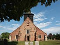
 St Giles Church, Mountnessing - geograph.org.uk - 2444457.jpg 1,000 × 679; 163 KB
-
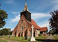
 St Giles Church, Mountnessing - geograph.org.uk - 2444460.jpg 1,000 × 609; 146 KB
-
 St Giles Church, Mountnessing - geograph.org.uk - 2444474.jpg 1,000 × 678; 145 KB
-
 St Giles Church, Mountnessing - geograph.org.uk - 2444478.jpg 1,000 × 762; 179 KB
-
 St Giles Church, Mountnessing - geograph.org.uk - 5394230.jpg 4,000 × 3,000; 5.01 MB
-
 St Giles Mountnessing - geograph.org.uk - 4465208.jpg 640 × 424; 90 KB
-
 St Giles Parish Church, Mountnessing - geograph.org.uk - 4293998.jpg 1,024 × 709; 688 KB
-
 St Giles Parish Church, Mountnessing - geograph.org.uk - 4294003.jpg 1,024 × 903; 729 KB
-
 St Giles, Mountnessing - Capital - geograph.org.uk - 3152034.jpg 1,000 × 666; 130 KB
-
 St Giles, Mountnessing - Chancel - geograph.org.uk - 3152051.jpg 1,000 × 666; 150 KB
-
 St Giles, Mountnessing - Chest - geograph.org.uk - 3152025.jpg 1,000 × 652; 133 KB
-
 St Giles, Mountnessing - East end - geograph.org.uk - 3152052.jpg 1,000 × 667; 148 KB
-
 St Giles, Mountnessing - Font - geograph.org.uk - 3152020.jpg 490 × 1,000; 110 KB
-
 St Giles, Mountnessing - Font - geograph.org.uk - 3152024.jpg 499 × 1,000; 76 KB
-
 St Giles, Mountnessing - geograph.org.uk - 3152009.jpg 1,000 × 724; 183 KB
-
 St Giles, Mountnessing - Ledger slab - geograph.org.uk - 3152046.jpg 826 × 1,000; 185 KB
-
 St Giles, Mountnessing - Organ - geograph.org.uk - 3152019.jpg 602 × 1,000; 143 KB
-
 St Giles, Mountnessing - Painting - geograph.org.uk - 3152017.jpg 646 × 1,000; 142 KB
-
 St Giles, Mountnessing - Pulpit - geograph.org.uk - 3152047.jpg 667 × 1,000; 127 KB
-
 St Giles, Mountnessing - Stained glass window - geograph.org.uk - 3152016.jpg 671 × 1,000; 274 KB
-
 St Giles, Mountnessing - Surplice fees - geograph.org.uk - 3152049.jpg 806 × 1,000; 203 KB
-
 St Giles, Mountnessing - Tower timbers - geograph.org.uk - 3152039.jpg 1,000 × 667; 146 KB
-
 St Giles, Mountnessing - Tower timbers - geograph.org.uk - 3152040.jpg 667 × 1,000; 119 KB
-
 St Giles, Mountnessing - Tower timbers - geograph.org.uk - 3152042.jpg 666 × 1,000; 148 KB
-
 St Giles, Mountnessing - Tower timbers - geograph.org.uk - 3152044.jpg 667 × 1,000; 161 KB
-
 St Giles, Mountnessing - Wall monument - geograph.org.uk - 3152010.jpg 685 × 1,000; 150 KB
-
 St Giles, Mountnessing - Wall monument - geograph.org.uk - 3152012.jpg 744 × 1,000; 154 KB


