Category:Mountcharles
Jump to navigation
Jump to search
village in Ulster, Ireland  | |||||
| Upload media | |||||
| Instance of | |||||
|---|---|---|---|---|---|
| Location | County Donegal, Ulster, Ireland | ||||
 | |||||
English: Mountcharles, known before the Plantation of Ulster as Tawnaghtallan , is a village in County Donegal, Ireland. It lies 6 km from Donegal town on the Killybegs road.
Media in category "Mountcharles"
The following 58 files are in this category, out of 58 total.
-
 Approach to Mountcharles - geograph.org.uk - 861721.jpg 640 × 480; 68 KB
-

-

-
 Butcher's shop, Mountcharles - geograph.org.uk - 3537522.jpg 640 × 480; 48 KB
-

-
 Coast road near Mountcharles - geograph.org.uk - 1202525.jpg 640 × 360; 49 KB
-
 Evening sky at Mountcharles coast - geograph.org.uk - 2474730.jpg 4,320 × 3,240; 3.62 MB
-
 Former Market House, Mountcharles (geograph 3537455).jpg 640 × 480; 52 KB
-
 Gable onto Bay - geograph.org.uk - 861723.jpg 640 × 480; 83 KB
-

-
 Gate House, Mountcharles - geograph.org.uk - 2474265.jpg 4,320 × 3,240; 5.5 MB
-
 Gillespie Bros, Mountcharles - geograph.org.uk - 3537517.jpg 640 × 480; 45 KB
-
 H Carr, Mountcharles - geograph.org.uk - 3537519.jpg 640 × 480; 51 KB
-
 Hailstones, St Peter's Lough road - geograph.org.uk - 1124540.jpg 360 × 640; 106 KB
-
-
 Inscribed plinth, Mountcharles - geograph.org.uk - 3537337.jpg 640 × 480; 80 KB
-
 Jimmy's House, Mountcharles - geograph.org.uk - 3537481.jpg 640 × 480; 42 KB
-

-
 Londis, Mountcharles - geograph.org.uk - 3537444.jpg 640 × 480; 56 KB
-
-
 Lower Main Street, Mountcharles - geograph.org.uk - 3537423.jpg 640 × 480; 44 KB
-
 Lower Main Street, Mountcharles - geograph.org.uk - 3537478.jpg 640 × 480; 44 KB
-
 Mainstreet Moin Searlas-Mountcharles - geograph.org.uk - 824039.jpg 640 × 480; 48 KB
-
 Mid Peninsula - geograph.org.uk - 861699.jpg 640 × 480; 78 KB
-

-
 Mountcharles Lower Main Street - geograph.org.uk - 2810742.jpg 1,600 × 1,200; 365 KB
-
-
 NoW.DOC, Mountcharles - geograph.org.uk - 3537341.jpg 640 × 480; 54 KB
-
 Old House, Mountcharles - geograph.org.uk - 3537502.jpg 640 × 480; 42 KB
-
 Old Temperance Hotel, Mountcharles - geograph.org.uk - 3537511.jpg 640 × 480; 53 KB
-

-
 Old village pump, Mountcharles, Co. Donegal - geograph.org.uk - 4754199.jpg 681 × 1,024; 150 KB
-
 Paddy Kelly's cottage, Teamhach an tSalainn-Montecharles - geograph.org.uk - 1894097.jpg 1,920 × 1,080; 906 KB
-
 Road leaving Teamhach an tSalainn - geograph.org.uk - 1894099.jpg 1,920 × 1,080; 883 KB
-
 Road to Inver, Mountcharles - geograph.org.uk - 3537437.jpg 640 × 480; 58 KB
-

-
 Small shop, Mountcharles - geograph.org.uk - 3537488.jpg 640 × 480; 49 KB
-
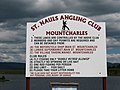 St Nauls Angling Club notice, St Peter's Lough - geograph.org.uk - 4077558.jpg 2,592 × 1,944; 1.1 MB
-
 St Peter's Lough, Mountcharles - geograph.org.uk - 4077544.jpg 2,592 × 1,944; 1.36 MB
-
 St Peter's Lough, Mountcharles - geograph.org.uk - 974668.jpg 427 × 640; 99 KB
-
 St. Peter's Lough, Mount Charles - geograph.org.uk - 3217472.jpg 1,024 × 612; 75 KB
-
 Storm damaged trees at Mountcharles - geograph.org.uk - 2474710.jpg 4,320 × 3,240; 5.48 MB
-

-
 The Lazy Bush Inn, Mountcharles - geograph.org.uk - 3537352.jpg 640 × 480; 54 KB
-

-

-
 The N56 skirting the village of Mount Charles - geograph.org.uk - 3217484.jpg 1,024 × 616; 114 KB
-
 The Village Tavern, Mountcharles - geograph.org.uk - 3537498.jpg 640 × 480; 61 KB
-

-
 Town house, Mountcharles - geograph.org.uk - 3537495.jpg 640 × 480; 49 KB
-
 Upper Main Street, Mountcharles - geograph.org.uk - 3537332.jpg 640 × 480; 49 KB
-
 Upper Main Street, Mountcharles - geograph.org.uk - 3537413.jpg 640 × 480; 51 KB
-
 Valley with iris near Mountcharles - geograph.org.uk - 2474252.jpg 4,320 × 3,240; 5.87 MB
-

-
 Drumkeelan Landscape - geograph.org.uk - 1438310.jpg 640 × 360; 50 KB
-
 Is it art^ - geograph.org.uk - 641166.jpg 640 × 591; 131 KB
-
 Island, Donegal Bay - geograph.org.uk - 641007.jpg 640 × 480; 50 KB
-


.jpg)


