Category:Mountains with snow in Uttarakhand
Jump to navigation
Jump to search
Media in category "Mountains with snow in Uttarakhand"
The following 200 files are in this category, out of 346 total.
(previous page) (next page)-
 "Didihat Town and Panchachuli peaks in the background.jpg".jpg 2,048 × 1,536; 585 KB
-
 (A) view of Himalayan foothills, Uttarakhand India November 2013.jpg 3,266 × 2,258; 2.9 MB
-
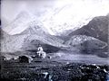
 1882 Photograph of Kedarnath.jpg 635 × 477; 190 KB
-
 A helicopter taking pilgrims to kedarnath.jpg 4,608 × 2,592; 3.56 MB
-
 A view of Neelkanth mountain.jpg 2,448 × 3,264; 2.37 MB
-
 Another valley, this one is better.jpg 4,096 × 2,304; 3.42 MB
-
 Auli mountains.jpg 5,184 × 3,456; 2.02 MB
-
 Badrinath hills.jpg 4,160 × 3,120; 4.34 MB
-
 Badrinath landscape.JPG 3,456 × 2,304; 2.58 MB
-
 Badrinath mountains.jpg 5,184 × 3,456; 6.57 MB
-
 Badrinath Sight.jpg 3,264 × 1,836; 2.78 MB
-
 Badrinath, Uttarakhand 246422, India - panoramio (2).jpg 1,600 × 1,067; 322 KB
-
 Badrinath1.jpg 4,320 × 2,432; 2.99 MB
-
 Bageshwar Town.jpg 6,000 × 4,000; 5.14 MB
-
 Bageshwar, Uttarakhand, India - panoramio.jpg 1,600 × 761; 334 KB
-
 Barkot With Bandarpunch.jpg 1,600 × 1,200; 412 KB
-
 Basecamp Kedarnath Uttarakhand.jpg 1,920 × 1,080; 262 KB
-
 Beautiful Himalyan ranges , badrinath india.jpg 4,032 × 3,024; 1.87 MB
-
 Beautiful Kedarnath2.jpg 992 × 744; 100 KB
-
 Beautiful secne of Montains near Badrinath.jpg 744 × 992; 29 KB
-
 Bethartoli peak from Thaing villgae.jpg 4,608 × 2,592; 3.74 MB
-
 Bhadrinath Temple and Nar Narayan.JPG 2,816 × 2,112; 1.04 MB
-
 Bhagat Kharak, Garhwal, India, 1934.jpg 520 × 327; 32 KB
-
 Bhagirathi River at Gangotri WTK20150915-IMG 2703.jpg 4,608 × 3,456; 2.04 MB
-
 Bhagirathi River at Gangotri.JPG 2,304 × 1,728; 1.93 MB
-
 Bharmatal trek camp site.jpg 2,112 × 2,112; 564 KB
-
 Binsar, a view of Kumaon Himalayas.jpg 1,024 × 702; 317 KB
-
 Blkn.JPG 1,600 × 1,143; 276 KB
-
 Borassu pass.jpg 4,288 × 2,848; 5.89 MB
-
 Brahmatal camp site.jpg 5,184 × 3,456; 4.06 MB
-
 Brahmatal.jpg 6,000 × 3,664; 4.86 MB
-
 Camels Back Mountain View (5281792060).jpg 4,000 × 3,000; 2.19 MB
-
 Chandrashila peak Uttarakhand.jpg 1,920 × 1,080; 255 KB
-
 Charming Himalyan ranges , badrinath india.jpg 4,032 × 3,024; 1.3 MB
-
 Chaukhambha (3641812744).jpg 3,872 × 2,592; 4.84 MB
-
 Chaukori.jpg 4,407 × 800; 796 KB
-
 Chm.JPG 1,600 × 1,143; 307 KB
-
 Click Direct from The Badrinath Temple.jpg 4,608 × 3,456; 2.42 MB
-
 Click Directly from The Badrinath Temple.jpg 4,608 × 3,456; 2.52 MB
-
 Closeup view of Kalanag,Dhumdhar kandi pass 1991 - panoramio.jpg 1,002 × 1,483; 1.57 MB
-
 Der Szurdse Kund aus Süden mit der Moräne des Milam-Gletschers.jpg 2,443 × 1,756; 1.57 MB
-
 Devi Kund, Uttarakhand.jpg 6,000 × 4,000; 12.69 MB
-
 Dhara vilage.jpg 4,608 × 3,456; 5.1 MB
-
 Distant Snows (5283894775).jpg 3,213 × 2,224; 1,018 KB
-
 Distant Snows (5284491590).jpg 3,648 × 2,529; 1.53 MB
-
 Dkd 2.jpg 4,032 × 3,024; 1.92 MB
-
 Dkd peak.jpg 4,032 × 3,024; 4.04 MB
-
 DraupadiKaDanda-HimalayanPeak-Garhwal,India.jpg 1,148 × 788; 134 KB
-
 F-2, Uttarakhand, India - panoramio.jpg 4,000 × 3,000; 476 KB
-
 FILE615.jpg 4,320 × 2,432; 2.72 MB
-
 Fire and Ice - panoramio.jpg 3,648 × 2,736; 2.38 MB
-
 Fully covered snow hill view just behind kedarnath 06.jpg 780 × 1,040; 78 KB
-
 Fully covered snow hill view just behind kedarnath 07.jpg 2,160 × 2,160; 1.5 MB
-
 Gangotri (ganga river).jpg 6,000 × 4,000; 5.01 MB
-
 Gangotri - Debabrata Ghosh, Birati.jpg 1,152 × 814; 340 KB
-
 Gangotri 15.JPG 2,048 × 1,536; 1.22 MB
-
 Gangotri 16.JPG 2,048 × 1,536; 937 KB
-
 Gangotri 17.JPG 2,048 × 1,536; 889 KB
-
 Gangotri 18.JPG 2,048 × 1,536; 852 KB
-
 Gangotri 19.JPG 2,048 × 1,536; 1.3 MB
-
 Gangotri 20.JPG 2,048 × 1,536; 988 KB
-
 Gangotri at night - Debabrata Ghosh, Birati.jpg 1,357 × 972; 201 KB
-
 Gangotri beauty.jpg 780 × 1,040; 127 KB
-
 Gangotri group of mountains.jpg 4,608 × 1,797; 3.35 MB
-
 Gangotri in evening - Debabrata Ghosh, Birati.jpg 1,350 × 807; 331 KB
-
 GANGOTRI MORNING- photography by Debabrata Ghosh, Birati.jpg 800 × 600; 124 KB
-
 Gangotri, Ganga riverbed.jpg 918 × 1,632; 421 KB
-
 Gangotri.JPG 2,048 × 1,536; 1.42 MB
-
 GangotriGroup.jpg 2,451 × 710; 230 KB
-
 Garhwal Himalaya views from Rudrpryag to Ukhimath during a road journey in winter 02.jpg 3,644 × 2,051; 1.19 MB
-
 Garhwal Himalaya views from Rudrpryag to Ukhimath during a road journey in winter 03.jpg 2,823 × 1,833; 1.69 MB
-
 Garhwal Himalaya views from Rudrpryag to Ukhimath during a road journey in winter 04.jpg 3,633 × 2,161; 2.05 MB
-
 Garhwal Himalaya views from Rudrpryag to Ukhimath during a road journey in winter 05.jpg 3,648 × 2,736; 2.6 MB
-
 Garhwal Himalaya views from Rudrpryag to Ukhimath during a road journey in winter 06.jpg 3,020 × 2,036; 1.29 MB
-
 Garhwal Himalaya views from Rudrpryag to Ukhimath during a road journey in winter 07.jpg 2,684 × 1,698; 1.39 MB
-
 Garhwal Himalaya views from Rudrpryag to Ukhimath during a road journey in winter 08.jpg 3,412 × 2,189; 1.53 MB
-
 Garhwal Himalaya views from Rudrpryag to Ukhimath during a road journey in winter 09.jpg 3,476 × 2,033; 1.28 MB
-
 Garhwal Himalaya views from Rudrpryag to Ukhimath during a road journey in winter 10.jpg 3,002 × 1,989; 1.18 MB
-
 Garhwal Himalaya views from Rudrpryag to Ukhimath during a road journey in winter 11.jpg 2,995 × 1,495; 694 KB
-
 Garhwal Himalaya views from Rudrpryag to Ukhimath during a road journey in winter 12.jpg 3,001 × 1,992; 1.36 MB
-
 Garhwal Himalaya views from Rudrpryag to Ukhimath during a road journey in winter 13.jpg 2,717 × 1,747; 1,000 KB
-
 Garhwal Himalaya views from Rudrpryag to Ukhimath during a road journey in winter 14.jpg 2,965 × 1,668; 949 KB
-
 Garhwal Himalaya views from Rudrpryag to Ukhimath during a road journey in winter 15.jpg 3,230 × 1,885; 1.02 MB
-
 Garhwal Himalaya views from Rudrpryag to Ukhimath during a road journey in winter 16.jpg 3,390 × 1,890; 1.11 MB
-
 Garhwal Himalayan Ranges (5283898625).jpg 2,884 × 2,006; 842 KB
-
 Garhwal Himalayas cloud and snow.jpg 4,000 × 3,000; 2.57 MB
-
 Garhwal Himalayas covered in snow.jpg 4,000 × 3,000; 2.15 MB
-
 Garhwal Himalayas only snow.jpg 4,000 × 3,000; 2.08 MB
-
 Garhwal Himalayas sharp mountain peek.jpg 4,000 × 3,000; 1.91 MB
-
 Garhwal Himalayas sharp peek.jpg 4,000 × 3,000; 2.07 MB
-
 Garhwal Himalayas snow covered.jpg 4,000 × 3,000; 2.11 MB
-
 Garhwal Himalayas snow layer.jpg 4,000 × 3,000; 2.7 MB
-
 Garhwal Himalayas snow.jpg 4,000 × 3,000; 2.47 MB
-
 Garhwal Himalayas view.jpg 4,000 × 3,000; 2.14 MB
-
 Garhwal Himalayas.jpg 4,000 × 3,000; 2.39 MB
-
 Garhwal Range 01.jpg 3,968 × 2,976; 2.61 MB
-
 Garhwal Range 04.jpg 3,968 × 2,976; 2.55 MB
-
 Garhwal Range 08.jpg 3,968 × 2,976; 2.67 MB
-
 Garhwal Range.jpg 3,968 × 2,976; 2.56 MB
-
 Garrhwal Himal (5281184955).jpg 4,000 × 3,000; 2.15 MB
-
 Garrhwal Himal (5281186145).jpg 3,612 × 2,500; 1.59 MB
-
 Gau mukh (47).JPG 2,048 × 1,536; 1.02 MB
-
 Gg 18.JPG 2,048 × 1,536; 803 KB
-
 Gg 19.JPG 2,048 × 1,536; 877 KB
-
 Gg 23.JPG 2,048 × 1,536; 955 KB
-
 Gg 24.JPG 2,048 × 1,536; 993 KB
-
 Gg 25.JPG 2,048 × 1,536; 750 KB
-
 Gg 26.JPG 2,048 × 1,536; 758 KB
-
 Gg 38.JPG 2,048 × 1,536; 663 KB
-
 Gg 39.JPG 2,048 × 1,536; 720 KB
-
 Gg 40.JPG 2,048 × 1,536; 727 KB
-
 Gg 41.JPG 2,048 × 1,536; 788 KB
-
 Gg 42.JPG 2,048 × 1,536; 731 KB
-
 Gg 43.JPG 2,048 × 1,536; 748 KB
-
 Glacial melt water carving the ice, river source Himalayas India.jpg 6,000 × 4,000; 2.94 MB
-
 Glacier reminents.jpg 3,072 × 1,728; 1.23 MB
-
 Glimses of Himalayas.jpg 2,560 × 1,920; 2.22 MB
-
 Haathi parvat.jpg 2,285 × 1,714; 2.39 MB
-
 Har Ki Dun 1.jpg 3,456 × 5,184; 6.2 MB
-
 Har Ki Dun 2.jpg 3,456 × 5,184; 6.41 MB
-
 Har Ki Dun 3.jpg 5,184 × 3,456; 5.55 MB
-
 Har Ki Dun 4.jpg 5,184 × 3,456; 4.59 MB
-
 Har Ki Dun 5.jpg 5,184 × 3,456; 4.56 MB
-
 Har Ki Dun 6.jpg 5,184 × 3,456; 4.44 MB
-
 Harshit 2 image.jpg 4,032 × 3,024; 1.15 MB
-
 Harshit's 4 image.jpg 4,032 × 3,024; 2.92 MB
-
 Hiking in Uttarakhand India November 2013.jpg 4,000 × 2,672; 3.64 MB
-
 Himalaya mountain range with peaks covered in snow during summers.jpg 4,608 × 2,592; 1.8 MB
-
 Himalaya mountain range with peaks covered in snow.jpg 4,608 × 2,592; 1.94 MB
-
 Himalaya Panorama Alok Prasad.jpg 9,704 × 904; 1.22 MB
-
 Himalaya view from Barkot city.jpg 1,600 × 1,200; 1.36 MB
-
 Himalayan peak Kedarnath ,Chaukhamaba and others from Deoria Tal.jpg 1,800 × 578; 132 KB
-
 Himalayan View (5275300549).jpg 3,565 × 2,464; 1.34 MB
-
 Himalayan View (5275302861).jpg 3,694 × 2,565; 1.4 MB
-
 Himalayan View (5275303457).jpg 3,448 × 2,394; 1.29 MB
-
 Himalayan View (5275878272).jpg 4,000 × 3,000; 1.88 MB
-
 Himalayan View (5275880902).jpg 4,000 × 3,000; 1.46 MB
-
 Himalayan view from Chandrashila.JPG 4,000 × 3,000; 5.53 MB
-
 Himalayan view from Kosani.jpg 4,160 × 3,120; 1.9 MB
-
 Himalayan View from Landour (5275877276).jpg 3,540 × 2,450; 1.42 MB
-
 Himalayan View.jpg 1,622 × 1,080; 233 KB
-
 Himalayas at dusk from Mussoorie, Uttarakhand.jpg 2,688 × 1,028; 577 KB
-
 Himalayas from Kedarkantha Summit.jpg 4,160 × 2,340; 3.5 MB
-
 Himalayas in Auli.jpg 2,592 × 1,944; 1.31 MB
-
 Himalayas in the morning light.jpg 1,500 × 465; 167 KB
-
 Himalayas near Auli.jpg 3,456 × 2,304; 1.65 MB
-
 Himalayas near Ukhimath, Rudraprayag.jpg 3,264 × 2,448; 1.75 MB
-
 HimalayaSnow@Badrinath.jpg 4,496 × 3,000; 7.25 MB
-
 Himalyan ranges , badrinath india.jpg 4,032 × 3,024; 1.99 MB
-
 Jogin I.jpg 2,844 × 1,932; 4.44 MB
-
 Joshimath peak(behind the scenes of Anjaan ek dastak).jpg 1,920 × 1,440; 2.19 MB
-
 Joshimath Snow.jpg 1,080 × 735; 161 KB
-
 Joshimath.jpg 3,264 × 2,448; 1.72 MB
-
 Joshimath2356.jpg 3,264 × 2,448; 1.16 MB
-
 Juda Ka Tabal.jpg 5,523 × 3,682; 5.63 MB
-
 Kala Parvat.jpg 3,264 × 1,836; 2.55 MB
-

-

-
 Kamet peak, Uttarakhand.jpg 4,000 × 3,000; 4.26 MB
-
 Kedar from Tungnath vvnataraj.jpg 3,008 × 2,000; 2.27 MB
-
 Kedar nath hills in snow and clouds.jpg 1,280 × 590; 68 KB
-
 Kedar peak.jpg 4,000 × 3,000; 3.38 MB
-
 Kedar Valley.jpg 4,208 × 2,368; 2.54 MB
-
 Kedarnath (2 of 1).jpg 4,000 × 4,000; 11.16 MB
-
 Kedarnath 002.jpg 3,264 × 1,836; 1.49 MB
-
 Kedarnath 003.jpg 3,264 × 1,836; 2.16 MB
-
 Kedarnath 004.jpg 1,836 × 3,264; 1.77 MB
-
 Kedarnath 005.jpg 3,264 × 1,836; 1.85 MB
-
 Kedarnath 010.jpg 1,836 × 3,264; 1.99 MB
-
 Kedarnath and Kedar Dome, Uttarakhand India November 2013.jpg 3,859 × 2,672; 3.48 MB
-
 Kedarnath basecamp.jpg 4,032 × 3,024; 2.6 MB
-
 Kedarnath Camp.jpg 960 × 1,280; 122 KB
-
 Kedarnath from Chopta (43705153930).jpg 2,048 × 1,441; 765 KB
-
 Kedarnath from Chopta (43705179960).jpg 2,048 × 644; 289 KB
-
 Kedarnath from Duggalbitta (43704655270).jpg 2,048 × 1,284; 989 KB
-
 Kedarnath Himalaya.jpg 2,176 × 4,608; 1.79 MB
-
 Kedarnath in 1860.jpg 600 × 450; 60 KB
-
 Kedarnath morning Sunrise.jpg 4,496 × 3,000; 7.39 MB
-
 Kedarnath peaks and temple.jpg 540 × 405; 62 KB
-
 Kedarnath shrine.jpg 3,264 × 2,448; 2.54 MB
-
 Kedarnath Temple and himalayas.jpg 4,608 × 3,456; 4.7 MB
-
 Kedarnath Temple in 2014.jpg 3,264 × 2,448; 3.38 MB
-
 Kedarnath temple in uttarakhand.jpg 4,000 × 1,800; 1.95 MB
-
 Kedarnath Temple with Snow Covered Mountains in Background.jpg 1,008 × 673; 328 KB
-
 Kedarnath Temple3.jpg 748 × 1,125; 126 KB
-
 Kedarnath view .jpg 4,096 × 2,304; 1.49 MB
-
 Kedarnath walkover.jpg 4,608 × 2,592; 2.77 MB
-
 Kedarnath, Bharte khunta and Thalay Sagar at dusk from Kartik Swamy.jpg 4,959 × 2,304; 1.43 MB
-
 Kedarnath.jpg 3,888 × 2,592; 3.84 MB
-
 Kedarnathhills.jpg 2,250 × 4,000; 2.32 MB
-
 Kedarnathji-mandir.JPG 2,304 × 1,728; 1.92 MB
-
 KedarRange.jpg 3,872 × 2,592; 7.55 MB
-
 Kuanri Pass, Uttarakhand, 4300m.jpg 6,000 × 4,000; 13.21 MB
-
 KUCHELA DHURA.JPG 1,529 × 1,211; 836 KB
-
 Lake of Kedarnath.jpg 2,992 × 2,000; 582 KB
-
 Lansdownesnow2.JPG 3,456 × 4,608; 5.56 MB
-
 Lincholi area Uttarakhand.jpg 1,920 × 1,080; 227 KB
-
 Lohaghat, Uttarakhand, India Himalayan Range November 2013.jpg 12,621 × 3,894; 20.23 MB
-
 Maiktoli Mrigthuni Devtoli.jpg 5,184 × 3,456; 4.07 MB
-
 Maiktoli.jpg 4,736 × 3,088; 9.99 MB

_view_of_Himalayan_foothills,_Uttarakhand_India_November_2013.jpg)


.jpg)


.jpg)


.jpg)


.jpg)
.jpg)


.jpg)


.jpg)


.jpg)
.jpg)
.JPG)


.jpg)
.jpg)
.jpg)
.jpg)
.jpg)


.jpg)


,_Uttarkashi_district,_Garhwal_division,_Uttarakhand,_India_a5-IMG_0514.jpg)
,_Uttarkashi_district,_Garhwal_division,_Uttarakhand,_India_a5-IMG_0515.jpg)


.jpg)


.jpg)
.jpg)


.jpg)
.jpg)