Category:Mountain passes of England
Jump to navigation
Jump to search
Wikimedia category | |||||
| Upload media | |||||
| Instance of | |||||
|---|---|---|---|---|---|
| Category combines topics | |||||
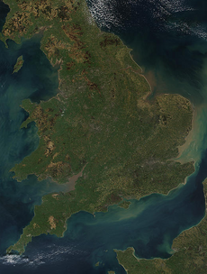
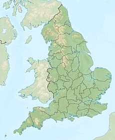
| England | |||||
country in north-west Europe, part of the United Kingdom | |||||
| Spoken text audio | |||||
| Pronunciation audio | |||||
| Instance of | |||||
| Name in native language |
| ||||
| Named after | |||||
| Patron saint | |||||
| Location |
| ||||
| Capital | |||||
| Basic form of government |
| ||||
| Official language | |||||
| Anthem |
| ||||
| Currency | |||||
| Head of state |
| ||||
| Head of government |
| ||||
| Highest point | |||||
| Population |
| ||||
| Area |
| ||||
| Replaces |
| ||||
| Different from | |||||
| official website | |||||
 | |||||
Subcategories
This category has the following 10 subcategories, out of 10 total.
B
C
- Carter Bar (40 F)
F
- Fleet Moss (18 F)
K
- Killhope Cross (4 F)
L
- Limers Gate (2 F)
N
S
T
- Trough of Bowland (9 F)
W
- Winnats Pass (1 P, 125 F)
Media in category "Mountain passes of England"
The following 51 files are in this category, out of 51 total.
-
Col Between Cringle and Cold Moors - geograph.org.uk - 377341.jpg 640 × 384; 60 KB
-
Col, Mungrisdale Common - geograph.org.uk - 98895.jpg 640 × 480; 63 KB
-
Crossing the col - geograph.org.uk - 770548.jpg 640 × 480; 99 KB
-
Ewes Doors - geograph.org.uk - 400441.jpg 640 × 480; 118 KB
-
Girl looking out to view over mountain with sunlight breaking through cloudy sky.jpg 4,032 × 3,024; 1.11 MB
-
Pendle Ski Club - geograph.org.uk - 59181.jpg 640 × 427; 126 KB
-
Souther Scales Fell - geograph.org.uk - 168504.jpg 640 × 476; 108 KB
-
Walking in Crummack Dale - geograph.org.uk - 9311.jpg 640 × 480; 141 KB
-
Wide bridleway south of Heughscar Hill (geograph 4282781).jpg 2,048 × 1,536; 1.24 MB
-
Ascending Gatesgarth Pass - geograph.org.uk - 677407.jpg 640 × 480; 75 KB
-
Barrow Door - geograph.org.uk - 501467.jpg 640 × 480; 98 KB
-
Beck Head - geograph.org.uk - 765729.jpg 640 × 480; 113 KB
-
Behind Dufton Pike - geograph.org.uk - 30871.jpg 440 × 296; 35 KB
-
Boredale Hause - geograph.org.uk - 7752.jpg 640 × 480; 98 KB
-
Burtree Fell - geograph.org.uk - 208049.jpg 640 × 480; 68 KB
-
Col between Caw Fell and Iron Crag - geograph.org.uk - 144991.jpg 640 × 480; 54 KB
-
Col Between Latrigg and Skiddaw - geograph.org.uk - 645624.jpg 640 × 480; 79 KB
-
Descent from Esk Hause. - geograph.org.uk - 64582.jpg 640 × 413; 76 KB
-
Dore Head - geograph.org.uk - 36926.jpg 640 × 480; 93 KB
-
From Lingmell Col - geograph.org.uk - 330208.jpg 640 × 355; 61 KB
-
Goats Hause - geograph.org.uk - 75029.jpg 640 × 480; 80 KB
-
Grisedale Hause - geograph.org.uk - 549504.jpg 640 × 480; 141 KB
-
Hartside pass, Alston - geograph.org.uk - 521561.jpg 640 × 480; 128 KB
-
Hordern Stoops - geograph.org.uk - 13158.jpg 640 × 420; 56 KB
-
Little Calva from Knott. - geograph.org.uk - 89706.jpg 458 × 291; 18 KB
-
Looking up to Peel Fell from the col - geograph.org.uk - 533712.jpg 640 × 480; 121 KB
-
Looking up to Scarth Gap Pass - geograph.org.uk - 272973.jpg 640 × 480; 82 KB
-
Mam Nick - geograph.org.uk - 188028.jpg 640 × 480; 122 KB
-
Mickleden - geograph.org.uk - 140913.jpg 640 × 351; 50 KB
-
Mickleden Beck - geograph.org.uk - 307380.jpg 640 × 430; 95 KB
-
Mickledore Col. - geograph.org.uk - 496273.jpg 640 × 426; 199 KB
-
Newlands Hause - geograph.org.uk - 497389.jpg 640 × 480; 71 KB
-
Nick Head - geograph.org.uk - 302356.jpg 640 × 480; 96 KB
-
Nick Head - geograph.org.uk - 302942.jpg 640 × 480; 120 KB
-
On Hunters Sleets - geograph.org.uk - 115791.jpg 640 × 480; 40 KB
-
Ore Gap - geograph.org.uk - 365112.jpg 640 × 480; 98 KB
-
Pass by Long Man - geograph.org.uk - 407394.jpg 640 × 480; 60 KB
-
Pass Peth, Upper Coquet Dale - geograph.org.uk - 335208.jpg 640 × 480; 82 KB
-
Steddale Mouth - geograph.org.uk - 568633.jpg 640 × 480; 92 KB
-
The Stang - geograph.org.uk - 129219.jpg 640 × 480; 96 KB
-
The Struggle - geograph.org.uk - 53706.jpg 640 × 480; 25 KB
-
The view up Newlands Pass from Keskadale - geograph.org.uk - 211829.jpg 640 × 480; 103 KB
-
Three Tarns - geograph.org.uk - 307389.jpg 424 × 640; 97 KB
-
Threshwaite Col - geograph.org.uk - 110410.jpg 360 × 480; 58 KB
-
Trusmadoor - geograph.org.uk - 654425.jpg 640 × 480; 52 KB
-
White Shaw Moss - geograph.org.uk - 130282.jpg 640 × 480; 66 KB
-
Widow Hause - geograph.org.uk - 91165.jpg 640 × 427; 77 KB
-
Windscarth Wyke - geograph.org.uk - 88608.jpg 640 × 425; 59 KB


