Category:Mountain passes in the Scottish Borders
Jump to navigation
Jump to search
Subcategories
This category has the following 4 subcategories, out of 4 total.
Media in category "Mountain passes in the Scottish Borders"
The following 22 files are in this category, out of 22 total.
-

-
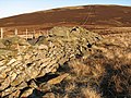 Dry stane dyke - geograph.org.uk - 638436.jpg 640 × 480; 117 KB
-
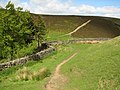
 Wylies Hill - Broad Law col - geograph.org.uk - 973882.jpg 640 × 480; 86 KB
-
 A68 leaving Lauderdale - geograph.org.uk - 1005788.jpg 640 × 480; 84 KB
-
 Cutting on Torphichen Hill. - geograph.org.uk - 12225.jpg 640 × 480; 101 KB
-
 Dewar Gill - geograph.org.uk - 322228.jpg 640 × 480; 53 KB
-
 Fanna Swire - geograph.org.uk - 521994.jpg 639 × 461; 124 KB
-
 Four Lords Lands - geograph.org.uk - 502550.jpg 640 × 480; 100 KB
-
 Hammer Head Pass - geograph.org.uk - 44820.jpg 640 × 480; 54 KB
-
 Heathery pass. - geograph.org.uk - 44823.jpg 640 × 480; 107 KB
-
 Looking up to Peel Fell from the col - geograph.org.uk - 533712.jpg 640 × 480; 121 KB
-
 Paddock Slack - geograph.org.uk - 325059.jpg 640 × 480; 80 KB
-
 Pass above Buckholm - geograph.org.uk - 6135.jpg 640 × 480; 48 KB
-
 Pass between Penvalla and Ladyurd Hill - geograph.org.uk - 44547.jpg 640 × 480; 61 KB
-
 Pass under Flint Hill - geograph.org.uk - 44667.jpg 640 × 480; 87 KB
-
 Pass under Flint Hill - geograph.org.uk - 44672.jpg 640 × 480; 103 KB
-
 Pastoral Farmland below Collie Law - geograph.org.uk - 392713.jpg 640 × 428; 58 KB
-
 Peat hags, Ramsey Knowe - geograph.org.uk - 584481.jpg 640 × 480; 80 KB
-
 Priesthope Sware - geograph.org.uk - 153848.jpg 480 × 640; 300 KB
-
 Rawburn Head - geograph.org.uk - 292948.jpg 640 × 480; 94 KB
-
 The col between Mid Hill and Corse Hill - geograph.org.uk - 657148.jpg 640 × 480; 124 KB
-
 The Garral - geograph.org.uk - 82629.jpg 640 × 480; 64 KB


