Category:Mount Shir (Yazd Province)
Jump to navigation
Jump to search
mountain in Taft County, Iran    | |||||
| Upload media | |||||
| Instance of | |||||
|---|---|---|---|---|---|
| Named after | |||||
| Location | Shirkuh Rural District, Central District, Taft County, Yazd Province, Iran | ||||
| Mountain range | |||||
| Topographic prominence |
| ||||
| Elevation above sea level |
| ||||
 | |||||
Media in category "Mount Shir (Yazd Province)"
The following 4 files are in this category, out of 4 total.
-
 ISS012-E-18778.jpg 1,520 × 1,008; 243 KB
-
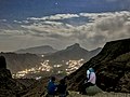
 Nights of Shir Kuh by Hadi Karimi.jpg 4,000 × 3,000; 2.73 MB
-
 Shir Kuh nights - panoramio.jpg 4,000 × 3,000; 2.98 MB
-
 Shokoh.jpg 763 × 573; 55 KB
