Category:Mount Pisgah (Oregon)
Jump to navigation
Jump to search
Mount Pisgah is a hill in Lane County, Oregon, United States, with a summit elevation of 1,531 feet (467 m) above sea level. It is located east of Eugene and south of Springfield, near the confluence of the Coast Fork Willamette River and the Middle Fork Willamette River.
 | |||||
| Upload media | |||||
| Instance of | |||||
|---|---|---|---|---|---|
| Location | Oregon | ||||
 | |||||
Media in category "Mount Pisgah (Oregon)"
The following 15 files are in this category, out of 15 total.
-
 Entoloma mushroom, Oregon.JPG 4,608 × 3,456; 3.41 MB
-
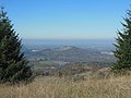
 Eugene and Springfield from Mount Pisgah.JPG 4,608 × 3,456; 3.54 MB
-
 FencePisgah.jpg 4,000 × 2,998; 4.3 MB
-
 Mount Pisgah at sunset.jpg 4,000 × 3,000; 2.92 MB
-
 Mount Pisgah in rain.JPG 4,608 × 3,456; 3.37 MB
-
 Mount Pisgah wetlands.JPG 1,936 × 2,592; 2.73 MB
-
 Mount Pisgah, view NW during inversion.JPG 4,426 × 3,319; 4.06 MB
-
 Mt Pisgah sign.jpg 1,200 × 900; 534 KB
-
 Mt Pisgah view.jpg 1,656 × 1,242; 307 KB
-
 Mt. Pisgah from butte.JPG 4,000 × 3,000; 3.37 MB
-
 Mt. Pisgah, fog below, view WSW.JPG 2,474 × 1,848; 1.61 MB
-
 Mt. Pisgah, OR, view southeast from summit.JPG 4,000 × 3,000; 2.52 MB
-
 Mt. Pisgah, view north to fog.JPG 2,592 × 1,564; 1.26 MB
-
 Teasels (Dipsacus) - Mount Pisgah (Oregon) - USA.jpg 3,737 × 2,135; 7.3 MB
-
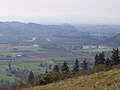
 Willamette Valley fog.JPG 4,000 × 3,000; 2.73 MB


_-_Mount_Pisgah_(Oregon)_-_USA.jpg)
