Category:Mount Oglethorpe
Jump to navigation
Jump to search
mountain in United States of America  | |||||
| Upload media | |||||
| Instance of | |||||
|---|---|---|---|---|---|
| Location | Pickens County, Georgia | ||||
| Mountain range | |||||
| Elevation above sea level |
| ||||
 | |||||
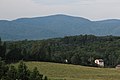
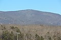
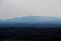
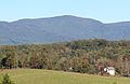
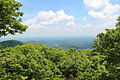
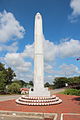
English: Mount Oglethorpe, the southernmost peak in the Blue Ridge Mountains, is located in Pickens County, Georgia and was the southern terminus of the Appalachian Trail from when the trail was completed in 1937 until 1958.
Media in category "Mount Oglethorpe"
The following 23 files are in this category, out of 23 total.
-
 Daffodil gardens in Gibbs Gardens, Feb 2017.jpg 3,456 × 2,304; 6.94 MB
-
 Mount Oglethorpe (22067905760).jpg 3,456 × 2,304; 4.05 MB
-
 Mount Oglethorpe (22149637375).jpg 3,456 × 2,304; 3.19 MB
-
 Mount Oglethorpe - panoramio (1).jpg 3,456 × 2,304; 3.44 MB
-
 Mount Oglethorpe - panoramio (2).jpg 3,456 × 2,304; 2.32 MB
-
 Mount Oglethorpe - panoramio (3).jpg 3,456 × 2,304; 2.17 MB
-
 Mount Oglethorpe - panoramio (4).jpg 3,456 × 2,304; 3.29 MB
-
 Mount Oglethorpe - panoramio.jpg 3,456 × 2,304; 3.18 MB
-
 Mount Oglethorpe communication towers.jpg 1,728 × 2,592; 2.32 MB
-
 Mount Oglethorpe covered in snow (24268287839).jpg 3,456 × 2,304; 3.72 MB
-
 Mount Oglethorpe from Sawnee Mountain color edit March 2017.jpg 3,456 × 2,304; 1.66 MB
-
 Mount Oglethorpe July 2015.jpg 2,878 × 1,691; 3.09 MB
-
 Mount Oglethorpe October 2015.jpg 2,670 × 1,726; 3.11 MB
-
 Mount Oglethorpe View - panoramio.jpg 2,592 × 1,728; 2.69 MB
-
 Mount Oglethorpe view - panoramio.jpg 3,456 × 2,304; 5.82 MB
-
 Mount Oglethorpe view.JPG 2,592 × 1,728; 2.76 MB
-
 Mount Oglethorpe viewed from Gibbs Gardens, Feb 2017.jpg 3,456 × 2,304; 4.31 MB
-
 Mount Oglethorpe viewed from Jasper.JPG 3,456 × 2,304; 3.73 MB
-
 Mount Oglethorpe, viewed from Sawnee Mountain - panoramio.jpg 3,456 × 2,304; 2.08 MB
-
 Mt Oglethorpe from Sawnee Mountain, June 2019.jpg 3,456 × 2,304; 2.57 MB
-
 Mt Oglethorpe viewed from Sawnee Mountain, March 2017.jpg 3,456 × 2,304; 2.01 MB
-
 Oglethorpe Monument, Jasper, Georgia.JPG 2,304 × 3,456; 3.15 MB
-
 View from Mount Oglethorpe in North Georgia (53507575108).png 3,840 × 2,160; 12.88 MB

.jpg)
.jpg)
.jpg)
.jpg)
.jpg)
.jpg)


.jpg)


.png)