Category:Mount Arafune
Jump to navigation
Jump to search
English: Category for Mount Arafune (Arafune-yama) on the border between Gunma and Nagano Prefectures, Japan
日本語: 群馬県と長野県の境界にある荒船山に関するカテゴリ
mountain in Shimonita, Gunma and Saku, Nagano prefecture, Japan  | |||||
| Upload media | |||||
| Instance of | |||||
|---|---|---|---|---|---|
| Part of |
| ||||
| Located in protected area | |||||
| Location |
| ||||
| Elevation above sea level |
| ||||
 | |||||
Subcategories
This category has only the following subcategory.
M
Media in category "Mount Arafune"
The following 14 files are in this category, out of 14 total.
-
 Mount Arafune Relief Map, SRTM-1.jpg 1,200 × 900; 634 KB
-
 Mt.Arafune.JPG 1,600 × 1,200; 478 KB
-
 信州街道から艫岩を見上げる.jpg 4,896 × 3,672; 5.88 MB
-
 内山牧場からの荒船山.jpg 5,472 × 3,648; 6.67 MB
-
 内山牧場からの荒船山2.jpg 5,472 × 3,648; 3.95 MB
-
 内山牧場からの荒船山3.jpg 5,472 × 3,648; 4.21 MB
-
 内山牧場からの荒船山4.jpg 5,472 × 3,648; 5.78 MB
-
 立岩から見た浅間山(中央奥)と荒船山(右手前).jpg 5,259 × 3,506; 2.7 MB
-
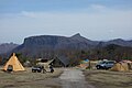
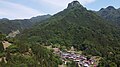 群馬県南牧村星尾 01.jpg 4,000 × 2,250; 3.84 MB
-
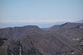 艫岩からの北アルプス.jpg 5,472 × 3,648; 5.07 MB
-
 艫岩からの浅間山.jpg 5,472 × 3,648; 6.23 MB
-
 艫岩からの浅間山2.jpg 5,472 × 3,648; 3.39 MB
-
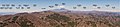 荒船山から浅間山方面(名前入り).jpg 7,521 × 1,705; 2.67 MB
-
 蓼科山からの荒船山.jpg 3,821 × 2,865; 1.87 MB


