Category:Mostyn
Jump to navigation
Jump to search
village in Wales | |||||
| Upload media | |||||
| Instance of | |||||
|---|---|---|---|---|---|
| Location | Flintshire, Wales | ||||
| Population |
| ||||
| Area |
| ||||
 | |||||
Cymraeg: Pentref yn Sir y Fflint, ar Lannau Dyfrdwy, ger Treffynnon, yw Mostyn. Bu'n borthladd fferri prysur yn y gorffennol fel rhan o'r gwasanaeth fferi Lerpwl - Dulyn, ond gorffennodd y gwasanaeth yn 2004. Heddiw mae'r esgyll anferth ar gyfer yr awyren A380 a gynhyrchir yn ffatri Airbus, Brychdyn (Broughton), yn cael eu cludo o Fostyn drosodd i Ffrainc ar fwrdd y long Ville De Bordeaux, ar ôl teithio yno ar fwrdd barges o'r ffatri hyd aber Afon Dyfrdwy.
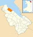
English: Mostyn is a village in Flintshire, North Wales, lying on the estuary of the River Dee, and located near the town of Holywell.
Subcategories
This category has the following 3 subcategories, out of 3 total.
L
- Lletty Hotel (8 F)
M
- Mostyn Docks (3 F)
- Mostyn railway station (4 F)
Media in category "Mostyn"
The following 200 files are in this category, out of 345 total.
(previous page) (next page)-
'The Council of Monkeys' by Goin - geograph.org.uk - 3254280.jpg 640 × 480; 140 KB
-
'WRECK' buoy next to the Duke of Lancaster - geograph.org.uk - 5579367.jpg 768 × 1,024; 191 KB
-
10th Tee Pennant Park Golf Course - geograph.org.uk - 4208672.jpg 640 × 480; 92 KB
-
12th Tee Pennant Park Golf Course - geograph.org.uk - 4208758.jpg 640 × 480; 47 KB
-
2010 Wales Flintshire Community Mostyn map.svg 512 × 568; 494 KB
-
2024 Wales Flintshire Community Mostyn map.svg 512 × 568; 394 KB
-
A bridge carries the A548 over a stream - geograph.org.uk - 2087399.jpg 1,500 × 1,000; 298 KB
-
A field at Llannerch-y-mor - geograph.org.uk - 3401137.jpg 640 × 480; 79 KB
-
A548 at Dock Road junction, Mostyn - geograph.org.uk - 3393805.jpg 640 × 481; 50 KB
-
A548 at Glan-y-don - geograph.org.uk - 6194427.jpg 800 × 523; 104 KB
-
A548 at Glan-y-Don Post Office - geograph.org.uk - 3393775.jpg 640 × 481; 50 KB
-
A548 at Greenfield Knitmesh works - geograph.org.uk - 3393662.jpg 640 × 481; 58 KB
-
A548 at Llannerch-y-môr - geograph.org.uk - 6194433.jpg 800 × 512; 140 KB
-
A548 heading north near Mostyn Quay - geograph.org.uk - 6027019.jpg 2,304 × 1,728; 1.53 MB
-
A548 near Garth - geograph.org.uk - 3393830.jpg 640 × 480; 99 KB
-
A548 near Mostyn Dock - geograph.org.uk - 3393818.jpg 640 × 481; 46 KB
-
A548, Mostyn - geograph.org.uk - 4498557.jpg 640 × 435; 72 KB
-
Abakhan - geograph.org.uk - 1147237.jpg 640 × 480; 63 KB
-
Abakhan at Mostyn - geograph.org.uk - 2899761.jpg 3,296 × 2,472; 1.93 MB
-
Abakhan in Llannerch-y-mor - geograph.org.uk - 2086089.jpg 1,500 × 1,005; 150 KB
-
Abakhan outlet (1) - geograph.org.uk - 5037513.jpg 640 × 427; 78 KB
-
Abakhan outlet (2) - geograph.org.uk - 5037515.jpg 640 × 427; 76 KB
-
Across grazing land and entry to Whitford Wood - geograph.org.uk - 3357357.jpg 1,600 × 1,200; 360 KB
-
Any old iron^ - geograph.org.uk - 5345082.jpg 640 × 480; 120 KB
-
Are they trying to tell us something^ - geograph.org.uk - 316588.jpg 640 × 427; 79 KB
-
Armorial de mostyn.svg 600 × 659; 2.61 MB
-
Autumn foliage, Mostyn, North Wales - geograph.org.uk - 5175082.jpg 3,070 × 3,070; 1.6 MB
-
Autumn grass - geograph.org.uk - 3186451.jpg 1,600 × 1,200; 417 KB
-
Barrier to Wales Coast Path - geograph.org.uk - 3704033.jpg 640 × 480; 68 KB
-
Beached Buoy - geograph.org.uk - 4498413.jpg 640 × 426; 59 KB
-
Bluebells in Whitford Wood - geograph.org.uk - 5532159.jpg 3,264 × 2,448; 5.29 MB
-
Bluebells in woodland beside the Wales Coast Path - geograph.org.uk - 5532261.jpg 3,264 × 2,448; 2.96 MB
-
Bryn Caesar - geograph.org.uk - 4498408.jpg 640 × 426; 51 KB
-
Bus stop on the Coast road near Mostyn - geograph.org.uk - 6027021.jpg 2,304 × 1,728; 1.69 MB
-
Busy at the sludge carting - geograph.org.uk - 3182456.jpg 1,600 × 1,200; 381 KB
-
Bychton 02561.jpg 1,194 × 798; 761 KB
-
Canalised inlet at Llanerch-y-Mor - geograph.org.uk - 2810590.jpg 640 × 480; 68 KB
-
Carpark at Llanerch-y-Mor - geograph.org.uk - 2810597.jpg 640 × 480; 62 KB
-
Chemical Works at Mostyn - geograph.org.uk - 6206614.jpg 800 × 489; 73 KB
-
Chemical works at Mostyn docks - geograph.org.uk - 3187921.jpg 1,600 × 1,200; 338 KB
-
Chemical works from the sea wall - geograph.org.uk - 3187931.jpg 1,600 × 1,200; 350 KB
-
Chester to Holyhead railway bridge - geograph.org.uk - 2769319.jpg 3,296 × 2,472; 1.91 MB
-
Children's play area - geograph.org.uk - 5037644.jpg 640 × 427; 76 KB
-
Children's play area at Abakhan - geograph.org.uk - 5866140.jpg 800 × 600; 139 KB
-
Christ Church, Mostyn - geograph.org.uk - 1150151.jpg 480 × 640; 55 KB
-
Christ Church, Mostyn - geograph.org.uk - 4498478.jpg 640 × 329; 44 KB
-
Coastal defences near Llanerch-y-Mor - geograph.org.uk - 2810897.jpg 640 × 480; 67 KB
-
Cysegr Chapel - geograph.org.uk - 1145287.jpg 480 × 640; 91 KB
-
Decor and security - geograph.org.uk - 3187896.jpg 1,600 × 1,200; 795 KB
-
Dee Estuary - geograph.org.uk - 1144718.jpg 640 × 480; 72 KB
-
Dee Estuary - geograph.org.uk - 4548461.jpg 640 × 426; 59 KB
-
Dee Estuary - geograph.org.uk - 4548462.jpg 640 × 351; 42 KB
-
Dee Estuary near Mostyn - geograph.org.uk - 4548464.jpg 640 × 426; 47 KB
-
Dee Estuary shoreline at Glan-y-don - geograph.org.uk - 6197123.jpg 800 × 600; 191 KB
-
Dee Estuary shoreline at Glan-y-don - geograph.org.uk - 6197127.jpg 800 × 554; 162 KB
-
Derelict factory Llannerch-y-Mor - geograph.org.uk - 5037966.jpg 640 × 427; 58 KB
-
Disused moorings - geograph.org.uk - 2769363.jpg 3,296 × 2,472; 1.92 MB
-
Disused moorings and Duke of Lancaster - geograph.org.uk - 2769377.jpg 3,296 × 2,472; 1.84 MB
-
Drainage ditch and farmland - geograph.org.uk - 6196710.jpg 800 × 600; 160 KB
-
Drainage gully west of Mostyn Quay - geograph.org.uk - 6027072.jpg 2,304 × 1,728; 1.88 MB
-
Dry Bridge Lodge, near Mostyn - geograph.org.uk - 2412766.jpg 903 × 1,303; 202 KB
-
Dry Bridge Lodge, near Mostyn - geograph.org.uk - 4755393.jpg 1,024 × 768; 256 KB
-
Drybridge Lodge, Mostyn (geograph 4166353).jpg 531 × 800; 177 KB
-
Drybridge Lodge, Mostyn - geograph.org.uk - 4166357.jpg 531 × 800; 171 KB
-
Drybridge Lodge, Mostyn - geograph.org.uk - 6838125.jpg 5,184 × 2,912; 1.92 MB
-
Duke of Lancaster (5205329500).jpg 3,872 × 2,592; 4.74 MB
-
Duke of Lancaster - art detail - geograph.org.uk - 4681442.jpg 4,000 × 3,000; 5.93 MB
-
Duke of Lancaster - art detail - geograph.org.uk - 4681444.jpg 4,000 × 3,000; 5.9 MB
-
Duke of Lancaster - art detail - geograph.org.uk - 4681445.jpg 4,000 × 3,000; 6.22 MB
-
Duke of Lancaster - art detail - geograph.org.uk - 4681447.jpg 3,000 × 4,000; 4.44 MB
-
Duke of Lancaster - art detail - geograph.org.uk - 4681448.jpg 4,000 × 3,000; 5.35 MB
-
Duke of Lancaster - art detail - geograph.org.uk - 4681449.jpg 4,000 × 3,000; 4.68 MB
-
Duke of Lancaster - art detail - geograph.org.uk - 4681452.jpg 4,000 × 3,000; 4.22 MB
-
Duke of Lancaster - geograph.org.uk - 2769370.jpg 3,296 × 2,472; 1.89 MB
-
Duke of Lancaster - geograph.org.uk - 3244488.jpg 640 × 427; 58 KB
-
Duke of Lancaster - geograph.org.uk - 791658.jpg 640 × 409; 41 KB
-
Duke of Lancaster - Llannerch-y-mor - geograph.org.uk - 4246010.jpg 427 × 640; 58 KB
-
Duke of Lancaster - pre street art - geograph.org.uk - 4681435.jpg 4,000 × 3,000; 5.17 MB
-
Duke of Lancaster IMG 5227 - panoramio.jpg 1,600 × 1,089; 576 KB
-
Duke of Lancaster painted black 2 - geograph.org.uk - 5579310.jpg 1,024 × 768; 157 KB
-
Duke of Lancaster painted black^ - geograph.org.uk - 5579265.jpg 768 × 1,024; 124 KB
-
Duke of Lancaster with graffiti - geograph.org.uk - 3673006.jpg 640 × 480; 70 KB
-
Ffordd Pennant - geograph.org.uk - 3357055.jpg 1,600 × 1,200; 349 KB
-
Field at Llannerch-y-môr - geograph.org.uk - 6194495.jpg 800 × 602; 153 KB
-
Field with electricity pole - geograph.org.uk - 1239756.jpg 640 × 480; 173 KB
-
Fields near Mostyn - geograph.org.uk - 4548468.jpg 640 × 426; 38 KB
-
Footpath (left) past Kennels Farm - geograph.org.uk - 3809227.jpg 3,264 × 2,448; 3.73 MB
-
Footpath along the Dee estuary - geograph.org.uk - 1144721.jpg 640 × 480; 44 KB
-
Footpath to Rhewl Mostyn - geograph.org.uk - 1145273.jpg 480 × 640; 108 KB
-
Footpath to the Coastal Path - geograph.org.uk - 2087384.jpg 1,500 × 980; 175 KB
-
Former Lodge to Mostyn Hall - geograph.org.uk - 1147284.jpg 640 × 480; 63 KB
-
Former public house in Rhewl Mostyn - geograph.org.uk - 1145284.jpg 640 × 480; 57 KB
-
Former railway station at Mostyn - geograph.org.uk - 6027067.jpg 2,304 × 1,728; 1.33 MB
-
Full tide under the railway - geograph.org.uk - 3186351.jpg 1,600 × 1,200; 414 KB
-
Garth hotel and fields - geograph.org.uk - 128338.jpg 640 × 480; 49 KB
-
Gate on the Wales Coast Path - geograph.org.uk - 6026870.jpg 2,304 × 1,728; 1.89 MB
-
Glan y Don - geograph.org.uk - 4498463.jpg 640 × 390; 64 KB
-
Goleulong - Lightship - geograph.org.uk - 6053310.jpg 640 × 480; 45 KB
-
Grade 2 listed signal box, Mostyn - geograph.org.uk - 5174061.jpg 2,676 × 2,728; 1.16 MB
-
High tide at Llannerch-y-mor - geograph.org.uk - 3186345.jpg 1,600 × 1,200; 310 KB
-
High tide on a westerly wind - geograph.org.uk - 3186314.jpg 1,600 × 1,200; 315 KB
-
Holyhead to Chester Railway - geograph.org.uk - 3182468.jpg 1,600 × 1,200; 515 KB
-
House by the A548 - geograph.org.uk - 4498447.jpg 640 × 322; 47 KB
-
Houses, Rhewl Mostyn - geograph.org.uk - 1147097.jpg 640 × 480; 86 KB
-
Industrial history in this shingle bank - geograph.org.uk - 3182561.jpg 1,600 × 1,200; 518 KB
-
Industry at Mostyn Dock - geograph.org.uk - 4548465.jpg 640 × 426; 42 KB
-
Large grazing field with a view - geograph.org.uk - 3809263.jpg 3,264 × 2,448; 4.2 MB
-
Lay-by on the A548 near Ffynnongroyw - geograph.org.uk - 2087453.jpg 1,500 × 1,000; 160 KB
-
Lions on guard - geograph.org.uk - 5345058.jpg 640 × 480; 102 KB
-
Llanerch-y-Môr - geograph.org.uk - 1144710.jpg 640 × 480; 34 KB
-
Lletty Hotel - geograph.org.uk - 6027011.jpg 2,304 × 1,728; 1.63 MB
-
Llwybr Arfordir Cymru - geograph.org.uk - 3182583.jpg 1,600 × 1,200; 543 KB
-
Llwybr Arfordir Cymru - geograph.org.uk - 3184099.jpg 1,600 × 1,200; 386 KB
-
Llwybr Arfordir Cymru - geograph.org.uk - 3187865.jpg 1,600 × 1,200; 417 KB
-
Local sewage works - geograph.org.uk - 3186469.jpg 1,600 × 1,200; 531 KB
-
Looking toward the sea wall - geograph.org.uk - 3182486.jpg 1,600 × 1,200; 465 KB
-
Looking west along the sea wall towards Mostyn - geograph.org.uk - 3182532.jpg 1,600 × 1,200; 392 KB
-
Maes Pennant - geograph.org.uk - 5094681.jpg 2,592 × 1,604; 1 MB
-
Men at work^ - geograph.org.uk - 6027076.jpg 2,304 × 1,728; 1.94 MB
-
Mertyn-Crew Farm - geograph.org.uk - 3809323.jpg 3,264 × 2,448; 4.82 MB
-
Milestone on the A548 - geograph.org.uk - 1144780.jpg 507 × 640; 162 KB
-
MOSTYN after a lick of paint - geograph.org.uk - 5885768.jpg 720 × 960; 96 KB
-
Mostyn as in 1684.jpeg 731 × 900; 772 KB
-
Mostyn Bank beyond the railway - geograph.org.uk - 6027098.jpg 2,304 × 1,728; 1.75 MB
-
Mostyn Docks - geograph.org.uk - 1073024.jpg 640 × 480; 37 KB
-
Mostyn Footpath - geograph.org.uk - 1569667.jpg 640 × 480; 147 KB
-
Mostyn Garage - geograph.org.uk - 3186413.jpg 1,600 × 1,200; 435 KB
-
Mostyn Lodge Hotel - geograph.org.uk - 3704045.jpg 640 × 480; 55 KB
-
Mostyn Lodge Hotel - geograph.org.uk - 4498947.jpg 640 × 539; 72 KB
-
Mostyn Lodge Hotel - geograph.org.uk - 6027061.jpg 2,304 × 1,728; 1.39 MB
-
Mostyn Police Station - geograph.org.uk - 1150149.jpg 640 × 480; 79 KB
-
Mostyn Quay - geograph.org.uk - 1483720.jpg 640 × 322; 52 KB
-
Mostyn Sawmill - geograph.org.uk - 5532252.jpg 1,024 × 768; 142 KB
-
Mostyn Signal Box - geograph.org.uk - 3672654.jpg 640 × 480; 137 KB
-
Mostyn Signal Box and crossing - geograph.org.uk - 3672652.jpg 640 × 480; 76 KB
-
Mostyn, Flintshire. The seat of..Edward Mostyn Lloyd Mostyn M.P.jpeg 611 × 454; 67 KB
-
Mostyn, UK - panoramio - IIya Kuzhekin.jpg 4,000 × 3,000; 2.86 MB
-
Mostyn, UK - panoramio.jpg 4,000 × 3,000; 2.29 MB
-
MostynLB01.JPG 2,048 × 1,536; 547 KB
-
MostynLB02.JPG 2,048 × 1,536; 526 KB
-
MostynLB03.JPG 2,048 × 1,536; 627 KB
-
MostynLB04.JPG 2,048 × 1,536; 587 KB
-
MostynLB05.JPG 2,048 × 1,536; 547 KB
-
MostynLB06.JPG 2,048 × 1,536; 556 KB
-
Mount Villas, Rhewl Mostyn - geograph.org.uk - 1145266.jpg 640 × 480; 48 KB
-
Mud Flats on the Dee Estuary from Mostyn Quay - geograph.org.uk - 1772378.jpg 3,504 × 2,336; 2.08 MB
-
Mudflats, Dee Estuary - geograph.org.uk - 4548460.jpg 640 × 426; 48 KB
-
Mudflats, River Dee - geograph.org.uk - 1483719.jpg 640 × 262; 51 KB
-
Nant Felin-blwm - geograph.org.uk - 5532286.jpg 3,264 × 2,448; 2.27 MB
-
Nant y Bi, Llanerch y Mor - geograph.org.uk - 6923501.jpg 1,200 × 1,600; 421 KB
-
Now it's a green field - geograph.org.uk - 4009911.jpg 640 × 480; 57 KB
-
Old engine at Mostyn Colliery 02571.jpg 1,628 × 1,681; 2.22 MB
-
Old Goods Shed at Mostyn - geograph.org.uk - 3672666.jpg 640 × 480; 71 KB
-
Old Milestone by the A548, Mostyn, Flintshire - geograph.org.uk - 6098002.jpg 765 × 1,160; 350 KB
-
Old sea wall - geograph.org.uk - 3186377.jpg 1,600 × 1,200; 358 KB
-
Oystercatchers, Mostyn Docks - geograph.org.uk - 1144732.jpg 640 × 443; 90 KB
-
Path through silver birch woodland - geograph.org.uk - 6126701.jpg 800 × 537; 224 KB
-
Pennant Walk - geograph.org.uk - 1147292.jpg 640 × 480; 103 KB
-
Pennsylvania Lodge, Whitford - geograph.org.uk - 4924220.jpg 1,600 × 1,200; 463 KB
-
Permanent Fixture - The Duke Of Lancaster - geograph.org.uk - 4440928.jpg 1,600 × 1,063; 436 KB


