Category:Mossburn
Jump to navigation
Jump to search
locality in Southland District, Southland Region, New Zealand  | |||||
| Upload media | |||||
| Instance of | |||||
|---|---|---|---|---|---|
| Location | Southland District, Southland Region, New Zealand | ||||
| Population |
| ||||
| Elevation above sea level |
| ||||
 | |||||
Deutsch: Mossburn ist eine kleine Ortschaft im Westen der Region Southland auf der Südinsel Neuseelands. Sie liegt südlich von Queenstown und östlich von Te Anau. Beim Zensus 2001 hatte der Ort 240 Einwohner, 129 männliche und 111 weibliche. Das ist ein Rückgang um 12,1 % seit dem vorherigen Zensus im Jahre 1996. Mossburn liegt am State Highway 94. (→Mossburn)
English: Mossburn is a small town in the northern Southland Region of New Zealand, south of Queenstown and east of Te Anau. In 2001, it had a usually resident population of 240, consisting of 129 males and 111 females. This constituted a 12.1% decrease in population since the previous New Zealand Census of Population and Dwellings in 1996. There has been little change in the population in the 2006 census. (→Mossburn)
Media in category "Mossburn"
The following 14 files are in this category, out of 14 total.
-
 Crown Grant Map - Township of South Mossburn.jpg 7,527 × 5,547; 2.47 MB
-
 Crown Grant Map - Village of Mossburn.jpg 10,290 × 10,170; 6.5 MB
-
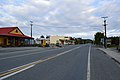
 Essex Street in Mossburn.jpg 2,565 × 1,538; 2.59 MB
-
 Holmes Street in Mossburn.jpg 2,692 × 1,339; 1.85 MB
-
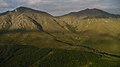
 Mid Dome, aerial view.jpg 3,072 × 1,728; 1,004 KB
-
 Mossburn Main Street.JPG 6,016 × 4,000; 8.47 MB
-
 Mossburn Railway Hotel 148.jpg 4,032 × 3,024; 4.28 MB
-
 Mossburn Railway Hotel 149.jpg 4,032 × 3,024; 4.32 MB
-
 Mossburn Railway Hotel 150.jpg 2,036 × 3,112; 862 KB
-
 Mossburn's Bracken Hall. - panoramio.jpg 3,264 × 2,448; 3.04 MB
-
 Mossburn.jpg 3,264 × 2,448; 1.29 MB
-
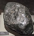 Serpentine, altered mantlerock, Otago Museum.jpg 2,701 × 2,833; 5.1 MB
-
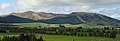
 West Dome, aerial view.jpg 3,072 × 1,728; 1.25 MB
-
 Whitehill.JPG 3,696 × 1,269; 1.18 MB


