Category:Morley, Norfolk
Jump to navigation
Jump to search
civil parish in the English county of Norfolk  | |||||
| Upload media | |||||
| Instance of | |||||
|---|---|---|---|---|---|
| Location | South Norfolk, Norfolk, East of England, England | ||||
| Population |
| ||||
| Area |
| ||||
| Different from | |||||
| official website | |||||
 | |||||
Subcategories
This category has the following 6 subcategories, out of 6 total.
Media in category "Morley, Norfolk"
The following 107 files are in this category, out of 107 total.
-
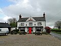 'The Buck' public house at Morley St. Botolph - geograph.org.uk - 5366006.jpg 3,456 × 2,592; 3.78 MB
-
 8th Air Force memorial at Wymondham College - geograph.org.uk - 5866626.jpg 3,285 × 2,464; 2.02 MB
-
 8th Air Force memorial at Wymondham College - geograph.org.uk - 6160411.jpg 2,592 × 3,456; 3.69 MB
-
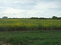
 A thin sliver of oil seed rape on the horizon - geograph.org.uk - 5366026.jpg 3,456 × 2,592; 3.43 MB
-
 A track in Morley St Botolph - geograph.org.uk - 4407782.jpg 2,592 × 1,944; 1.86 MB
-
 Attleborough Road, Morley - geograph.org.uk - 5866620.jpg 3,456 × 2,592; 4 MB
-
 Bench Mark, St Botolphs - geograph.org.uk - 1923394.jpg 3,648 × 2,736; 2.14 MB
-
 Chapel Road, Morley St. Botolph - geograph.org.uk - 5394451.jpg 640 × 480; 91 KB
-

-
 College Farm (farmhouse) - geograph.org.uk - 1610884.jpg 640 × 547; 149 KB
-
 College Farm - geograph.org.uk - 1610881.jpg 640 × 489; 118 KB
-

-
 Crop field near Morley Manor - geograph.org.uk - 5393700.jpg 640 × 480; 58 KB
-
 Crop field off Wood Lane - geograph.org.uk - 5393729.jpg 640 × 480; 46 KB
-
-
 Crop field, High Common - geograph.org.uk - 5394477.jpg 640 × 480; 62 KB
-
 Cultivated field east of Golf Links Lane - geograph.org.uk - 1611014.jpg 640 × 480; 109 KB
-
 Deopham Road, Morley - geograph.org.uk - 5393711.jpg 2,848 × 2,136; 1.32 MB
-
 Ditch beside Morley Lane - geograph.org.uk - 1610765.jpg 640 × 480; 132 KB
-
 Drain near Low Farm - geograph.org.uk - 5394482.jpg 640 × 480; 75 KB
-
 Elizabeth II postbox on Golf Links Road, Wymondham College - geograph.org.uk - 5393849.jpg 2,848 × 2,136; 1.42 MB
-
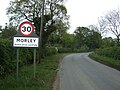 Entering Morley - geograph.org.uk - 5393707.jpg 640 × 480; 95 KB
-
 Entrance gate to Hook Wood farm - geograph.org.uk - 5866617.jpg 3,456 × 2,592; 3.98 MB
-
 Entrance to College Farm - geograph.org.uk - 1610886.jpg 640 × 460; 109 KB
-
 Entrance to Wymondham college - geograph.org.uk - 6193567.jpg 3,456 × 2,592; 3.56 MB
-
 Farm buildings, Morley Manor - geograph.org.uk - 5393698.jpg 640 × 480; 57 KB
-
 Farmland near Deopham - geograph.org.uk - 4407826.jpg 2,592 × 1,944; 1.63 MB
-
 Farmland near Wymondham College - geograph.org.uk - 4407775.jpg 2,592 × 1,944; 1.86 MB
-
 Field north of Morley Lane - geograph.org.uk - 1610767.jpg 640 × 525; 126 KB
-
 Field north of Wymondham College - geograph.org.uk - 1611011.jpg 640 × 454; 82 KB
-
 Field west of Golf Links Lane - geograph.org.uk - 1611007.jpg 480 × 640; 124 KB
-
 Field, Morley - geograph.org.uk - 5393705.jpg 640 × 480; 49 KB
-
 Flowering japanese cherry overhanging the path - geograph.org.uk - 5365791.jpg 3,456 × 2,592; 2.3 MB
-
 Former R.A.F. Deopham Green, aerial 2018 - geograph.org.uk - 5835932.jpg 1,024 × 683; 107 KB
-
 Gates to Old Hall - geograph.org.uk - 5866616.jpg 2,944 × 2,208; 1.98 MB
-
 Glimpsed through trees - geograph.org.uk - 773268.jpg 480 × 640; 193 KB
-
 Golf Links Lane past Wymondham College - geograph.org.uk - 1610964.jpg 640 × 481; 114 KB
-

-
 Hall Road, Morley St Peter - geograph.org.uk - 2236602.jpg 640 × 480; 114 KB
-
 High Common Farm, Morley St. Botolph - geograph.org.uk - 5394468.jpg 640 × 480; 82 KB
-
 High Common, Morley - geograph.org.uk - 6174621.jpg 3,456 × 2,592; 2.2 MB
-
 Hill Farmhouse - geograph.org.uk - 4437302.jpg 4,320 × 3,240; 5.92 MB
-
 Hill Road, Besthorpe - geograph.org.uk - 4407401.jpg 2,592 × 1,944; 1.84 MB
-
-

-
 Leaving Morley St. Botolph - geograph.org.uk - 5394471.jpg 640 × 480; 58 KB
-
-
 Millhill Lane - geograph.org.uk - 5393701.jpg 640 × 480; 70 KB
-
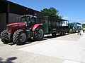
 Morley Arable Research Centre - geograph.org.uk - 1922873.jpg 3,648 × 2,736; 2.15 MB
-
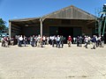
 Morley Arable Research Centre open day - geograph.org.uk - 1923408.jpg 3,648 × 2,736; 2.17 MB
-
 Morley Arable Research Centre open day - geograph.org.uk - 1923413.jpg 3,648 × 2,736; 2.14 MB
-
 Morley Arable Research Centre open day - geograph.org.uk - 1923419.jpg 3,648 × 2,736; 2.09 MB
-
 Morley Arable Research Centre open day - geograph.org.uk - 1923432.jpg 3,648 × 2,736; 2.13 MB
-
 Morley CE Primary School - geograph.org.uk - 772906.jpg 640 × 462; 155 KB
-

-
 Morley primary school - geograph.org.uk - 4437371.jpg 4,320 × 3,240; 2.99 MB
-
 Morley Primary School - geograph.org.uk - 5393713.jpg 640 × 480; 53 KB
-
 Morley St Botolph - geograph.org.uk - 4437355.jpg 3,858 × 2,659; 4.64 MB
-
 Morley St Botolph Church, font - geograph.org.uk - 5543972.jpg 480 × 640; 48 KB
-
-

-

-

-

-
 Morley St Botolph Church, nave - geograph.org.uk - 5543973.jpg 640 × 480; 38 KB
-
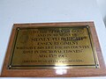
 Morley St Botolph Church, tablet - geograph.org.uk - 5543979.jpg 640 × 480; 45 KB
-
 Morley St Botolph village sign (detail) - geograph.org.uk - 6804584.jpg 2,337 × 2,337; 1.01 MB
-
 Morley St Botolph village sign - geograph.org.uk - 6804595.jpg 4,608 × 3,072; 2.71 MB
-
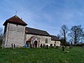
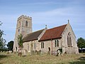 Morley St Botolph's church - geograph.org.uk - 2253744.jpg 640 × 480; 87 KB
-
 Morley St Peter - geograph.org.uk - 4437340.jpg 4,320 × 3,240; 4.53 MB
-
 Morley St Peter's church - geograph.org.uk - 2253752.jpg 640 × 480; 94 KB
-
 Morley St. Peter village sign (detail) - geograph.org.uk - 6194110.jpg 2,592 × 2,592; 2.04 MB
-
 Morley St. Peter village sign - geograph.org.uk - 6194107.jpg 3,456 × 2,592; 2.5 MB
-
 Morley Village Hall - geograph.org.uk - 1610828.jpg 640 × 544; 127 KB
-
 Morley War Memorial - geograph.org.uk - 4518344.jpg 3,456 × 2,592; 2.88 MB
-
 Morley War Memorial - geograph.org.uk - 5393716.jpg 640 × 480; 44 KB
-
 New House,Hall Road - geograph.org.uk - 2236611.jpg 640 × 480; 85 KB
-
-
 Oilseed rape crop off Wood Lane - geograph.org.uk - 5393726.jpg 640 × 480; 68 KB
-
-
 Pasture south of Morley Lane - geograph.org.uk - 1610757.jpg 640 × 480; 133 KB
-
 Postbox on Deopham road near Morley Manor - geograph.org.uk - 1922853.jpg 3,648 × 2,736; 2.21 MB
-
 Private track to Morley Wood - geograph.org.uk - 772831.jpg 640 × 480; 161 KB
-

-

-
 St Botolph's church, Morley - geograph.org.uk - 4407799.jpg 2,592 × 1,944; 1.45 MB
-
 St Peter's Hill - geograph.org.uk - 772878.jpg 640 × 480; 124 KB
-
 Stone Brigg, Morley St. Botolph - geograph.org.uk - 5393722.jpg 640 × 480; 56 KB
-
 Swingy Lane - geograph.org.uk - 1923436.jpg 3,648 × 2,736; 2.11 MB
-
 Swingy Lane from Millhill Lane, Deopham - geograph.org.uk - 4518239.jpg 1,024 × 768; 301 KB
-
 Swingy Lane from the Millhill Lane end - geograph.org.uk - 5365959.jpg 3,456 × 2,592; 3.86 MB
-
 Telegraph poles along Morley Lane - geograph.org.uk - 1610747.jpg 640 × 457; 103 KB
-

-
 The Buck, Morley St. Botolph - geograph.org.uk - 4704856.jpg 640 × 480; 69 KB
-
 The footpath leads to Old Hall, Morley - geograph.org.uk - 5866618.jpg 3,456 × 2,592; 3.81 MB
-
 The new sign for 'The Buck' at Morley - geograph.org.uk - 5366012.jpg 2,592 × 3,456; 3.06 MB
-
 The old sign of 'The Buck' - geograph.org.uk - 5366020.jpg 2,592 × 3,456; 3.25 MB
-
 Transformer beside Golf Links Lane - geograph.org.uk - 1610830.jpg 480 × 640; 80 KB
-
 View across wheat field - geograph.org.uk - 773297.jpg 640 × 431; 117 KB
-
 View from St Peter's Hill - geograph.org.uk - 772887.jpg 640 × 480; 157 KB
-

-
 View south across wheat field - geograph.org.uk - 772796.jpg 640 × 480; 184 KB
-

-
 War memorial, Morley - geograph.org.uk - 4437378.jpg 4,320 × 3,240; 2.97 MB
-
 Wood Lane - geograph.org.uk - 5394445.jpg 640 × 480; 61 KB
-
 Wood Lane towards Golf Links Road - geograph.org.uk - 5393731.jpg 640 × 480; 44 KB
-
 Wymondham Road, Deopham - geograph.org.uk - 5393697.jpg 640 × 480; 41 KB


_-_geograph.org.uk_-_1610884.jpg)


_-_geograph.org.uk_-_5543982.jpg)
_-_geograph.org.uk_-_5543983.jpg)
_-_geograph.org.uk_-_5543986.jpg)
_-_geograph.org.uk_-_5543989.jpg)
_-_geograph.org.uk_-_5543994.jpg)


_-_geograph.org.uk_-_6804584.jpg)


_-_geograph.org.uk_-_6194110.jpg)


