Category:Morley, Derbyshire
Jump to navigation
Jump to search
village and civil parish in Erewash district, Derbyshire, England  | |||||
| Upload media | |||||
| Instance of | |||||
|---|---|---|---|---|---|
| Location | Erewash, Derbyshire, East Midlands, England | ||||
| Population |
| ||||
| Different from | |||||
| Said to be the same as | Morley (Wikimedia duplicated page, civil parish) | ||||
| official website | |||||
 | |||||
Subcategories
This category has the following 3 subcategories, out of 3 total.
M
- St Matthew's Church, Morley (14 F)
V
- The Village Cross, Morley (4 F)
Media in category "Morley, Derbyshire"
The following 128 files are in this category, out of 128 total.
-
 A fine line of trees near Morleymoor farm - geograph.org.uk - 360826.jpg 640 × 480; 104 KB
-
 A minor road with many twists - geograph.org.uk - 5752283.jpg 2,000 × 1,333; 2.41 MB
-
 Almshouses at Morleymoor - geograph.org.uk - 3110610.jpg 3,840 × 2,774; 1.67 MB
-
 Almshouses, Morleymoor - geograph.org.uk - 1844256.jpg 2,048 × 1,536; 1.39 MB
-
 Bench mark, Smithy Farm, Morley - geograph.org.uk - 5474748.jpg 1,280 × 848; 396 KB
-
 Bit of wasteland in farmland, Chaddesden, Derby - geograph.org.uk - 2502412.jpg 3,648 × 2,736; 6 MB
-
 Brackley Gate - geograph.org.uk - 5472597.jpg 1,280 × 867; 284 KB
-
 Breadsall Priory, aerial 2014 - geograph.org.uk - 3926006.jpg 640 × 427; 58 KB
-
 Brick Kiln Lane junction - geograph.org.uk - 5472604.jpg 1,280 × 870; 379 KB
-
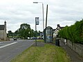
 Brickiln Lane bus stop - geograph.org.uk - 5472602.jpg 960 × 1,280; 333 KB
-
 Bridleway and Grassland near Chaddesden - geograph.org.uk - 3490171.jpg 4,000 × 3,000; 2.9 MB
-
 Bridleway from Locko Park to Oakwood - geograph.org.uk - 955118.jpg 640 × 480; 247 KB
-
 Bridleway from Locko Park to Oakwood - geograph.org.uk - 955128.jpg 640 × 480; 165 KB
-
 Bridleway from Locko Park to Oakwood - geograph.org.uk - 955139.jpg 480 × 640; 215 KB
-

-

-

-
 Bull, cows and calves, Morley - geograph.org.uk - 2498749.jpg 3,648 × 2,736; 5.48 MB
-
 Bus stop closed - geograph.org.uk - 5472596.jpg 1,280 × 900; 343 KB
-
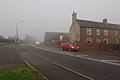
 Bus stop on Main Road (A608), Morley - geograph.org.uk - 6198052.jpg 800 × 541; 82 KB
-
 Centenary Way - geograph.org.uk - 5752312.jpg 2,000 × 1,333; 2.06 MB
-
 Chapel and Garden of Remembrance - geograph.org.uk - 2498728.jpg 2,822 × 2,177; 1.34 MB
-
 Church Lane, Morley - geograph.org.uk - 5472605.jpg 1,280 × 960; 461 KB
-
 Church Lane, Morley - geograph.org.uk - 6198029.jpg 800 × 600; 192 KB
-
 Church Lane, Morley - geograph.org.uk - 866032.jpg 640 × 336; 66 KB
-
 Church of St Matthew, Morley - geograph.org.uk - 5472608.jpg 1,168 × 1,280; 298 KB
-
 Church of St Matthew, Morley - geograph.org.uk - 5472617.jpg 1,280 × 960; 487 KB
-
 Church of St Matthew, Morley - geograph.org.uk - 5472619.jpg 1,054 × 1,280; 226 KB
-
 Church of St Matthew, Morley - geograph.org.uk - 5472621.jpg 1,280 × 960; 402 KB
-
 Church of St Matthew, Morley - geograph.org.uk - 5474740.jpg 1,280 × 960; 263 KB
-
 Crop Fields to the West of Locko Park - geograph.org.uk - 3490335.jpg 3,980 × 2,974; 2.61 MB
-
 Cross Roads Farm - geograph.org.uk - 78608.jpg 640 × 480; 35 KB
-
 Deer on the footpath at Birch Wood - geograph.org.uk - 6221830.jpg 1,280 × 960; 423 KB
-
 Derby County Training Ground - geograph.org.uk - 5452237.jpg 2,000 × 1,333; 1.69 MB
-
 Derby Road - geograph.org.uk - 722559.jpg 640 × 505; 115 KB
-
 Derby Road towards Stanley - geograph.org.uk - 6198017.jpg 800 × 600; 115 KB
-
 Derbyshire UK parish map highlighting Morley.svg 888 × 1,308; 2.34 MB
-
 Derwent Aqueduct gate and air valve - geograph.org.uk - 6364546.jpg 1,280 × 960; 462 KB
-
 Farmland to the East of Morley - geograph.org.uk - 4230690.jpg 4,000 × 3,000; 3 MB
-
 Field beside Main Road (A608), Morley - geograph.org.uk - 6198051.jpg 800 × 600; 119 KB
-
 Field entrance off the Derby Road - geograph.org.uk - 6198015.jpg 800 × 494; 86 KB
-
 Fields near Locko Park - geograph.org.uk - 2855222.jpg 3,872 × 2,592; 2.95 MB
-
 Fields near Morley Smithy - geograph.org.uk - 5752307.jpg 2,000 × 1,333; 1.57 MB
-
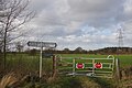
 Fingerpost at Brackley Gate - geograph.org.uk - 5472599.jpg 960 × 1,280; 691 KB
-
 Footbridge over a field drain - geograph.org.uk - 6221831.jpg 1,280 × 960; 580 KB
-
 Footbridge over a stream - geograph.org.uk - 5874514.jpg 1,280 × 960; 589 KB
-
 Footbridge over Lees Brook - geograph.org.uk - 5874509.jpg 1,280 × 960; 689 KB
-
 Footbridge over the Stanley Brook - geograph.org.uk - 5474817.jpg 1,280 × 960; 398 KB
-
 Footpath on a farm track - geograph.org.uk - 6221845.jpg 1,280 × 960; 495 KB
-
 Footpath through arable field, Morleymoor - geograph.org.uk - 1844249.jpg 2,048 × 1,536; 1.34 MB
-
 Footpath through mowing grass at Morley - geograph.org.uk - 2498709.jpg 3,648 × 2,736; 5.76 MB
-
 Footpath to Morley - geograph.org.uk - 5118393.jpg 1,280 × 960; 609 KB
-
 Footpath to Morley Road - geograph.org.uk - 5874496.jpg 1,280 × 960; 557 KB
-
 Footpath to Morley Smithy - geograph.org.uk - 5499160.jpg 1,280 × 960; 637 KB
-
 Ford on Stanley Brook - geograph.org.uk - 5603321.jpg 4,032 × 3,024; 6.78 MB
-
 Ford, over Stanley Brook - geograph.org.uk - 582038.jpg 640 × 480; 150 KB
-
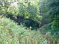 Former Great Northern Railway over-bridge - geograph.org.uk - 5118378.jpg 1,280 × 960; 663 KB
-
 Gate on Quarry Road, Morley - geograph.org.uk - 3792004.jpg 1,280 × 849; 372 KB
-
 Grassland near the Dobbs Hill Plantation - geograph.org.uk - 3490982.jpg 3,926 × 2,900; 2.65 MB
-
 Hay trailer - geograph.org.uk - 955120.jpg 640 × 428; 172 KB
-
 Hayes Park Farmhouse, Stanley Common - geograph.org.uk - 5474823.jpg 1,280 × 960; 330 KB
-
 House on Lime Lane, Morley - geograph.org.uk - 6198021.jpg 800 × 524; 87 KB
-
 Jesse Farm, Morley - geograph.org.uk - 2498679.jpg 3,648 × 2,736; 5.71 MB
-
 Junction of Brick Kiln Lane and Quarry Road - geograph.org.uk - 5472600.jpg 1,280 × 855; 298 KB
-
 Kings Corner valve house - geograph.org.uk - 2253660.jpg 640 × 480; 81 KB
-
 Lime Lane towards Morley - geograph.org.uk - 6198018.jpg 800 × 600; 180 KB
-
 Long distance footpath junction - geograph.org.uk - 5474819.jpg 1,280 × 960; 374 KB
-
 Main Road (A608), Morley Smithy - geograph.org.uk - 6198047.jpg 800 × 600; 99 KB
-
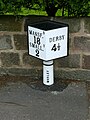 Milepost, Morley Smithy - geograph.org.uk - 5474747.jpg 960 × 1,280; 321 KB
-
 Morley Primary School - geograph.org.uk - 6198030.jpg 800 × 475; 72 KB
-
 Morley Smithy - geograph.org.uk - 3792000.jpg 1,280 × 851; 180 KB
-
 Morley Smithy, bus stop, milepost and pub - geograph.org.uk - 5474752.jpg 1,280 × 960; 209 KB
-
 Morley war memorial - geograph.org.uk - 5472615.jpg 960 × 1,280; 479 KB
-
 Morton Village Hall, Derbyshire (geograph 380006).jpg 640 × 360; 63 KB
-
 Mowing grass field at King's Corner - geograph.org.uk - 2498675.jpg 3,648 × 2,736; 5.62 MB
-
 Multiple waymarks - geograph.org.uk - 5474820.jpg 960 × 1,280; 404 KB
-
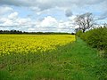
 Oil Seed Fields near Morley - geograph.org.uk - 3490962.jpg 4,000 × 3,000; 2.41 MB
-
 Old lane remnant - geograph.org.uk - 5499182.jpg 1,280 × 960; 725 KB
-
 Old Sign, Church Lane , Morley - geograph.org.uk - 80529.jpg 640 × 480; 99 KB
-

-
 Open land Acorn Way - geograph.org.uk - 5434482.jpg 2,000 × 1,333; 2.28 MB
-
 Park Farm and Hayes Park Farm - geograph.org.uk - 5474822.jpg 1,280 × 960; 254 KB
-
 Path through a barley field at Morley - geograph.org.uk - 2498687.jpg 3,648 × 2,736; 5.69 MB
-
 Path through grass fields - geograph.org.uk - 2498716.jpg 3,648 × 2,736; 5.77 MB
-
 Pipe-line laying operations - geograph.org.uk - 3250445.jpg 3,648 × 2,736; 4.68 MB
-
 Quarry Road - geograph.org.uk - 5752280.jpg 2,000 × 1,333; 3.25 MB
-
 Quarry Road, junction with Cloves Hill - geograph.org.uk - 2211092.jpg 3,648 × 2,736; 5.8 MB
-
 Rape field by Lime Lane - geograph.org.uk - 866019.jpg 640 × 480; 104 KB
-
 Ridge and furrow at Spring Oak Farm - geograph.org.uk - 5499187.jpg 1,280 × 960; 388 KB
-
 Riding school car park - geograph.org.uk - 5434486.jpg 2,000 × 1,333; 1.8 MB
-
 Ripening Oil Seed Rape - geograph.org.uk - 5452245.jpg 2,000 × 1,333; 2.8 MB
-
 Road to Morleymoor Farm - geograph.org.uk - 4230707.jpg 4,000 × 3,000; 2.55 MB
-
 Rough Pasture - geograph.org.uk - 5434508.jpg 2,000 × 1,333; 2.72 MB
-
-
 Site of a farm being developed - geograph.org.uk - 2502354.jpg 3,648 × 2,736; 4.92 MB
-
 Small stone building, Kings Corner - geograph.org.uk - 6198014.jpg 800 × 600; 123 KB
-
 Smithy Barn, Morley Smithy - geograph.org.uk - 6198046.jpg 800 × 477; 79 KB
-
 Smithy Farm, Morley Smithy - geograph.org.uk - 5474750.jpg 1,280 × 960; 214 KB
-
 Sports facility Broomfield Hall - geograph.org.uk - 4186563.jpg 640 × 480; 75 KB
-
 St. Matthew's Church - geograph.org.uk - 5752308.jpg 1,333 × 2,000; 2.12 MB
-
 Stables at Spring Oak Farm - geograph.org.uk - 866036.jpg 640 × 381; 63 KB
-
 Stanley Brook Ford, Morley Lane - geograph.org.uk - 5474816.jpg 960 × 1,280; 437 KB
-
 Statham arms.png 1,000 × 1,200; 117 KB
-
 Stile near Spring Oak Farm, Morley - geograph.org.uk - 2498682.jpg 3,648 × 2,736; 5.68 MB
-
 StreynshamMaster.jpg 157 × 175; 5 KB
-
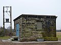
 Telephone box near the almshouses, Morelymoor - geograph.org.uk - 1844263.jpg 1,536 × 2,048; 1.37 MB
-
 The hedge of North Lodge - geograph.org.uk - 5752317.jpg 2,000 × 1,333; 3.06 MB
-
 The Midshires Way near Morley - geograph.org.uk - 3110592.jpg 4,000 × 3,000; 2.69 MB
-
 The Midshires Way near Spring Oak Farm - geograph.org.uk - 3490836.jpg 4,000 × 3,000; 2.84 MB
-
 The Mound at Morley (geograph 2498742).jpg 3,648 × 2,736; 6.22 MB
-
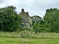
 The old rectory, Morley - geograph.org.uk - 5474742.jpg 1,280 × 960; 364 KB
-
 The Three Horse Shoes, Morley - geograph.org.uk - 6198033.jpg 800 × 535; 92 KB
-
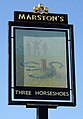
 The Three Horse Shoes, Morley Smithy - geograph.org.uk - 3791998.jpg 1,280 × 851; 224 KB
-
 ThomasStathum.jpg 500 × 1,217; 137 KB
-
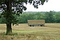
 Tithe barn at Morley - geograph.org.uk - 5474737.jpg 1,280 × 990; 229 KB
-
 Tithe barn, Morley Geograph-2539473-by-Richard-Croft.jpg 640 × 427; 80 KB
-
 Track and Farmland near King's Corner - geograph.org.uk - 4230625.jpg 4,000 × 3,000; 3.47 MB
-
 Track and Footpath near The Limes - geograph.org.uk - 4230630.jpg 4,000 × 3,000; 3.22 MB
-
 Track to Morleymoor Farm - geograph.org.uk - 6198056.jpg 800 × 600; 153 KB
-
 Tree and trailer - geograph.org.uk - 955124.jpg 640 × 480; 200 KB
-
 Tree in middle of a field - geograph.org.uk - 2502362.jpg 3,648 × 2,736; 5.37 MB
-
-
 Jesse Farm - geograph.org.uk - 722580.jpg 640 × 449; 78 KB
-
 Railway Cutting near Morley Tunnel - geograph.org.uk - 582292.jpg 640 × 480; 144 KB
-
 Rams Academy Training Ground - geograph.org.uk - 78606.jpg 640 × 480; 92 KB
-
 Spring Oak Farm - geograph.org.uk - 582057.jpg 640 × 480; 77 KB
-
 The Priory Golf Course - geograph.org.uk - 573835.jpg 640 × 387; 80 KB
-
 Track to Park Farm - geograph.org.uk - 153038.jpg 640 × 480; 129 KB


_-_geograph.org.uk_-_6168234.jpg)
_-_geograph.org.uk_-_6168248.jpg)
_-_geograph.org.uk_-_6168256.jpg)


,_Morley_-_geograph.org.uk_-_6198052.jpg)


,_Morley_-_geograph.org.uk_-_6198051.jpg)


,_Morley_Smithy_-_geograph.org.uk_-_6198047.jpg)


.jpg)


.jpg)


