Category:Moorlands in County Antrim
Jump to navigation
Jump to search
Media in category "Moorlands in County Antrim"
The following 15 files are in this category, out of 15 total.
-

-
 Bog hole on the side of Mid Hill - geograph.org.uk - 800053.jpg 640 × 480; 138 KB
-
 Cranny Lough from Colin Top - geograph.org.uk - 785676.jpg 640 × 480; 47 KB
-
 Descending into the Clady Valley - geograph.org.uk - 3211024.jpg 1,024 × 768; 191 KB
-
 Moorland above the River Inver - geograph.org.uk - 1415973.jpg 640 × 480; 67 KB
-
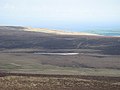
 Moorland near Ballypatrick Forest. - geograph.org.uk - 239282.jpg 640 × 427; 85 KB
-
 Moorland on the side of Mid Hill - geograph.org.uk - 785638.jpg 640 × 480; 68 KB
-

-
 Moorland on the south of Carncormick - geograph.org.uk - 803950.jpg 640 × 480; 68 KB
-
 Moorland to the east of Colin Top - geograph.org.uk - 785688.jpg 640 × 480; 70 KB
-

-
 Rainbow over the Trosk from moorland - geograph.org.uk - 1415979.jpg 640 × 480; 65 KB
-
 Rough moorland - geograph.org.uk - 864254.jpg 640 × 360; 35 KB
-
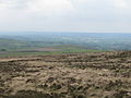
 Belfast Hills - geograph.org.uk - 448009.jpg 640 × 343; 25 KB
-
 Clady - geograph.org.uk - 465731.jpg 640 × 427; 260 KB


