Category:Monts Chic-Chocs
Jump to navigation
Jump to search
Subrange of the Appalachian Mountains in Quebec, Canada | |||||
| Upload media | |||||
| Instance of | |||||
|---|---|---|---|---|---|
| Location | |||||
| Width |
| ||||
| Length |
| ||||
| Mountain range |
| ||||
| Highest point | |||||
| Elevation above sea level |
| ||||
 | |||||
Description
[edit]Français : Le massif des monts Chic-Chocs, situé dans la partie à la fois nord et centrale de la péninsule de la Gaspésie, constitue la zone la plus élevée des monts Notre-Dame qui sont le prolongement le plus à l'est appartenant à la chaîne des Appalaches.
English: The Chic-Chocs mountains massif, localized within the northern and central part of the Gaspesian peninsula, is the highest area of the Notre-Dame mountains, which constitute the most eastern part of the Appalachian mountains range.
Subcategories
This category has the following 7 subcategories, out of 7 total.
M
- Mont Hog's Back (7 F)
- Mont Jacques-Cartier (4 F)
- Mont Logan (Québec) (6 F)
- Mont Nicol-Albert (4 F)
Media in category "Monts Chic-Chocs"
The following 33 files are in this category, out of 33 total.
-
019 - Parc national de la Gaspésie Mont Xalibu (29333171510).jpg 4,160 × 3,120; 3.81 MB
-
032 - Parc national de la Gaspésie Mont Xalibu (29333160990).jpg 4,160 × 3,120; 2.67 MB
-
Arriere pays.jpg 535 × 359; 167 KB
-
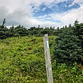
Balise SIA régulière (poteau).jpg 1,946 × 1,946; 1.4 MB
-
ChicChoc.jpg 1,024 × 768; 265 KB
-
Chicchoc1.jpg 640 × 480; 57 KB
-
Chichoc2.jpg 640 × 480; 58 KB
-
Gaspésie.jpg 1,363 × 1,022; 404 KB
-
Mont aux Perches - hiver.jpg 4,160 × 3,120; 1.14 MB
-
Mont Blanc (Gaspésie).jpg 1,660 × 1,364; 1.33 MB
-
Mont Blanc Réserve faunique Matane 2010-03-12 Denis Desjardins 8289.jpg 3,072 × 2,304; 1.35 MB
-
Mont Jean-Yves-Bérubé 2023-07-20.jpg 2,674 × 2,356; 1.19 MB
-
Mont Nicol-Albert 2024-08-11.jpg 2,824 × 3,537; 2.89 MB
-
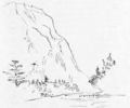
Mont Nicol-Albert par Logan (1844).png 1,181 × 983; 548 KB
-
Mont Nicol-Albert.jpg 4,896 × 3,264; 5.48 MB
-
Mont Raoul-Fafard.jpg 3,024 × 4,032; 2.19 MB
-
Mont Xalibu.jpg 3,120 × 2,340; 4.47 MB
-
MontHog'sBack.jpg 6,000 × 4,000; 1.9 MB
-
Monthogsback.jpg 6,000 × 4,000; 2.84 MB
-
Monthogsback2.jpg 6,000 × 4,000; 5.78 MB
-
Monthogsback3.jpg 6,000 × 4,000; 7.24 MB
-
Monthogsback5.jpg 6,000 × 4,000; 5.46 MB
-
Monts Albert et Macoun, parc de la Gaspésie.jpg 4,160 × 3,120; 2.8 MB
-
Monts Chic-Chocs.jpg 6,000 × 4,000; 3.41 MB
-
Réserve faunique des Chic-Chocs, Route 14.jpg 2,192 × 2,192; 1.29 MB
-
Saint-Adelme, une ferme et les monts Chic-Chocs.jpg 3,264 × 1,717; 1.68 MB
-
Ski dans les Chic-Chocs.jpeg 750 × 1,000; 413 KB
-
Sommet du mont Blanc (Gaspésie).jpg 3,612 × 2,032; 1.73 MB
-
Sommet du mont Pointu-Est.jpg 4,102 × 1,882; 2.66 MB
-
Sommet du mont Pointu-Nord.jpg 3,723 × 1,882; 2.62 MB
-
Vallée de la rivière Marsoui.jpg 3,024 × 3,024; 2.37 MB
-
Vue de Bonhomme 2023-07-18.jpg 4,629 × 3,086; 2.06 MB
-
Winterinchicchoc.jpg 1,600 × 1,200; 217 KB


