Category:Monte Perdido Massif
Jump to navigation
Jump to search
| Camera location | | View all coordinates using: OpenStreetMap |
|---|
mountain range of the Pyrenees on both sides of the Franco-Spanish border   | |||||
| Upload media | |||||
| Instance of | |||||
|---|---|---|---|---|---|
| Made from material | |||||
| Location |
| ||||
| Heritage designation |
| ||||
| Significant event |
| ||||
| Mountain range | |||||
| Highest point | |||||
| Area |
| ||||
| Elevation above sea level |
| ||||
 | |||||
Català: Massís del Mont Perdut, als Pirineus centrals (Bielsa, Fanlo i Torla - Aragó) (Alts Pirineus (França))
Subcategories
This category has the following 38 subcategories, out of 38 total.
*
B
- Brèche de Roland (83 F)
C
- Casco de Marboré (10 F)
- Cilindro de Marboré (35 F)
- Col de la Cascade (1 F)
D
- Dedo del Monte Perdido (4 F)
E
- Espalda de Marboré (9 F)
F
- Fausse Brèche (13 F)
G
- Gabieto Oriental (6 F)
- Glacier de la Brèche (5 F)
- Grand Astazou (11 F)
H
- Hourquette d'Alans (6 F)
M
- Monte Perdido Glacier (7 F)
N
- Nappe du Mont Perdu (4 F)
P
- Parador de Bielsa (16 F)
- Petit Astazou (12 F)
- Pic des Sarradets (6 F)
- Pic du Marboré (15 F)
- Pic du Piméné (7 F)
- Pic du Taillon (32 F)
- Pic Rouge de Pailla (7 F)
- Pico Central de la Cascada (3 F)
- Pico Oriental de la Cascada (3 F)
- Pitón SW del Cilindro (3 F)
- Pointe Bazillac (4 F)
- Portillo de Tella (1 F)
- Punta de las Olas (5 F)
R
- Refuge de Tuquerouye (19 F)
- Refuge des Sarradets (22 F)
S
- Soum de Ramond (14 F)
T
- Torre de Marboré (7 F)
V
Media in category "Monte Perdido Massif"
The following 36 files are in this category, out of 36 total.
-
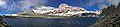
 Altos Pirineos 1981 52.jpg 1,014 × 680; 850 KB
-
 Bielsa - Barranco del Montillo 01.jpg 4,592 × 3,448; 10.8 MB
-
 Castillo de Aínsa y Monte Perdido..jpg 1,002 × 736; 186 KB
-
 Castillo de Boltaña y Monte Perdido.jpg 2,304 × 3,072; 1.05 MB
-
 Cañon de Ordesa.jpg 3,872 × 2,592; 5.35 MB
-
 Dolina mondoto.jpg 1,024 × 768; 253 KB
-
 Fuen blanca.jpg 640 × 427; 176 KB
-
 Ibón de Marmorés.jpg 1,248 × 835; 398 KB
-
 Isards Mont Perdu.jpg 5,184 × 3,888; 7.32 MB
-
 Lago de Marboré.jpg 4,436 × 1,000; 3.12 MB
-
 Lapiaz mondoto.jpg 2,560 × 1,920; 1.97 MB
-
 Lapiaz.jpg 640 × 480; 144 KB
-
 Las Tres Marías.jpg 258 × 406; 29 KB
-
 Macizo de Monte Perdido desde el valle de Pineta.jpg 3,456 × 2,304; 5.98 MB
-
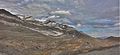
 Macizo perdido.jpg 801 × 536; 49 KB
-
 Massif du Mont-Perdu.png 947 × 459; 659 KB
-
 Massifmontperdu.jpg 2,304 × 1,728; 1.46 MB
-
 MONTE PERDIDO.JPG 1,024 × 768; 100 KB
-
 MontePerdido in MontePerdidoGroup.jpg 1,400 × 931; 1.19 MB
-
 MontePerdido-CirqueDeGavarnie.jpg 4,000 × 3,000; 4.45 MB
-
 Mt Perdu-Cylindre.jpg 921 × 567; 97 KB
-
 Ordesa - Monte perdido.jpg 2,048 × 1,536; 1.55 MB
-
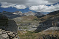
 Ordesa valle.jpg 3,872 × 2,592; 8.45 MB
-
 Ordesa y Monte Perdido.jpg 3,872 × 2,592; 7.84 MB
-
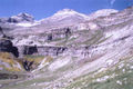
 Ordesa, Faja de Pelay 1993 11.jpg 1,068 × 698; 190 KB
-
 Ordesa, panorámicas (1993) 02.jpg 5,368 × 2,112; 13.46 MB
-
 Panorámica del Monte Perdido - WLE Spain 2015.jpg 3,648 × 1,685; 1.5 MB
-
 Parque nacional de Ordesa y Monte Perdido - Arbol del castillo mayor.jpg 3,457 × 2,000; 3.95 MB
-
 Perdido Ordesa 400.jpg 400 × 300; 147 KB
-
 Pirineos (1973).jpg 1,106 × 721; 568 KB
-
 Pirineos 075.jpg 480 × 640; 142 KB
-
 Py06MontePerdido.jpg 3,280 × 1,456; 804 KB
-
 Pyrenees - Parque Nacional de Ordesa y Monte Perdido - Monte Perdido - panoramio.jpg 2,816 × 2,112; 1.42 MB
-
 Restos lapiaz cutas.jpg 1,600 × 1,200; 1.1 MB
-
 Río Arazas Ordesa.jpg 2,048 × 2,046; 5.73 MB
-
 WLE - 2022 - Parque nacional de Ordesa y Monte Perdido - 02.jpg 4,992 × 3,328; 7.74 MB


.jpg)


_02.jpg)