Category:Monte Gambarogno
Jump to navigation
Jump to search
|
Monte Gambarogno has an entry on OpenStreetMap (show). |
mountain in Switzerland  | |||||
| Upload media | |||||
| Instance of | |||||
|---|---|---|---|---|---|
| Location | Ticino, Switzerland | ||||
| Mountain range | |||||
| Topographic prominence |
| ||||
| Topographic isolation |
| ||||
| Elevation above sea level |
| ||||
| Parent peak | |||||
 | |||||
Pages in category "Monte Gambarogno"
This category contains only the following page.
Media in category "Monte Gambarogno"
The following 17 files are in this category, out of 17 total.
-
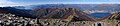
 Auf dem Monte Gambarogno.jpg 1,600 × 1,200; 796 KB
-
 ETH-BIB-Monte Lema, Blick nach Norden, Monte Gambarogno-LBS H1-016421.tif 6,645 × 4,628; 88.02 MB
-

-
 Grandioser Ausblick von der Alpe Bardughe.jpg 3,456 × 2,304; 4.01 MB
-
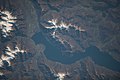 ISS030-E-253884 - View of Italy.jpg 6,048 × 4,032; 2.31 MB
-
 ISS039-E-19477 - View of Earth.jpg 4,256 × 2,832; 1.42 MB
-
 LagoMaggioreGambarogno.jpg 4,000 × 2,248; 3.18 MB
-
 Maggia Delta 2014 Air.jpg 3,532 × 2,649; 2.39 MB
-
 Monte Gambarogno con albero.jpg 4,624 × 3,468; 4.96 MB
-
 Monte Gambarogno con sassi.jpg 4,096 × 3,072; 2.18 MB
-
 Monte Gambarogno da Madonna del Sasso.png 3,864 × 5,152; 24 MB
-
 Monte Gambarogno tea time.jpg 4,096 × 3,072; 4.17 MB
-
 Monte gambarogno.jpg 987 × 436; 87 KB
-
 Monte Tamaro von Norden.jpg 860 × 645; 87 KB
-
 Monte Tamaro.jpg 4,912 × 1,080; 2.41 MB
-
 Panorama Monte Cimetta.jpg 9,067 × 3,747; 13.94 MB
-
 Sich vom Salmone auf Locarno.jpg 3,872 × 2,592; 3.18 MB


