Category:Mont Pèlerin
Jump to navigation
Jump to search
| Object location | | View all coordinates using: OpenStreetMap |
|---|
mountain of the Swiss Plateau  | |||||
| Upload media | |||||
| Instance of | |||||
|---|---|---|---|---|---|
| Part of |
| ||||
| Made from material | |||||
| Location | |||||
| Has part(s) | |||||
| Topographic prominence |
| ||||
| Elevation above sea level |
| ||||
| Different from | |||||
 | |||||
Subcategories
This category has the following 2 subcategories, out of 2 total.
L
T
- Tour relais du Mont Pèlerin (25 F)
Media in category "Mont Pèlerin"
The following 38 files are in this category, out of 38 total.
-
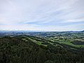
 2011-11-17 13-34-01 Switzerland Canton de Vaud Cugy.jpg 4,288 × 2,848; 3.83 MB
-
 CH-NB - Vevey, von Süden - Collection Gugelmann - GS-GUGE-JOYEUX-WEXELBERG-A-4.tif 6,260 × 4,552, 2 pages; 81.55 MB
-
 CH-NB-Les environs du Léman-18973-page023.tif 1,631 × 1,171; 1.4 MB
-

-
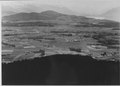
 ETH-BIB-Mont Pelerin-LBS H1-025957.tif 5,200 × 3,570; 53.15 MB
-
 ETH-BIB-Mont Pelerin-LBS H1-025970.tif 6,695 × 4,757; 91.27 MB
-
 ETH-BIB-Mont Pèlerin-LBS H1-025960.tif 5,200 × 3,604; 53.66 MB
-
 Fog on the lake.jpg 4,032 × 2,268; 1.38 MB
-
 Forest stairs.jpg 2,268 × 4,032; 3.7 MB
-
 Fotografi av berg och sjö i Schweiz - Hallwylska museet - 103173.tif 3,261 × 2,712; 25.33 MB
-
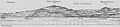 GLS Mont Pelerin von Le Bouveret her gesehen.jpg 1,504 × 336; 101 KB
-
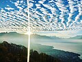 Good morning Sunrise view from Mont Pelerin at 1075 above sea level.jpg 2,048 × 1,536; 377 KB
-
 Lac Léman 3.jpg 3,264 × 2,448; 1.75 MB
-
 Les pléiades 46.jpg 4,592 × 3,056; 9.92 MB
-
 Mont Pèlerin (42763002700).jpg 5,184 × 3,456; 5.1 MB
-
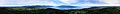 Mont Pèlerin Fernsehturm 360 Panorama.JPG 19,466 × 2,322; 7.96 MB
-
 Mont Pèlerin Fernsehturm N.JPG 4,000 × 3,000; 2.53 MB
-
 Mont Pèlerin Fernsehturm NO.JPG 4,000 × 3,000; 2.66 MB
-
 Mont Pèlerin Fernsehturm NW.JPG 4,000 × 3,000; 2.45 MB
-
 Mont Pèlerin Fernsehturm O.JPG 4,000 × 3,000; 2.89 MB
-
 Mont Pèlerin Fernsehturm S.JPG 4,000 × 3,000; 2.44 MB
-
 Mont Pèlerin Fernsehturm SO.JPG 4,000 × 3,000; 2.71 MB
-
 Mont Pèlerin Fernsehturm SW.JPG 4,000 × 3,000; 2.04 MB
-
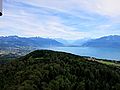
 Mont Pèlerin vu depuis le Léman - 2022-09-12 - 1.jpg 5,989 × 3,367; 9.7 MB
-
 Mont Pèlerin vu depuis le Léman - 2022-09-12 - 2.jpg 5,787 × 3,254; 9.44 MB
-
 Mont Pèlerin vu depuis le Léman - 2022-09-12 - 3.jpg 5,944 × 3,343; 11.52 MB
-
 Mont Pèlerin vu depuis le Léman - 2022-09-12 - 4.jpg 5,909 × 3,323; 10.9 MB
-
 Mont Pèlerin vu depuis le Léman - 2022-09-12 - 5.jpg 5,960 × 3,351; 11.38 MB
-
 Mont Pélerin tower behind the trees.jpg 1,836 × 3,264; 2.07 MB
-
 Mont-Pèlerin, Vevey by ArmAg (1).jpg 4,032 × 1,960; 2.37 MB
-
 Mont-Pèlerin, Vevey by ArmAg (3).jpg 4,032 × 1,960; 2.5 MB
-
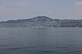
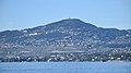
 MontPelerinFromMontreux.JPG 3,648 × 2,736; 4.74 MB
-
 Pink Sunset view in Autumn.jpg 2,048 × 1,536; 289 KB
-
 President Obama Congratulates Secretary Kerry on Syria Agreement (9757076696).jpg 2,784 × 1,848; 1.47 MB
-
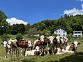 Red holsteins in Vevey.jpg 4,032 × 3,024; 2.5 MB
-
 Secretary Kerry Greets Swiss Residents During Mountain Hike (9757155623).jpg 2,784 × 1,848; 2.43 MB
-
 Secretary Kerry Hikes in the Swiss Mountains (9757086334).jpg 2,295 × 1,522; 1.66 MB
-
 Secretary Kerry Pauses During a Walk in the Swiss Mountains (9757075346).jpg 2,629 × 1,745; 1.37 MB


.jpg)


.jpg)
.jpg)


.jpg)

.jpg)
.jpg)
.jpg)