Category:Monnikenburenmolen
Jump to navigation
Jump to search
| Object location | | View all coordinates using: OpenStreetMap |
|---|
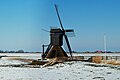
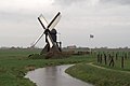
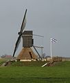
windmill in Nijhuizum, Netherlands  | |||||
| Upload media | |||||
| Instance of | |||||
|---|---|---|---|---|---|
| Location | Nijhuizum, Súdwest-Fryslân, Friesland, Netherlands | ||||
| Has use |
| ||||
| Heritage designation |
| ||||
| Source of energy | |||||
 | |||||
|
This is a category about rijksmonument number 527646
|
| Address |
|
Media in category "Monnikenburenmolen"
The following 10 files are in this category, out of 10 total.
-
 20180817 Nijhuizumer molen1 Nijhuzum.jpg 5,121 × 3,414; 2.59 MB
-
 20180817 Nijhuizumer molen2 Nijhuzum.jpg 5,050 × 3,366; 2.38 MB
-
 20180817 Nijhuizumer molen3 Nijhuzum.jpg 5,184 × 3,456; 3.06 MB
-
 20180817 Nijhuizumer molen4 Nijhuzum.jpg 5,184 × 3,456; 4.82 MB
-
 Monnikeburen.jpg 1,203 × 1,728; 254 KB
-
 Mûntsjebuorstermole, Nijhuzum.jpg 1,739 × 1,160; 1.02 MB
-
 Nijhuizum - Monnikenburenmolen met 4 zeilen.jpg 1,800 × 1,200; 750 KB
-
 Nijhuzum, Mûntsjebuorstermole.jpg 1,784 × 1,191; 898 KB
-
 Spinnekop Nijhuizum.JPG 3,072 × 2,304; 2.75 MB
-
 Spinnekop Nijhuizum.jpg 1,398 × 1,646; 203 KB


