Category:Monks Kirby
Jump to navigation
Jump to search
village in Warwickshire, England, UK  | |||||
| Upload media | |||||
| Instance of | |||||
|---|---|---|---|---|---|
| Location | Rugby, Warwickshire, West Midlands, England | ||||
| Population |
| ||||
| Area |
| ||||
 | |||||
English: Monks Kirby is a village and civil parish in north-eastern Warwickshire, England. The population of the parish is 434 (2001 census).
Subcategories
This category has the following 2 subcategories, out of 2 total.
E
- St Edith's Church, Monks Kirby (10 F)
N
- Newnham Paddox (10 F)
Media in category "Monks Kirby"
The following 123 files are in this category, out of 123 total.
-
 A lay-by on the A5 - geograph.org.uk - 5863685.jpg 1,600 × 900; 412 KB
-
 A straight Fosse Way - geograph.org.uk - 3155742.jpg 640 × 480; 88 KB
-

-
 Ahead, Cestersover Farm - geograph.org.uk - 1705679.jpg 1,024 × 768; 161 KB
-
 Approaching the A5 - geograph.org.uk - 5303083.jpg 4,128 × 2,322; 4.01 MB
-
 B4428 east of Street Ashton - geograph.org.uk - 6719810.jpg 1,280 × 851; 1.34 MB
-
 B4455 Fosse Way heading north - geograph.org.uk - 6238190.jpg 1,024 × 684; 261 KB
-
 B4455 Fosse Way heading north - geograph.org.uk - 6238192.jpg 1,024 × 684; 268 KB
-
 B4455 Fosse Way heading north - geograph.org.uk - 6239154.jpg 1,024 × 684; 269 KB
-
 B4455 Fosse Way heading north - geograph.org.uk - 6239158.jpg 1,024 × 684; 403 KB
-
 Benchmark on culvert - geograph.org.uk - 4501571.jpg 2,560 × 1,920; 1.05 MB
-
 Benchmark on Stretton Tollhouse - geograph.org.uk - 4489625.jpg 2,560 × 1,920; 1.03 MB
-
 Brockhurst Lane (1) - geograph.org.uk - 2039554.jpg 1,024 × 768; 199 KB
-
 Brockhurst Lane (2) - geograph.org.uk - 2039561.jpg 1,024 × 768; 243 KB
-
 Brockhurst Lane - geograph.org.uk - 5274036.jpg 2,322 × 4,128; 2.05 MB
-
 Brockhurst Lane - geograph.org.uk - 5274045.jpg 2,322 × 4,128; 2.58 MB
-
 Brockhurst Lane looking North - geograph.org.uk - 2039527.jpg 1,024 × 768; 303 KB
-
 Brockhurst Lane looking South - geograph.org.uk - 2039533.jpg 1,024 × 768; 293 KB
-
 Chapel ruins - geograph.org.uk - 5274050.jpg 4,128 × 2,322; 6.4 MB
-
 Cloudesley Bush Farmland - geograph.org.uk - 2292196.jpg 640 × 480; 70 KB
-
 Coal Pit Lane - geograph.org.uk - 5457994.jpg 1,600 × 900; 458 KB
-
 Coal Pit Lane heading towards Cross in Hand - geograph.org.uk - 4171518.jpg 1,600 × 1,243; 637 KB
-
 Cottage, Cloudesley Farm - geograph.org.uk - 3155774.jpg 640 × 480; 102 KB
-
 Cottages, Monks Kirby - geograph.org.uk - 2039617.jpg 1,024 × 768; 144 KB
-
 Denbigh Arms, Monk's Kirby - geograph.org.uk - 6083014.jpg 800 × 507; 305 KB
-

-
 Denbigh Memorial Chapel (1) - geograph.org.uk - 2039586.jpg 1,024 × 768; 177 KB
-
 Denbigh Memorial Chapel (2) - geograph.org.uk - 2039612.jpg 1,024 × 768; 208 KB
-
 Denbigh Memorial Chapel (Interior) - geograph.org.uk - 2039595.jpg 768 × 1,024; 123 KB
-
 Denbigh Memorial Chapel - geograph.org.uk - 6257573.jpg 882 × 1,024; 383 KB
-
 Emphasised junction on the Fosse Way - geograph.org.uk - 3155718.jpg 640 × 480; 55 KB
-
 Farmland east of the Fosse Way - geograph.org.uk - 4173378.jpg 1,600 × 1,286; 476 KB
-
 Farmland near Monks Kirby - geograph.org.uk - 5274039.jpg 4,128 × 2,322; 5.38 MB
-
 Farmland off Lutterworth Road, near Cross in Hand - geograph.org.uk - 6698263.jpg 1,280 × 851; 1.85 MB
-
 Farmland south of Cloudesley Bush - geograph.org.uk - 4171556.jpg 1,600 × 1,177; 438 KB
-
 Farmland towards Street Ashton House - geograph.org.uk - 3155724.jpg 640 × 446; 80 KB
-
 Farmland west of the Fosse Way - geograph.org.uk - 4957924.jpg 1,280 × 851; 347 KB
-
 Farmland, Cloudesley Farm - geograph.org.uk - 3155778.jpg 640 × 480; 74 KB
-
 Farmland, Fosse Farm - geograph.org.uk - 3155754.jpg 640 × 480; 74 KB
-
 Farmland, Foxon's Corner - geograph.org.uk - 3155737.jpg 640 × 480; 89 KB
-
 Field entrance along the B4455 Fosse Way - geograph.org.uk - 4173349.jpg 1,600 × 1,200; 598 KB
-
 Footpath alongside a hedge - geograph.org.uk - 4411089.jpg 1,306 × 979; 459 KB
-
 Footpath beneath the railway line - geograph.org.uk - 4411049.jpg 1,142 × 857; 458 KB
-
 Footpath from Tythe Farm to Churchover - geograph.org.uk - 4399696.jpg 1,306 × 979; 498 KB
-
 Footpath to Churchover - geograph.org.uk - 4809891.jpg 1,280 × 960; 405 KB
-
 Former Rugby - Leicester railway - geograph.org.uk - 5285449.jpg 1,280 × 851; 656 KB
-
 Former St. Joseph's Convent, Monks Kirby (1) - geograph.org.uk - 2039638.jpg 1,024 × 768; 204 KB
-
 Former St. Joseph's Convent, Monks Kirby (2) - geograph.org.uk - 2039643.jpg 1,024 × 768; 209 KB
-
 Fosse Way - geograph.org.uk - 5371183.jpg 4,128 × 2,322; 3.57 MB
-
 Green Lane towards Wibtoft - geograph.org.uk - 5410710.jpg 640 × 459; 94 KB
-
 Green Lane-Coal Pit Lane junction - geograph.org.uk - 5410709.jpg 640 × 449; 120 KB
-
 Harborough Fields Farm from the east - geograph.org.uk - 4411103.jpg 1,142 × 857; 314 KB
-
 Heading north along the B4455 Fosse Way - geograph.org.uk - 4173433.jpg 1,600 × 1,340; 632 KB
-
 Kirby Lane Cottage, Monks Kirby - geograph.org.uk - 171082.jpg 640 × 427; 134 KB
-
 Lay-by on the Fosse Way - geograph.org.uk - 1265873.jpg 640 × 480; 83 KB
-
 Little Walton - geograph.org.uk - 5303033.jpg 4,128 × 2,322; 4.6 MB
-
 Lonely tree in farmland - geograph.org.uk - 5302987.jpg 4,128 × 2,322; 4.22 MB
-
 Lutterworth Road - geograph.org.uk - 5274027.jpg 4,128 × 2,322; 4.65 MB
-
 Mere Lane - geograph.org.uk - 3155793.jpg 640 × 480; 62 KB
-
 Miller's Lane, Monks Kirby - geograph.org.uk - 2039863.jpg 1,024 × 768; 278 KB
-
 Minor Road leading to Monks Kirby - geograph.org.uk - 5274033.jpg 2,322 × 4,128; 2.67 MB
-
 Monk's Kirby - geograph.org.uk - 6257581.jpg 1,024 × 620; 214 KB
-
 Monks Kirby - geograph.org.uk - 171101.jpg 640 × 427; 114 KB
-
 Monks Kirby - geograph.org.uk - 79786.jpg 640 × 480; 145 KB
-
 Monks Kirby - geograph.org.uk - 79787.jpg 640 × 480; 147 KB
-
 Monks Kirby - geograph.org.uk - 79789.jpg 640 × 480; 61 KB
-
 Monks Kirby Lodge - geograph.org.uk - 2292203.jpg 640 × 480; 64 KB
-
 Monks Kirby Roman Catholic Burial Ground - geograph.org.uk - 2916376.jpg 640 × 480; 131 KB
-
 Monks Kirby Village Hall - geograph.org.uk - 2916753.jpg 640 × 476; 90 KB
-
 Monks Kirby-Brockhurst Lane - geograph.org.uk - 2916731.jpg 640 × 434; 51 KB
-
 Monks Kirby-Brockhurst Lane - geograph.org.uk - 2939469.jpg 640 × 571; 109 KB
-
 Monks Kirby-Foxon's Corner - geograph.org.uk - 2916337.jpg 640 × 480; 81 KB
-

-

-
 Mud on Miller's Lane - geograph.org.uk - 2838186.jpg 1,024 × 768; 129 KB
-
 National Grid Wibtoft 311 - geograph.org.uk - 2292168.jpg 640 × 480; 129 KB
-
 Newnham Paddock Park - geograph.org.uk - 5274053.jpg 2,322 × 4,128; 2.27 MB
-
 Newnham Paddox daffodils - geograph.org.uk - 1626036.jpg 640 × 480; 149 KB
-
 Newnham Paddox House - geograph.org.uk - 1626014.jpg 640 × 480; 120 KB
-
 Newnham Paddox lake - geograph.org.uk - 1626084.jpg 640 × 480; 120 KB
-
 Newnham Paddox lake - geograph.org.uk - 1626089.jpg 640 × 480; 92 KB
-
 Newnham Paddox Park - geograph.org.uk - 6257552.jpg 1,024 × 628; 155 KB
-
 North along the B4455 Fosse Way - geograph.org.uk - 4173402.jpg 1,600 × 1,214; 548 KB
-
 Old railway embankment, Churchover - geograph.org.uk - 5285444.jpg 1,280 × 851; 428 KB
-
 Pailton Pastures - geograph.org.uk - 4809881.jpg 1,280 × 960; 146 KB
-
 Pailton to Monks Kirby, footbridge - geograph.org.uk - 2039680.jpg 1,024 × 768; 319 KB
-
 Path crossroads near Harborough Fields Farm - geograph.org.uk - 4411096.jpg 1,142 × 857; 377 KB
-
 Railway bridge by Cestersover Farm - geograph.org.uk - 4411059.jpg 1,142 × 857; 613 KB
-
 Remains of WWII aerodrome defences - geograph.org.uk - 739496.jpg 640 × 463; 153 KB
-
 Ridge and furrow fields at Cestersover - geograph.org.uk - 4411084.jpg 1,306 × 979; 370 KB
-
 Road from Monks Kirby - geograph.org.uk - 5274061.jpg 2,322 × 4,128; 2.46 MB
-
 Road Junction south of Stretton - geograph.org.uk - 5274066.jpg 2,322 × 4,128; 2.03 MB
-
 Road to Withybrook at Fosse Farm - geograph.org.uk - 5274070.jpg 4,128 × 2,322; 3.69 MB
-
 Rough ground by the footpath - geograph.org.uk - 4399701.jpg 1,142 × 857; 442 KB
-
 Sign along the Fosse Way at Foxon's Corner - geograph.org.uk - 4173395.jpg 1,600 × 1,200; 605 KB
-
 South along the B4455 Fosse Way - geograph.org.uk - 4173425.jpg 1,600 × 1,157; 458 KB
-
 St. Joseph's Roman Catholic church, Monks Kirby - geograph.org.uk - 2039629.jpg 1,024 × 768; 195 KB
-
 Street Ashton - geograph.org.uk - 6719445.jpg 1,280 × 851; 1.43 MB
-
 Street Ashton House - geograph.org.uk - 2916305.jpg 640 × 480; 90 KB
-
 Stretton Tollhouse - geograph.org.uk - 4489639.jpg 2,560 × 1,920; 1.05 MB
-
 The B4429 at Walton Lodge Farm - geograph.org.uk - 5303092.jpg 2,322 × 4,128; 2.49 MB
-
 The entrance to Tythe Farm - geograph.org.uk - 5303036.jpg 4,128 × 2,322; 2.9 MB
-

-

-

-
 The Fosse Way - geograph.org.uk - 2838190.jpg 1,024 × 768; 145 KB
-
 The Fosse Way - geograph.org.uk - 5300684.jpg 2,322 × 4,128; 2.8 MB
-
 The Fosse Way at Foxon's Corner - geograph.org.uk - 5274074.jpg 4,128 × 2,322; 5.57 MB
-
 Towards Monks Kirby - geograph.org.uk - 6719824.jpg 1,280 × 851; 1.33 MB
-
 Track to Fosse Farm - geograph.org.uk - 3155751.jpg 640 × 480; 67 KB
-
 View across the corner of the square - geograph.org.uk - 2039651.jpg 1,024 × 768; 262 KB
-
 View from Miller's Lane, Monks Kirby - geograph.org.uk - 2039866.jpg 1,024 × 768; 197 KB
-
 View towards Home Farm, Newnham Paddox - geograph.org.uk - 2039542.jpg 1,024 × 768; 155 KB
-

-
 War Memorial, Monks Kirby - geograph.org.uk - 2039623.jpg 1,024 × 768; 284 KB
-
 Well and truly 'gubbed' - geograph.org.uk - 4411093.jpg 1,142 × 857; 318 KB
-
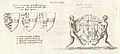 Wenceslas Hollar - Monks Kirby (Feilding).jpg 3,874 × 1,747; 1.38 MB
-
 Withybrook Spinney - geograph.org.uk - 3155771.jpg 640 × 480; 131 KB
-
 Wood Farm Brewery - geograph.org.uk - 4560071.jpg 1,280 × 851; 316 KB
-
 Wood Farm Brewery - geograph.org.uk - 4560075.jpg 1,280 × 851; 278 KB
-
 Manor Farm, Monks Kirby - geograph.org.uk - 171045.jpg 640 × 427; 116 KB
-
 Monks Kirby - Fosse Way - geograph.org.uk - 178428.jpg 640 × 480; 145 KB
-
 Monks Kirby - geograph.org.uk - 80230.jpg 640 × 480; 137 KB


_-_geograph.org.uk_-_2039554.jpg)
_-_geograph.org.uk_-_2039561.jpg)


_-_geograph.org.uk_-_2039586.jpg)
_-_geograph.org.uk_-_2039612.jpg)
_-_geograph.org.uk_-_2039595.jpg)


_-_geograph.org.uk_-_2039638.jpg)
_-_geograph.org.uk_-_2039643.jpg)


_towards_Leicester_-_geograph.org.uk_-_3155726.jpg)
_towards_Leicester_-_geograph.org.uk_-_3155757.jpg)
_towards_Leicester_-_geograph.org.uk_-_3155783.jpg)


.jpg)


