Category:Monk Fryston
Jump to navigation
Jump to search
village and civil parish in North Yorkshire, United Kingdom  | |||||
| Upload media | |||||
| Instance of | |||||
|---|---|---|---|---|---|
| Location | Selby, North Yorkshire, Yorkshire and the Humber, England | ||||
| Said to be the same as | Monk Fryston (Wikimedia duplicated page, civil parish) | ||||
 | |||||
Subcategories
This category has the following 8 subcategories, out of 8 total.
B
- Blue Bell, Monk Fryston (6 F)
C
- The Crown Inn, Monk Fryston (4 F)
H
- Monk Fryston Hall (2 F)
M
- Milford Junction (35 F)
- Milford Sidings (4 F)
- Monk Fryston War Memorial (5 F)
W
Media in category "Monk Fryston"
The following 92 files are in this category, out of 92 total.
-
 66 545 Monk Fryston - geograph.org.uk - 330644.jpg 640 × 411; 127 KB
-
 91 101 heads South - geograph.org.uk - 330549.jpg 640 × 438; 153 KB
-
 A 'Forest' of Pylons - geograph.org.uk - 3110366.jpg 1,530 × 990; 167 KB
-
 A very elegant residence - geograph.org.uk - 3352113.jpg 800 × 533; 173 KB
-
 A63 East near to Selby Fork off the new A1 - geograph.org.uk - 2152458.jpg 1,024 × 768; 196 KB
-
 A63 heading west - geograph.org.uk - 2627267.jpg 1,600 × 1,200; 551 KB
-
 At Fox Bridge - geograph.org.uk - 6344713.jpg 1,280 × 775; 444 KB
-

-
 Brecks Farm, Near Hillam - geograph.org.uk - 254171.jpg 640 × 480; 84 KB
-
 British Rail Class 56 No. 56112 at Monk Fryston - May 2001 - 01.jpg 1,600 × 1,121; 1,009 KB
-
 British Rail Class 56 No. 56112 at Monk Fryston - May 2001 - 02.jpg 1,700 × 1,128; 1,012 KB
-
 British Rail Class 66 No. 66237 at Monk Fryston - May 2001 - 01.jpg 2,130 × 1,271; 1.29 MB
-
 British Rail Class 66 No. 66237 at Monk Fryston - May 2001 - 02.jpg 1,920 × 1,265; 1.28 MB
-
 Butts Lane towards Lumby - geograph.org.uk - 2628692.jpg 1,600 × 1,200; 620 KB
-
 Church of St Wilfred, Monk Fryston - geograph.org.uk - 6341908.jpg 960 × 1,280; 301 KB
-
 Church of St Wilfred, Monk Fryston - geograph.org.uk - 6341909.jpg 960 × 1,280; 369 KB
-
 Church of St Wilfred, Monk Fryston - geograph.org.uk - 6341914.jpg 1,280 × 960; 373 KB
-
 Church of St Wilfred, Monk Fryston - geograph.org.uk - 6341916.jpg 960 × 1,280; 395 KB
-
 Church of St Wilfred, Monk Fryston - geograph.org.uk - 6341920.jpg 1,280 × 960; 362 KB
-

-
 Farm track heading east from Austfield Lane - geograph.org.uk - 5998713.jpg 2,560 × 1,920; 2.38 MB
-
 Farmland east of Austfield Farm - geograph.org.uk - 5998710.jpg 2,560 × 1,920; 2.32 MB
-
 Farmland off Fryston Common Lane - geograph.org.uk - 2627239.jpg 1,600 × 1,200; 447 KB
-
 Farmland off the A63 - geograph.org.uk - 2627216.jpg 640 × 480; 30 KB
-
 Farmland off the A63 - geograph.org.uk - 2627261.jpg 1,600 × 1,200; 376 KB
-
 Farmland off the A63 - geograph.org.uk - 2628688.jpg 1,600 × 1,200; 400 KB
-
 Fields at Monk Fryston - geograph.org.uk - 2918200.jpg 640 × 393; 37 KB
-
 Fields towards the A63, Monk Fryston - geograph.org.uk - 2022378.jpg 640 × 480; 51 KB
-
 Footpath east of the Deer Park - geograph.org.uk - 3410231.jpg 2,048 × 1,536; 431 KB
-

-
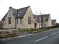 Former school, Monk Fryston - geograph.org.uk - 1167764.jpg 640 × 480; 77 KB
-
 Former Wesleyan chapel, Monk Fryston - geograph.org.uk - 6341940.jpg 1,280 × 960; 461 KB
-
 Former Wesleyan chapel, Monk Fryston - geograph.org.uk - 6341942.jpg 1,280 × 960; 356 KB
-
 Fryston Common Lane - geograph.org.uk - 3352132.jpg 1,600 × 1,066; 730 KB
-
 Fryston Common Lane - geograph.org.uk - 6345414.jpg 1,280 × 960; 313 KB
-
 Fryston Common Lane - geograph.org.uk - 6345422.jpg 1,280 × 960; 342 KB
-
 Fryston Grange Farm - geograph.org.uk - 250971.jpg 640 × 480; 96 KB
-
 Fryston Grange Fishing Pond - geograph.org.uk - 3592623.jpg 2,251 × 1,686; 660 KB
-
 Gates to Monk Fryston Hall - geograph.org.uk - 6341924.jpg 1,280 × 850; 485 KB
-
 Hillam Grange, Hillam - geograph.org.uk - 250961.jpg 640 × 480; 87 KB
-
 Houses on The Crescent, Monk Fryston - geograph.org.uk - 3644929.jpg 800 × 600; 216 KB
-
 Ingthorns Lane Monk Fryston - geograph.org.uk - 3251356.jpg 4,288 × 3,216; 4.53 MB
-
 Kissing Gate - geograph.org.uk - 3352124.jpg 1,600 × 1,066; 557 KB
-
 Lodge cottage, Monk Fryston - geograph.org.uk - 1167750.jpg 640 × 393; 80 KB
-
 Lodge to Monk Fryston Hall - geograph.org.uk - 6341937.jpg 1,280 × 960; 495 KB
-
 Lodges and gateway to Monk Fryston Lodge - geograph.org.uk - 6341895.jpg 1,280 × 960; 363 KB
-
 Looking north along the A162 - geograph.org.uk - 3645051.jpg 800 × 600; 98 KB
-
 Main Street Monk Fryston - geograph.org.uk - 3251388.jpg 3,848 × 2,731; 1.74 MB
-
 Main Street, Monk Fryston (A63) - geograph.org.uk - 2627232.jpg 1,600 × 1,200; 573 KB
-
 Main Street, Monk Fryston - geograph.org.uk - 6341907.jpg 1,280 × 960; 322 KB
-
 Malvern House, Monk Fryston - geograph.org.uk - 6341901.jpg 1,280 × 1,280; 388 KB
-
 Malvern House, Monk Fryston - geograph.org.uk - 6341903.jpg 1,280 × 920; 259 KB
-
 Milford Grange - geograph.org.uk - 293513.jpg 640 × 480; 69 KB
-
 Milford Junction - geograph.org.uk - 6345446.jpg 1,280 × 960; 387 KB
-
 Milford Junction - geograph.org.uk - 6345450.jpg 1,280 × 960; 485 KB
-
 Monk Fryston (8039928838).jpg 2,290 × 2,667; 4.64 MB
-
 Monk Fryston Community Centre - geograph.org.uk - 1167770.jpg 640 × 470; 85 KB
-
 Monk Fryston Deer Park Gates - geograph.org.uk - 3251369.jpg 3,492 × 2,086; 2.74 MB
-
 Monk Fryston Hall - geograph.org.uk - 6341897.jpg 1,280 × 960; 511 KB
-
 Monk Fryston Hall - geograph.org.uk - 6341922.jpg 1,280 × 960; 559 KB
-
 Monk Fryston Lodge Farm - geograph.org.uk - 98454.jpg 640 × 480; 92 KB
-
 Monk Fryston Village Main Street.jpg 640 × 427; 145 KB
-
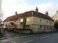
 Monk Fryston village stores - geograph.org.uk - 1167753.jpg 481 × 640; 68 KB
-
 My sweet little boy, tho so dearly we loved thee (8054759475).jpg 2,304 × 3,419; 6.01 MB
-
 Northern end of Monk Fryston - geograph.org.uk - 2918221.jpg 640 × 350; 45 KB
-
 Ordnance Survey Flush Bracket S8673 - geograph.org.uk - 4158435.jpg 4,000 × 3,000; 3.76 MB
-
 Prebendal House, Monk Fryston - geograph.org.uk - 6341913.jpg 1,280 × 960; 503 KB
-

-
 Pylons in the field - geograph.org.uk - 2006218.jpg 640 × 427; 52 KB
-
 Railway tracks at Monk Fryston - geograph.org.uk - 5784401.jpg 800 × 600; 151 KB
-

-
 Siddle Farm - geograph.org.uk - 250972.jpg 640 × 480; 94 KB
-
 Stone House Farmhouse, Monk Fryston - geograph.org.uk - 6341900.jpg 1,280 × 960; 338 KB
-
 Stone House Mews, Monk Fryston - geograph.org.uk - 6341904.jpg 1,280 × 960; 489 KB
-
 Thatched cottage at Monk Fyston - geograph.org.uk - 3251381.jpg 3,904 × 2,601; 1.9 MB
-
 Thatched Cottage, Monk Fryston - geograph.org.uk - 244226.jpg 640 × 480; 81 KB
-
 The cemetery at Monk Fryston - geograph.org.uk - 3644920.jpg 800 × 600; 144 KB
-
 The cemetery at Monk Fryston - geograph.org.uk - 3644922.jpg 800 × 600; 165 KB
-
 The lane to Fryston Grange - geograph.org.uk - 6345419.jpg 1,280 × 960; 460 KB
-
 The lane to Siddle Farm House from the A63 - geograph.org.uk - 6344756.jpg 1,280 × 960; 476 KB
-
 The Manor House, Monk Fryston - geograph.org.uk - 6341899.jpg 1,280 × 960; 355 KB
-
 Track off Fryston Common Lane - geograph.org.uk - 2627237.jpg 1,600 × 1,200; 520 KB
-
 Track to Siddle Farm House - geograph.org.uk - 2627222.jpg 1,600 × 1,200; 423 KB
-
 View to Monk Fryston Lodge - geograph.org.uk - 244468.jpg 640 × 480; 40 KB
-
 Village store, Monk Fryston - geograph.org.uk - 6341944.jpg 1,280 × 960; 369 KB
-
 Village Stores, Monk Fryston - geograph.org.uk - 2627223.jpg 1,600 × 1,200; 380 KB
-
 Where lies Samuel Hemingley? (8057276094).jpg 1,982 × 3,399; 5.88 MB
-
 Bowers House farm, Hillam - geograph.org.uk - 244160.jpg 640 × 480; 90 KB
-

-
 Monk Fryston Village Main Street - geograph.org.uk - 104925.jpg 640 × 427; 147 KB
-
 Northfield Farm, Birkin - geograph.org.uk - 244148.jpg 640 × 480; 83 KB
-
 The grounds of Monk Fryston Lodge. - geograph.org.uk - 244047.jpg 640 × 480; 123 KB


_-_geograph.org.uk_-_2627232.jpg)


.jpg)


.jpg)


.jpg)


