Category:Monikie
Jump to navigation
Jump to search
village in Angus, Scotland, UK  | |||||
| Upload media | |||||
| Instance of | |||||
|---|---|---|---|---|---|
| Location |
| ||||
 | |||||
Media in category "Monikie"
The following 67 files are in this category, out of 67 total.
-
 Bales - geograph.org.uk - 562428.jpg 640 × 364; 61 KB
-
 Barley fields south of Husbandtown - geograph.org.uk - 14122.jpg 640 × 480; 101 KB
-
 Bractullo, near Monikie - geograph.org.uk - 663389.jpg 640 × 480; 88 KB
-
 Camuston Avenue.JPG 3,072 × 2,304; 2.95 MB
-
 Countryside near Bractullo, Monikie - geograph.org.uk - 663370.jpg 640 × 480; 82 KB
-
 Cows - geograph.org.uk - 562415.jpg 550 × 640; 117 KB
-
 Craigton school.jpg 600 × 403; 62 KB
-
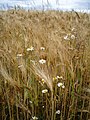 Daisies and ripening barley - geograph.org.uk - 493873.jpg 480 × 640; 103 KB
-
 Downiebank - geograph.org.uk - 576325.jpg 640 × 427; 242 KB
-
 East Denside farm - geograph.org.uk - 9995.jpg 640 × 480; 86 KB
-
 East Hillhead farm - geograph.org.uk - 17452.jpg 640 × 480; 156 KB
-
 Fairnyfauld - geograph.org.uk - 14133.jpg 640 × 480; 98 KB
-
 Fallaws - geograph.org.uk - 701165.jpg 640 × 320; 194 KB
-
 Farmland near Husbandtown - geograph.org.uk - 14114.jpg 640 × 480; 88 KB
-
 Farmland near West Bankhead - geograph.org.uk - 14155.jpg 640 × 480; 107 KB
-
 Farmland south of Bractullo - geograph.org.uk - 493807.jpg 640 × 480; 67 KB
-
 Field Drain near Fallaws - geograph.org.uk - 701150.jpg 640 × 427; 268 KB
-
 Field entrance - geograph.org.uk - 493864.jpg 640 × 480; 80 KB
-
 Former Railway Bridge - geograph.org.uk - 701168.jpg 640 × 405; 241 KB
-
 Harecairn transmitter from East Bankhead - geograph.org.uk - 14130.jpg 640 × 480; 121 KB
-
 Luckyslap - Carrot Hill Road - geograph.org.uk - 663407.jpg 640 × 480; 63 KB
-
 Mains of Panmure Farm - geograph.org.uk - 17086.jpg 640 × 480; 80 KB
-
 Monikie Village Hall - geograph.org.uk - 10008.jpg 640 × 480; 116 KB
-
 Newlandhead farm - geograph.org.uk - 14126.jpg 640 × 480; 112 KB
-
 Newton of Affleck farm - geograph.org.uk - 9996.jpg 640 × 480; 105 KB
-
 Ploughed Field - geograph.org.uk - 701155.jpg 640 × 427; 233 KB
-
 Pylons, West Denside - geograph.org.uk - 16809.jpg 640 × 480; 79 KB
-
 Sawmill, Panmure Estate - geograph.org.uk - 17379.jpg 640 × 480; 188 KB
-
 The northwest end of Crombie reservoir. - geograph.org.uk - 433249.jpg 640 × 480; 100 KB
-
 The old manse Monikie - geograph.org.uk - 738780.jpg 600 × 428; 132 KB
-
 Transmitter at Harecairn - geograph.org.uk - 14120.jpg 480 × 640; 41 KB
-
 View to Old Downie farm - geograph.org.uk - 11615.jpg 640 × 480; 105 KB
-

-
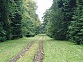
 Avenue of trees, Panmure estate - geograph.org.uk - 17381.jpg 640 × 480; 179 KB
-
 Barley, Mains of Panmure - geograph.org.uk - 1437585.jpg 640 × 480; 105 KB
-
 Beech wood, Crombie Country Park. - geograph.org.uk - 433231.jpg 480 × 640; 133 KB
-
 Blueberries^ being grown commercially - geograph.org.uk - 17092.jpg 640 × 480; 114 KB
-
 Boats on Crombie reservoir. - geograph.org.uk - 433209.jpg 640 × 480; 113 KB
-
 Boghall - geograph.org.uk - 17464.jpg 640 × 480; 122 KB
-
 Carmyllie Moor - geograph.org.uk - 291738.jpg 640 × 481; 91 KB
-
 Crombie Country Park. - geograph.org.uk - 426937.jpg 424 × 640; 104 KB
-
 Crombie Reservoir - geograph.org.uk - 363687.jpg 640 × 360; 103 KB
-
 Cunmont Farm - geograph.org.uk - 10010.jpg 640 × 480; 175 KB
-
 Cunmont Quarry - geograph.org.uk - 10012.jpg 640 × 480; 127 KB
-
 Deer hide, Crombie Country Park. - geograph.org.uk - 433238.jpg 640 × 480; 112 KB
-
 Derelict granary in Monikie - geograph.org.uk - 10004.jpg 480 × 640; 118 KB
-
 Disused field entrance - geograph.org.uk - 427700.jpg 640 × 480; 127 KB
-
 Farmland, beside Whigstreet. - geograph.org.uk - 427872.jpg 640 × 480; 59 KB
-
 Geographing..... run that past us again - geograph.org.uk - 17370.jpg 640 × 480; 129 KB
-
 Guildymuir Pendacle. - geograph.org.uk - 433189.jpg 640 × 480; 83 KB
-
 Inside Cunmont Quarry - geograph.org.uk - 10015.jpg 640 × 480; 133 KB
-

-
 Kirkton of Monikie - geograph.org.uk - 738775.jpg 600 × 378; 106 KB
-

-
 Looking Towards Glen Clova - geograph.org.uk - 291743.jpg 640 × 481; 91 KB
-
 Monikie Country Park - geograph.org.uk - 9999.jpg 640 × 480; 110 KB
-
 Monikie village store and post office - geograph.org.uk - 9997.jpg 640 × 480; 133 KB
-
 Pitairlie Moor Plantation - geograph.org.uk - 17372.jpg 640 × 480; 131 KB
-
 Rhododendrons, Crombie Country park - geograph.org.uk - 433174.jpg 640 × 480; 101 KB
-
 Rose in garden of ruined cottages - geograph.org.uk - 493834.jpg 480 × 640; 112 KB
-

-
 Struan Cottage, Panmure Road, Monikie - geograph.org.uk - 104796.jpg 640 × 480; 68 KB
-
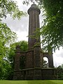 The Panmure Testimonial - geograph.org.uk - 17376.jpg 480 × 640; 155 KB
-
 Track beside the Downiemoor Burn - geograph.org.uk - 562399.jpg 640 × 527; 102 KB
-
 Track in a field, beyond Fallaws - geograph.org.uk - 562224.jpg 640 × 480; 134 KB
-
 West Hillhead farm - geograph.org.uk - 17459.jpg 640 × 480; 146 KB
-
 Wrong side of the shelter belt^ - geograph.org.uk - 17082.jpg 640 × 480; 144 KB


