Category:Mollington, Oxfordshire
Jump to navigation
Jump to search
village and civil parish in Cherwell district, Oxfordshire, England  | |||||
| Upload media | |||||
| Instance of | |||||
|---|---|---|---|---|---|
| Location | Cherwell, Oxfordshire, South East England, England | ||||
| Population |
| ||||
| Area |
| ||||
| Said to be the same as | Mollington (Wikimedia duplicated page, civil parish) | ||||
 | |||||
English: Mollington is a village in Oxfordshire.
Subcategories
This category has only the following subcategory.
A
Media in category "Mollington, Oxfordshire"
The following 67 files are in this category, out of 67 total.
-
 A423 east of Mollington - geograph.org.uk - 3124001.jpg 3,402 × 2,627; 1.6 MB
-
 A423 junction with Mollington Road - geograph.org.uk - 3123990.jpg 3,438 × 2,522; 1.08 MB
-
 All Saints Church, Mollington - geograph.org.uk - 6300597.jpg 1,024 × 667; 162 KB
-
 All Saints, Mollington, cross - geograph.org.uk - 5098707.jpg 640 × 480; 61 KB
-
 All Saints, Mollington, cwgc grave - geograph.org.uk - 5098700.jpg 480 × 640; 76 KB
-
 All Saints, Mollington, graves - geograph.org.uk - 5098705.jpg 640 × 480; 59 KB
-

-

-
 All Saints, Mollington, path - geograph.org.uk - 5098706.jpg 640 × 480; 108 KB
-
 All Saints, Mollington, south door - geograph.org.uk - 5098711.jpg 480 × 640; 80 KB
-
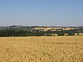
 Arable field near Mollington - geograph.org.uk - 1994533.jpg 1,500 × 987; 294 KB
-
 Clattercote Reservoir - geograph.org.uk - 2627195.jpg 640 × 480; 59 KB
-
 Fields near Mollington - geograph.org.uk - 3488951.jpg 640 × 480; 66 KB
-
 Footpath to Cropredy - geograph.org.uk - 202612.jpg 640 × 480; 56 KB
-
 Houses in Mollington - geograph.org.uk - 3488960.jpg 640 × 479; 68 KB
-
 Inside All Saints, Mollington (A) - geograph.org.uk - 5098715.jpg 480 × 640; 38 KB
-
 Inside All Saints, Mollington (B) - geograph.org.uk - 5098717.jpg 640 × 480; 51 KB
-
 Inside All Saints, Mollington (C) - geograph.org.uk - 5098721.jpg 640 × 480; 61 KB
-
 Inside All Saints, Mollington (D) - geograph.org.uk - 5098723.jpg 480 × 640; 55 KB
-
 Inside All Saints, Mollington (E) - geograph.org.uk - 5098726.jpg 480 × 640; 69 KB
-

-
 Junction of Whiteway and School Hill - geograph.org.uk - 5098680.jpg 640 × 480; 82 KB
-
 M40 - geograph.org.uk - 3488930.jpg 640 × 480; 89 KB
-
 M40 - March Road Bridge - geograph.org.uk - 3250827.jpg 640 × 375; 25 KB
-
 M40 east of Warmington - geograph.org.uk - 2829654.jpg 640 × 480; 36 KB
-
 M40 entering Oxfordshire - geograph.org.uk - 3250954.jpg 640 × 588; 50 KB
-

-
 M40 motorway - March Road bridge - geograph.org.uk - 3025556.jpg 640 × 480; 56 KB
-
 M40 motorway near Great Ground Barn - geograph.org.uk - 3025569.jpg 640 × 480; 48 KB
-
 M40 motorway north of Shotteswell - geograph.org.uk - 3025548.jpg 640 × 480; 55 KB
-

-
 M40 north of Valley Farm - geograph.org.uk - 3155007.jpg 640 × 441; 32 KB
-
 M40 northbound - geograph.org.uk - 3224342.jpg 640 × 480; 48 KB
-
 M40, March Road overbridge - geograph.org.uk - 2463906.jpg 640 × 383; 27 KB
-
 March Road Mollington - geograph.org.uk - 131897.jpg 640 × 482; 103 KB
-
 Mast by the M40 - geograph.org.uk - 4508869.jpg 640 × 426; 81 KB
-
 Mollington Farmland - geograph.org.uk - 3938579.jpg 1,024 × 768; 189 KB
-
 Mollington-All Saints Church - geograph.org.uk - 2126756.jpg 640 × 480; 146 KB
-
 Mollington-Lower Farm Lane - geograph.org.uk - 6213058.jpg 1,600 × 1,067; 721 KB
-
 Mollington-The Green Man - geograph.org.uk - 2131537.jpg 640 × 480; 99 KB
-
 Northbound M40 near Warmington - geograph.org.uk - 3299405.jpg 640 × 480; 390 KB
-
 Path to Mollington Church - geograph.org.uk - 5098682.jpg 640 × 480; 89 KB
-
 Rush hour in Mollington - geograph.org.uk - 5098685.jpg 640 × 480; 69 KB
-
 Seven Shires Way - geograph.org.uk - 2698814.jpg 640 × 480; 102 KB
-
 Seven Shires Way - geograph.org.uk - 2698835.jpg 640 × 480; 72 KB
-
 Seven Shires Way - geograph.org.uk - 2698842.jpg 640 × 480; 82 KB
-
 Seven Shires Way - geograph.org.uk - 2698853.jpg 640 × 480; 76 KB
-
 Seven Shires Way - geograph.org.uk - 2698867.jpg 640 × 480; 73 KB
-
 Sewage Works Gate - geograph.org.uk - 3488956.jpg 640 × 480; 77 KB
-
 Southam Road at Mollington - geograph.org.uk - 2837374.jpg 640 × 480; 50 KB
-
 Southam Road looking north - geograph.org.uk - 2836571.jpg 640 × 480; 41 KB
-
 Southam Road north of Mollington - geograph.org.uk - 2837965.jpg 640 × 482; 65 KB
-
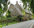 Thatched cottages,Mollington - geograph.org.uk - 131146.jpg 640 × 518; 131 KB
-
 The A423 to Banbury - geograph.org.uk - 1994508.jpg 1,500 × 1,000; 259 KB
-
 The A423, approaching the turn-off to Farnborough - geograph.org.uk - 1890817.jpg 3,296 × 2,472; 1.87 MB
-

-
 The jetty,Mollington - geograph.org.uk - 131144.jpg 480 × 640; 167 KB
-
 The M40 runs under March Road - geograph.org.uk - 5763592.jpg 2,700 × 2,025; 290 KB
-
 The road to Mollington - geograph.org.uk - 1994510.jpg 1,500 × 1,000; 245 KB
-

-
 Bourton Fields Farm - geograph.org.uk - 202607.jpg 640 × 480; 75 KB
-
 Farmland near Great Bourton - geograph.org.uk - 163723.jpg 640 × 427; 159 KB
-
 Green Man Inn, Mollington - geograph.org.uk - 131142.jpg 640 × 482; 105 KB
-
 Ride to Cropredy Lawn - geograph.org.uk - 202615.jpg 640 × 480; 43 KB
-
 The Old Chapel, Mollington - geograph.org.uk - 131145.jpg 482 × 640; 150 KB
-
 The Old School Mollington - geograph.org.uk - 131143.jpg 640 × 482; 135 KB
-
 View towards Cropredy - geograph.org.uk - 202610.jpg 640 × 480; 53 KB


_-_geograph.org.uk_-_5098715.jpg)
_-_geograph.org.uk_-_5098717.jpg)
_-_geograph.org.uk_-_5098721.jpg)
_-_geograph.org.uk_-_5098723.jpg)
_-_geograph.org.uk_-_5098726.jpg)


