Category:Molenweg 33, Giethoorn
Jump to navigation
Jump to search
| Object location | | View all coordinates using: OpenStreetMap |
|---|
building in the Netherlands  | |||||
| Upload media | |||||
| Instance of | |||||
|---|---|---|---|---|---|
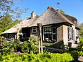
| Location | Giethoorn, Steenwijkerland, Overijssel, Netherlands | ||||
| Street address |
| ||||
| Located on street |
| ||||
| Heritage designation |
| ||||
 | |||||
|
This is a category about rijksmonument number 10517
|
| Address |
|
Media in category "Molenweg 33, Giethoorn"
The following 6 files are in this category, out of 6 total.
-
 Aanzicht - Giethoorn - 20078404 - RCE.jpg 1,200 × 803; 341 KB
-
 Deel zijgevel - Giethoorn - 20507670 - RCE.jpg 1,200 × 900; 188 KB
-
 Molenweg 33 Giethoorn.jpg 3,648 × 2,736; 1.43 MB
-
 Voorgevel - Giethoorn - 20507673 - RCE.jpg 1,200 × 900; 201 KB
-
 Zij- en voorgevel - Giethoorn - 20507672 - RCE.jpg 1,200 × 900; 187 KB
-
 Zijgevel woonged. - Giethoorn - 20507671 - RCE.jpg 1,200 × 900; 177 KB


