Category:Molen De Hoop, Hellevoetsluis
Jump to navigation
Jump to search
| Object location | | View all coordinates using: OpenStreetMap |
|---|
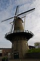
windmill in Hellevoetsluis, Netherlands  | |||||
| Upload media | |||||
| Instance of | |||||
|---|---|---|---|---|---|
| Location | Hellevoetsluis, Voorne aan Zee, South Holland, Netherlands | ||||
| Street address |
| ||||
| Located on street |
| ||||
| Has use | |||||
| Heritage designation |
| ||||
| Inception |
| ||||
| Source of energy | |||||
 | |||||
|
This is a category about rijksmonument number 21410
|
| Address |
|
Media in category "Molen De Hoop, Hellevoetsluis"
The following 30 files are in this category, out of 30 total.
-
 15-26 285A032 Burgemeester van der Jagtkade Hellevoetsluis waterkelders 19e eeuw 2001.tif 2,214 × 1,413; 8.98 MB
-
 Bovenwiel Hellevoetsluis.jpg 960 × 720; 117 KB
-
 De Hoop - panoramio (1).jpg 4,928 × 3,264; 7.48 MB
-
 De Hoop - panoramio (2).jpg 3,264 × 4,928; 13.08 MB
-
 De Hoop - panoramio.jpg 4,928 × 3,264; 10.17 MB
-
 De Hoop Hellevoetsluis.jpg 960 × 720; 107 KB
-
 De Hoop te hellevoetsluis.jpg 720 × 960; 79 KB
-
 Exterieur OVERZICHT - Hellevoetsluis - 20270366 - RCE.jpg 953 × 1,200; 250 KB
-
 Hellevoetsluis - molen De Hoop bij nacht.jpg 1,300 × 1,950; 1.52 MB
-
 Hellevoetsluis 005.jpg 1,600 × 1,200; 759 KB
-
 Hellevoetsluis 007.jpg 1,114 × 1,538; 1.07 MB
-
 Hellevoetsluis 009.jpg 1,600 × 1,200; 1.27 MB
-
 Hellevoetsluis 128.jpg 4,608 × 3,456; 3.23 MB
-
 Hellevoetsluis 129.jpg 3,456 × 4,608; 3.49 MB
-
 Hellevoetsluis 130.jpg 3,456 × 4,608; 3.32 MB
-
 Hellevoetsluis 131.jpg 4,608 × 3,456; 2.88 MB
-
 Hellevoetsluis 132.jpg 3,456 × 4,608; 3.13 MB
-
 Hellevoetsluis molen - panoramio.jpg 1,200 × 1,600; 699 KB
-
 Hellevoetsluis, Netherlands - panoramio (35).jpg 4,896 × 3,264; 5.5 MB
-
 Hellevoetsluis,2010 (49) (8221078790).jpg 2,563 × 3,565; 1.43 MB
-
 Hellevoetsluis,2010 (50) (8221077040).jpg 2,912 × 4,368; 2.35 MB
-
 Korenmolen "De Hoop", exterieur - Hellevoetsluis - 20107904 - RCE.jpg 951 × 1,200; 222 KB
-
 Korenmolen "De Hoop", exterieur - Hellevoetsluis - 20107905 - RCE.jpg 949 × 1,200; 175 KB
-
 Korenmolen "De Hoop", overzicht - Hellevoetsluis - 20107902 - RCE.jpg 1,200 × 946; 261 KB
-
 Korenmolen "De Hoop", overzicht - Hellevoetsluis - 20107903 - RCE.jpg 953 × 1,200; 240 KB
-
 Molen - Hellevoetsluis - 20107896 - RCE.jpg 807 × 1,200; 144 KB
-
 Molen - panoramio (3).jpg 3,264 × 4,928; 7.48 MB
-
 Molen de Hoop H'sluis - maanlicht.jpg 3,765 × 2,510; 1.89 MB
-
 Molen de Hoop H'sluis - verguld.jpg 2,549 × 3,824; 2.38 MB
-
 Molen, overzicht - Hellevoetsluis - 20107906 - RCE.jpg 1,190 × 1,200; 293 KB

.jpg)
.jpg)


.jpg)
_(8221078790).jpg)
_(8221077040).jpg)


.jpg)


