Category:Moddershall
Jump to navigation
Jump to search
village in Staffordshire, England, UK  | |||||
| Upload media | |||||
| Instance of | |||||
|---|---|---|---|---|---|
| Location | Stone Rural, Stafford, Staffordshire, West Midlands, England | ||||
 | |||||
Media in category "Moddershall"
The following 23 files are in this category, out of 23 total.
-
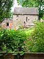
 All Saints' church, Moddershall - geograph.org.uk - 1805828.jpg 717 × 538; 176 KB
-
 All Saints' churchyard - geograph.org.uk - 1805831.jpg 717 × 538; 188 KB
-
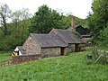
 Barn on Stallington Road, Moddershall - geograph.org.uk - 199444.jpg 640 × 480; 80 KB
-
 Driveway to Moddershall Cricket Club - geograph.org.uk - 2702945.jpg 640 × 428; 67 KB
-
 Ivy Mill, Moddershall Valley - geograph.org.uk - 668669.jpg 640 × 427; 100 KB
-
 Moddershall Cricket Club - geograph.org.uk - 517155.jpg 640 × 480; 87 KB
-
 Moddershall Mill - geograph.org.uk - 199368.jpg 640 × 480; 111 KB
-
 Moddershall Mill - geograph.org.uk - 199370.jpg 480 × 640; 116 KB
-
 Moddershall Phone - geograph.org.uk - 1892788.jpg 600 × 800; 239 KB
-
 Moddershall Sports Ground - geograph.org.uk - 1805810.jpg 717 × 538; 172 KB
-
 Moddershall View - geograph.org.uk - 1892799.jpg 640 × 399; 95 KB
-
 Mosty Lea Mill.jpg 640 × 480; 86 KB
-
 Sign and Mast - geograph.org.uk - 516827.jpg 480 × 640; 108 KB
-
 Splashy Mill - geograph.org.uk - 551570.jpg 640 × 480; 151 KB
-
 The bench mark plate on the trig point - geograph.org.uk - 1805815.jpg 480 × 640; 187 KB
-

-

-
 Top or Splashy Mill, Moddershall - geograph.org.uk - 668653.jpg 640 × 427; 104 KB
-
 Top or Splashy Mill, Moddershall. - geograph.org.uk - 668657.jpg 640 × 427; 92 KB
-
 Trig Point Above Moddershall - geograph.org.uk - 516824.jpg 640 × 480; 77 KB
-
 Trig point and the sports field - geograph.org.uk - 1805812.jpg 819 × 614; 180 KB
-

-
 Village duck pond at Moddershall - geograph.org.uk - 199430.jpg 480 × 640; 104 KB


