Category:Mixbury
Jump to navigation
Jump to search
village and civil parish in Cherwell district, Oxfordshire, England  | |||||
| Upload media | |||||
| Instance of | |||||
|---|---|---|---|---|---|
| Location | Cherwell, Oxfordshire, South East England, England | ||||
| Population |
| ||||
| Area |
| ||||
 | |||||
English: Mixbury is a village and civil parish in Oxfordshire, about southeast of Brackley in Northamptonshire.
Subcategories
This category has the following 3 subcategories, out of 3 total.
M
- Mixbury House (4 F)
- Mixbury milestone (3 F)
Media in category "Mixbury"
The following 124 files are in this category, out of 124 total.
-
 A421 crossroads near Mixbury Lodge - geograph.org.uk - 3154540.jpg 640 × 422; 69 KB
-
 A421 entering Northamptonshire - geograph.org.uk - 3154549.jpg 640 × 431; 54 KB
-
 All Saints' Church, Mixbury - geograph.org.uk - 6281888.jpg 800 × 600; 164 KB
-
 All Saints' Mixbury - geograph.org.uk - 5131300.jpg 1,066 × 1,600; 601 KB
-
 All Saints' Mixbury - geograph.org.uk - 5131306.jpg 1,600 × 1,066; 497 KB
-
 Alongside Park Thorns - geograph.org.uk - 4390926.jpg 1,024 × 768; 203 KB
-
 Barn, Mixbury - geograph.org.uk - 6281879.jpg 640 × 480; 61 KB
-
 Bend on road towards Evenley and Brackley - geograph.org.uk - 6579324.jpg 1,024 × 684; 370 KB
-
 Bridge over dismantled railway - geograph.org.uk - 5129825.jpg 1,600 × 1,066; 573 KB
-
 Bridleway through Park Thorns - geograph.org.uk - 4390931.jpg 1,024 × 768; 344 KB
-
 Bridleway through Park Thorns - geograph.org.uk - 4390935.jpg 1,024 × 768; 345 KB
-
 Bridleway to Finmere - geograph.org.uk - 4390971.jpg 1,024 × 768; 133 KB
-
 Bridleway to Park Thorns - geograph.org.uk - 5131421.jpg 1,600 × 1,066; 443 KB
-
 Bridleway to Shelswell - geograph.org.uk - 4384424.jpg 1,024 × 768; 187 KB
-
 Bridleway to Westbury Mill - geograph.org.uk - 5129817.jpg 1,600 × 1,066; 583 KB
-
 Bridleway towards Shelswell Park - geograph.org.uk - 5131423.jpg 1,600 × 1,066; 412 KB
-
 Cherwell , The A421 - geograph.org.uk - 6113567.jpg 6,000 × 4,000; 6.98 MB
-
 Cherwell , The A421 - geograph.org.uk - 6113568.jpg 6,000 × 4,000; 3.14 MB
-
 Church Lane, Mixbury - geograph.org.uk - 5948576.jpg 1,024 × 684; 276 KB
-
 Church Lane, Mixbury - geograph.org.uk - 6281924.jpg 640 × 480; 134 KB
-
 Churchyard All Saints' Mixbury and the Old Rectory - geograph.org.uk - 4307010.jpg 4,320 × 3,240; 5.67 MB
-

-
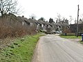
 Cottages and modern houses, Mixbury - geograph.org.uk - 143134.jpg 640 × 427; 110 KB
-
 Cottages, Mixbury - geograph.org.uk - 143128.jpg 640 × 427; 101 KB
-
 Cottages, Mixbury - geograph.org.uk - 4385261.jpg 1,024 × 768; 181 KB
-
 Dung heap in Fulwell - geograph.org.uk - 6712368.jpg 1,888 × 1,230; 2.26 MB
-
 Elizabeth II postbox on near Fulwell Cottages - geograph.org.uk - 6282402.jpg 3,888 × 5,184; 7.21 MB
-
 Entering Mixbury - geograph.org.uk - 4072502.jpg 640 × 454; 58 KB
-
 Entering Mixbury - geograph.org.uk - 6281881.jpg 800 × 600; 147 KB
-
 Evenley Road, Mixbury - geograph.org.uk - 6281920.jpg 800 × 600; 173 KB
-
 Evenly Road - Mixbury - geograph.org.uk - 4072501.jpg 800 × 557; 78 KB
-
 Farmland off Church Lane, Mixbury - geograph.org.uk - 6281923.jpg 640 × 480; 66 KB
-
 Field in Fulwell - geograph.org.uk - 6683409.jpg 1,888 × 1,230; 1.92 MB
-
 Field in Fulwell - geograph.org.uk - 6684190.jpg 1,920 × 1,280; 1.5 MB
-
 Field in Fulwell - geograph.org.uk - 6712365.jpg 1,920 × 1,280; 1.33 MB
-
 Field in Mixbury - geograph.org.uk - 6682787.jpg 1,920 × 1,280; 1.54 MB
-
 Footpath along the edge of The Hulls - geograph.org.uk - 5804090.jpg 1,600 × 1,066; 514 KB
-
 Footpath goes into Shelswell Park - geograph.org.uk - 5131362.jpg 1,600 × 1,066; 473 KB
-
 Footpath into Mixbury - geograph.org.uk - 5131321.jpg 1,600 × 1,066; 545 KB
-
 Footpath through the corn - geograph.org.uk - 5131245.jpg 1,600 × 1,066; 540 KB
-
 Footpath to Coldharbour Farm - geograph.org.uk - 5804015.jpg 1,600 × 1,066; 529 KB
-
 Footpath to Coldharbour Farm - geograph.org.uk - 5804069.jpg 1,600 × 1,066; 460 KB
-
 Footpath to Mixbury - geograph.org.uk - 4384437.jpg 1,024 × 768; 266 KB
-
 Footpath to Mixbury - geograph.org.uk - 5791529.jpg 1,600 × 1,066; 757 KB
-
 Footpath to Mixbury Hall Farm - geograph.org.uk - 5131312.jpg 1,600 × 1,066; 642 KB
-
 Footpath towards Finmere - geograph.org.uk - 5129826.jpg 1,600 × 1,066; 455 KB
-
 Footpath towards Juniper Hill - geograph.org.uk - 5804080.jpg 1,600 × 1,066; 528 KB
-
 Footpath towards Park Thorns - geograph.org.uk - 5131343.jpg 1,600 × 1,066; 498 KB
-
 Fulwell Cottages - geograph.org.uk - 6281935.jpg 800 × 600; 98 KB
-
 Fulwell Road - geograph.org.uk - 6711584.jpg 1,812 × 1,090; 1.49 MB
-
 Gate in the hedge - geograph.org.uk - 5179849.jpg 1,024 × 768; 252 KB
-
 Gate into woodland - geograph.org.uk - 4384422.jpg 1,024 × 768; 340 KB
-
 Great Central Railway Bridge - geograph.org.uk - 5084642.jpg 1,600 × 1,200; 689 KB
-
 Hayrake at rest - geograph.org.uk - 5175647.jpg 1,024 × 768; 337 KB
-
 House on Evenley Road, Mixbury - geograph.org.uk - 6281916.jpg 640 × 483; 118 KB
-
 Houses on Evenley Road, Mixbury - geograph.org.uk - 5948595.jpg 1,024 × 684; 350 KB
-
 Houses on Evenley Road, Mixbury - geograph.org.uk - 6281884.jpg 800 × 600; 108 KB
-
 Lane and field in Mixbury - geograph.org.uk - 6682782.jpg 1,818 × 1,102; 1.38 MB
-
 Lane to Westbury - geograph.org.uk - 5129799.jpg 1,600 × 1,066; 559 KB
-
 Meeting of path and bridleway near Park Thorns - geograph.org.uk - 4390921.jpg 1,024 × 768; 127 KB
-
 Minor road near Fulwell Cottages - geograph.org.uk - 6282408.jpg 5,184 × 3,888; 4.88 MB
-
 Bridge over dismantled railway - geograph.org.uk - 339339.jpg 640 × 480; 113 KB
-
 Dismantled Railway - geograph.org.uk - 339343.jpg 640 × 480; 123 KB
-
 Mixbury Church - geograph.org.uk - 5080729.jpg 1,600 × 1,200; 667 KB
-
 Mixbury House - panoramio.jpg 360 × 240; 61 KB
-
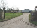
 Mixbury Lodge Farm - geograph.org.uk - 339330.jpg 640 × 480; 146 KB
-
 Mixbury Recycling - geograph.org.uk - 5084658.jpg 1,600 × 1,200; 584 KB
-
 Mixbury Road, Mixbury - geograph.org.uk - 6281882.jpg 800 × 600; 120 KB
-
 Mixbury turning from A421 - geograph.org.uk - 3154541.jpg 640 × 454; 42 KB
-
 Mixbury-Great Central Railway - geograph.org.uk - 5080711.jpg 1,600 × 1,200; 472 KB
-
 Old Toll House, Finmere - geograph.org.uk - 6114672.jpg 640 × 416; 144 KB
-
 Pasture in front of Middle Farm - geograph.org.uk - 5131339.jpg 1,600 × 1,066; 316 KB
-
 Pasture on the way out of Mixbury - geograph.org.uk - 5131269.jpg 1,600 × 1,067; 320 KB
-
 Path junction with Park Thorn beyond - geograph.org.uk - 5129833.jpg 1,600 × 1,066; 415 KB
-
 Path towards Coldharbour Farm - geograph.org.uk - 5131354.jpg 1,600 × 1,066; 376 KB
-
 Pylons by Mixbury - geograph.org.uk - 5129823.jpg 1,600 × 1,066; 312 KB
-
 Angel Witch - geograph.org.uk - 339341.jpg 640 × 480; 130 KB
-
 Great Central Railway Bridge - geograph.org.uk - 393571.jpg 640 × 436; 123 KB
-
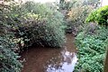 River Great Ouse - geograph.org.uk - 5129796.jpg 1,600 × 1,066; 769 KB
-
 Road to Evenley - geograph.org.uk - 5179844.jpg 1,024 × 768; 340 KB
-
 Road to Mixbury - geograph.org.uk - 339358.jpg 537 × 640; 92 KB
-
 Road towards Evenley - geograph.org.uk - 5179854.jpg 1,024 × 768; 200 KB
-
 Roadside shrubbery by the entrance to Monk's House - geograph.org.uk - 5791391.jpg 1,600 × 1,066; 444 KB
-
 Seven Shires Way - geograph.org.uk - 2736873.jpg 640 × 480; 99 KB
-
 Seven Shires Way - geograph.org.uk - 2737614.jpg 640 × 480; 68 KB
-
 Seven Shires Way - geograph.org.uk - 2737616.jpg 640 × 480; 133 KB
-
 Seven Shires Way - geograph.org.uk - 2737621.jpg 640 × 480; 123 KB
-
 Seven Shires Way - geograph.org.uk - 5129819.jpg 1,600 × 1,066; 636 KB
-
 Seven Shires Way under the disused railway bridge - geograph.org.uk - 5129813.jpg 1,600 × 1,066; 572 KB
-
 Sheep near Monk's House - geograph.org.uk - 5175660.jpg 1,024 × 768; 214 KB
-
 Shelswell Park lodge - geograph.org.uk - 5131369.jpg 1,600 × 1,066; 584 KB
-
 South Northamptonshire , The A421 - geograph.org.uk - 6113566.jpg 6,000 × 4,000; 7.27 MB
-
 Stand of trees by River Great Ouse - geograph.org.uk - 5216126.jpg 640 × 480; 153 KB
-
 Stonepit Spinney - geograph.org.uk - 5129800.jpg 1,600 × 1,066; 437 KB
-
 Stonepit Spinney, Fulwell - geograph.org.uk - 6712367.jpg 1,920 × 1,280; 1.8 MB
-

-
 Stubble field near Fulwell Cottages - geograph.org.uk - 6281937.jpg 800 × 600; 93 KB
-
 Stubble field near Tibbets Farm - geograph.org.uk - 6281930.jpg 640 × 480; 79 KB
-
 The old A421 heading for Monk's House - geograph.org.uk - 5791397.jpg 1,600 × 1,066; 547 KB
-
 The Old School House, Mixbury - geograph.org.uk - 4385250.jpg 1,024 × 768; 249 KB
-
 The Pits - geograph.org.uk - 5804063.jpg 1,600 × 1,066; 429 KB
-
 The Pits across a field - geograph.org.uk - 5131334.jpg 1,600 × 1,066; 454 KB
-
 The private road by Monk's House - geograph.org.uk - 2736879.jpg 640 × 480; 92 KB
-
 Tibbett's Farm - geograph.org.uk - 4385238.jpg 1,024 × 768; 194 KB
-
 Track towards Westbury - geograph.org.uk - 5131233.jpg 1,600 × 1,066; 534 KB
-
 Tree on Hethe Road near Evenley - geograph.org.uk - 6652053.jpg 1,920 × 1,280; 1.36 MB
-
 View towards a small plantation - geograph.org.uk - 4390979.jpg 1,024 × 768; 170 KB
-
 View towards The Pits - geograph.org.uk - 5179836.jpg 1,024 × 768; 150 KB
-
 Watchful Cow - geograph.org.uk - 339292.jpg 640 × 480; 68 KB
-
 Wheat field by the footpath - geograph.org.uk - 5804084.jpg 1,600 × 1,066; 414 KB
-
 Church Lane, Mixbury - geograph.org.uk - 143132.jpg 640 × 427; 99 KB
-
 Coldharbour Farm - geograph.org.uk - 339307.jpg 640 × 497; 72 KB
-
 Coldharbour Farm - geograph.org.uk - 339317.jpg 640 × 480; 119 KB
-
 House at Coldharbour Farm - geograph.org.uk - 339312.jpg 640 × 480; 95 KB
-
 Middle Farm Barn - geograph.org.uk - 339301.jpg 640 × 480; 67 KB
-
 Middle Farm Barns - geograph.org.uk - 339297.jpg 640 × 480; 133 KB
-
 Mixbury - geograph.org.uk - 339349.jpg 640 × 480; 79 KB
-
 Mixbury Hall Farm - geograph.org.uk - 339360.jpg 640 × 480; 63 KB
-
 Mixbury Lodge Farm - geograph.org.uk - 339333.jpg 640 × 480; 76 KB
-
 Mixbury Lodge Farm - geograph.org.uk - 339335.jpg 640 × 480; 75 KB
-
 Outbuilding, Coldharbour Farm - geograph.org.uk - 339322.jpg 640 × 480; 78 KB
-
 Road to Evenley - geograph.org.uk - 339353.jpg 640 × 480; 111 KB
-
 Road to Westbury - geograph.org.uk - 339284.jpg 640 × 480; 95 KB
-
 Westbury to Cottisford - geograph.org.uk - 339346.jpg 640 × 480; 124 KB


