Category:Mitchell, Cornwall
Jump to navigation
Jump to search
village in Cornwall, United Kingdom  | |||||
| Upload media | |||||
| Instance of | |||||
|---|---|---|---|---|---|
| Location | St Newlyn East, Cornwall, South West England, England | ||||
 | |||||
English: Mitchell (also known as Michael and St Michael's) is a village in Cornwall, England, United Kingdom, on the A30. The original name was Medeschole and the first recorded mention of the village was in a court case in 1234, establishing the legal status of an annual market on St Francis's Day.
Subcategories
This category has only the following subcategory.
P
- Plume of Feathers, Mitchell (1 F)
Media in category "Mitchell, Cornwall"
The following 65 files are in this category, out of 65 total.
-
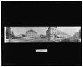 3rd Ave. and Main St., Mitchell, S. Dak LCCN2007662779.tif 4,096 × 3,301; 12.9 MB
-
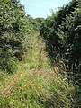
 A bend in the road. - geograph.org.uk - 354593.jpg 640 × 480; 85 KB
-
 A muddy gateway. - geograph.org.uk - 354574.jpg 640 × 427; 58 KB
-
 A muddy lane - geograph.org.uk - 367308.jpg 640 × 480; 90 KB
-

-
 B-25 Mitchell 1 (28883814623).jpg 2,358 × 1,575; 4.86 MB
-
 B-25 Mitchell 2 (28883867223).jpg 3,374 × 2,253; 10.33 MB
-
 B-25 Mitchell 3 (29471901516).jpg 3,513 × 2,346; 9.4 MB
-
 B-25 Mitchell 4 (29397714102).jpg 4,705 × 3,142; 16.9 MB
-
 B-25 Mitchell 5 (29472078206).jpg 3,562 × 2,379; 9.08 MB
-
 B-25 Mitchell, P51 Mustang & Bronco 1 (29398320372).jpg 4,809 × 3,210; 17.84 MB
-
 B-25 Mitchell, P51 Mustang & Bronco 2 (29426836121).jpg 4,157 × 2,188; 12.06 MB
-
 B-25 Mitchell, P51 Mustang & Bronco 3 (29425797311).jpg 4,333 × 2,893; 16.15 MB
-
 B-25J Mitchell (9421102585).jpg 3,438 × 2,292; 1.33 MB
-
 B-25J Mitchell (9421105587).jpg 3,573 × 2,382; 1.17 MB
-
 B-25J Mitchell (9421110507).jpg 1,684 × 2,528; 559 KB
-
 Bridge over the A39 Trispen by pass - geograph.org.uk - 1510420.jpg 640 × 480; 82 KB
-
 Feeling happy...my wife - panoramio.jpg 1,600 × 1,200; 473 KB
-
 Former Wesleyan Chapel at Mitchell - geograph.org.uk - 1013539.jpg 640 × 480; 83 KB
-
 Galleria Asian Market - panoramio.jpg 4,752 × 3,168; 5.85 MB
-
 Green Lane near Pollamounter - geograph.org.uk - 529699.jpg 480 × 640; 310 KB
-
 Home of my GGGG Grandfather, Laurence Mitchell, Byres Close (4823051139).jpg 1,536 × 2,048; 1.19 MB
-

-
 MilestoneMitchell.jpg 3,983 × 5,974; 17.33 MB
-
 Minor Road Junction east of Trevilson - geograph.org.uk - 185196.jpg 640 × 427; 89 KB
-
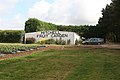 Mitchell Fruit Garden shop - geograph.org.uk - 1390499.jpg 640 × 427; 70 KB
-
 Mitchell, Cornwall.jpg 640 × 427; 94 KB
-
 Mitchell, SD 57301, USA - panoramio (3).jpg 4,128 × 3,096; 5.35 MB
-
 Mitchell, SD 57301, USA - panoramio (5).jpg 4,128 × 3,096; 4.39 MB
-
 Mitchell, SD 57301, USA - panoramio (6).jpg 4,128 × 3,096; 5.08 MB
-
 Mitchell, SD 57301, USA - panoramio (7).jpg 4,128 × 3,096; 4.87 MB
-
 Mitchell, SD 57301, USA - panoramio.jpg 4,128 × 3,096; 3.79 MB
-
 MitDemo (2).jpg 1,704 × 2,272; 1.33 MB
-
 Nanchang, Spitfire, B-25 Mitchell & Hurricane (29428455751).jpg 5,448 × 1,612; 9.43 MB
-
 Pasture with Roller - geograph.org.uk - 186088.jpg 640 × 427; 117 KB
-
 Powerlines - geograph.org.uk - 185717.jpg 640 × 526; 102 KB
-
 Roadside Shrine by the old A39 - geograph.org.uk - 232082.jpg 640 × 439; 150 KB
-
 School of Psychology etc. at CSU Bathurst - panoramio.jpg 1,600 × 1,200; 461 KB
-
 Scottsbluff,Nebraska.USA. - panoramio (1).jpg 1,402 × 988; 320 KB
-
 Sleepy City of Mitchell - panoramio.jpg 1,024 × 656; 449 KB
-
 Statue of Robinson Mitchell (20791815856).jpg 3,205 × 3,456; 3.47 MB
-

-
 A narrow lane^ - geograph.org.uk - 1510473.jpg 640 × 480; 83 KB
-
 Along the A39 - geograph.org.uk - 232098.jpg 483 × 640; 77 KB
-
 Another Ex Methodist Church - geograph.org.uk - 185697.jpg 640 × 427; 112 KB
-
 Boswiddle Farm - geograph.org.uk - 186118.jpg 640 × 427; 123 KB
-
 Canopy of Oak above the Road - geograph.org.uk - 186095.jpg 640 × 427; 159 KB
-

-
 Farm at West Nancemeer - geograph.org.uk - 185690.jpg 640 × 427; 92 KB
-
 Fields and wood - geograph.org.uk - 186113.jpg 640 × 427; 104 KB
-
 Fields, Woodland and Farm - geograph.org.uk - 230669.jpg 640 × 425; 102 KB
-
 Fingerpost at a Minor Road Junction - geograph.org.uk - 186086.jpg 448 × 640; 115 KB
-
 Higher Ennis Farm - geograph.org.uk - 231617.jpg 640 × 427; 94 KB
-
 Newly Planted Field - geograph.org.uk - 185200.jpg 640 × 427; 122 KB
-
 Powerlines down the Valley - geograph.org.uk - 186109.jpg 640 × 427; 122 KB
-
 Sheep Pasture - geograph.org.uk - 231604.jpg 640 × 427; 81 KB
-
 Sheep Pasture by the A39 - geograph.org.uk - 232058.jpg 640 × 427; 82 KB
-
 Sheep Pasture near Killiserth - geograph.org.uk - 231628.jpg 640 × 426; 99 KB
-
 Sheep Pasture outside Mitchell - geograph.org.uk - 185710.jpg 640 × 427; 88 KB
-

-
 The A30 near Mitchell - geograph.org.uk - 184067.jpg 640 × 427; 92 KB
-
 The A39 Road - geograph.org.uk - 231623.jpg 640 × 427; 77 KB
-
 The Village of Mitchell - geograph.org.uk - 184062.jpg 640 × 427; 122 KB
-
 Track to Oak Tree Covert - geograph.org.uk - 430922.jpg 640 × 480; 147 KB
-
 Underpass Overpass - geograph.org.uk - 185693.jpg 640 × 432; 102 KB


.jpg)
.jpg)
.jpg)
.jpg)
.jpg)
.jpg)
.jpg)
.jpg)
.jpg)
.jpg)
.jpg)


.jpg)


.jpg)
.jpg)
.jpg)
.jpg)

.jpg)


.jpg)

.jpg)
_-_geograph.org.uk_-_415942.jpg)


.jpg)