Category:Minster Way in Kexby CP
Jump to navigation
Jump to search
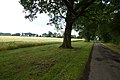
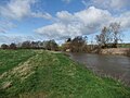
English: The Minster Way is a long distance path between Beverley Minster and York Minster. Part of the Minster Way passes through Kexby civil parish.
Media in category "Minster Way in Kexby CP"
The following 39 files are in this category, out of 39 total.
-
 Access Lane on Kexby Stray - geograph.org.uk - 2102795.jpg 2,816 × 2,112; 1.82 MB
-
 Along Kexby Stray - geograph.org.uk - 3573682.jpg 640 × 427; 121 KB
-
 Elvington Lane towards Grimston. - geograph.org.uk - 2450844.jpg 3,264 × 2,448; 2.68 MB
-
 Finger post at Rabbit Warren (wood) - geograph.org.uk - 4076482.jpg 1,600 × 1,064; 694 KB
-
 Finger post near Millfield Wood - geograph.org.uk - 4084323.jpg 1,600 × 1,064; 966 KB
-
 Kexby Stray (track) towards White Carr Farm - geograph.org.uk - 4076411.jpg 1,600 × 1,064; 534 KB
-
 Kexby Stray (track) towards White Carr Farm - geograph.org.uk - 4076454.jpg 1,600 × 1,064; 762 KB
-
 Kexby Stray - geograph.org.uk - 158880.jpg 640 × 479; 76 KB
-
 Millfield Wood - geograph.org.uk - 1824675.jpg 480 × 640; 191 KB
-
 Minster Way - geograph.org.uk - 3573721.jpg 640 × 427; 107 KB
-

-
 Minster Way at Kexby Carr Farm - geograph.org.uk - 4077738.jpg 1,600 × 1,064; 867 KB
-
 Minster Way at White Carr Farm - geograph.org.uk - 4076469.jpg 1,600 × 1,064; 842 KB
-
 Minster Way by the Derwent River - geograph.org.uk - 6085194.jpg 1,024 × 768; 199 KB
-
 Minster Way finger post at Kexby Stray Farm - geograph.org.uk - 4077865.jpg 1,600 × 1,064; 925 KB
-
 Minster Way finger post on Elvington Lane - geograph.org.uk - 4077924.jpg 1,064 × 1,600; 926 KB
-
 Minster Way footpath alongside River Derwent - geograph.org.uk - 2494266.jpg 3,264 × 2,448; 2.22 MB
-
 Minster Way in the Rabbit Warren (wood) - geograph.org.uk - 4076497.jpg 1,600 × 1,064; 936 KB
-
 Minster Way in the Rabbit Warren (wood) - geograph.org.uk - 4076523.jpg 1,600 × 1,064; 827 KB
-
 Minster Way in the Rabbit Warren (wood) - geograph.org.uk - 4076527.jpg 1,600 × 1,064; 900 KB
-
 Minster Way towards Gypsy Corner - geograph.org.uk - 4077933.jpg 1,600 × 1,064; 862 KB
-
 Minster Way towards Gypsy Corner - geograph.org.uk - 4077938.jpg 1,600 × 1,064; 892 KB
-
 Minster Way towards Gypsy Corner - geograph.org.uk - 4077946.jpg 1,600 × 1,064; 902 KB
-
 Minster Way towards Gypsy Corner - geograph.org.uk - 4077949.jpg 1,600 × 1,064; 873 KB
-
 Minster Way towards Gypsy Corner - geograph.org.uk - 4077952.jpg 1,600 × 1,064; 719 KB
-
 Minster Way towards Kexby Carr Farm - geograph.org.uk - 4076541.jpg 1,600 × 1,064; 674 KB
-
 Minster Way towards Kexby Carr Farm - geograph.org.uk - 4076545.jpg 1,600 × 1,064; 709 KB
-
 Minster Way towards Kexby Carr Farm - geograph.org.uk - 4076552.jpg 1,600 × 1,064; 798 KB
-
 Minster Way towards Kexby Carr Farm - geograph.org.uk - 4076566.jpg 1,600 × 1,064; 783 KB
-
 Minster Way towards Kexby Carr Farm - geograph.org.uk - 4076571.jpg 1,600 × 1,064; 834 KB
-
 Minster Way towards Millfield Wood - geograph.org.uk - 4084296.jpg 1,600 × 1,064; 828 KB
-
 Minster Way towards Millfield Wood - geograph.org.uk - 4084298.jpg 1,600 × 1,140; 974 KB
-
 Minster Way towards Millfield Wood - geograph.org.uk - 4084317.jpg 1,600 × 1,064; 1.03 MB
-
 Minster Way towards Rabbit Warren (wood) - geograph.org.uk - 4076473.jpg 1,600 × 1,064; 790 KB
-
 Path beside the Derwent - geograph.org.uk - 6116943.jpg 2,048 × 1,536; 1.18 MB
-
 Path by the River Derwent - geograph.org.uk - 6085198.jpg 1,024 × 768; 191 KB
-
 The Minster Way at White Carr Farm - geograph.org.uk - 4076460.jpg 1,600 × 1,064; 872 KB
-
 Track through Millfield Wood - geograph.org.uk - 2451900.jpg 3,264 × 2,448; 3.24 MB
-
 White Carr Farm from Kexby Stray - geograph.org.uk - 2451875.jpg 3,264 × 2,448; 2.59 MB


_-_geograph.org.uk_-_4076482.jpg)

_towards_White_Carr_Farm_-_geograph.org.uk_-_4076411.jpg)
_towards_White_Carr_Farm_-_geograph.org.uk_-_4076454.jpg)


_-_geograph.org.uk_-_4076497.jpg)
_-_geograph.org.uk_-_4076523.jpg)
_-_geograph.org.uk_-_4076527.jpg)


_-_geograph.org.uk_-_4076473.jpg)


